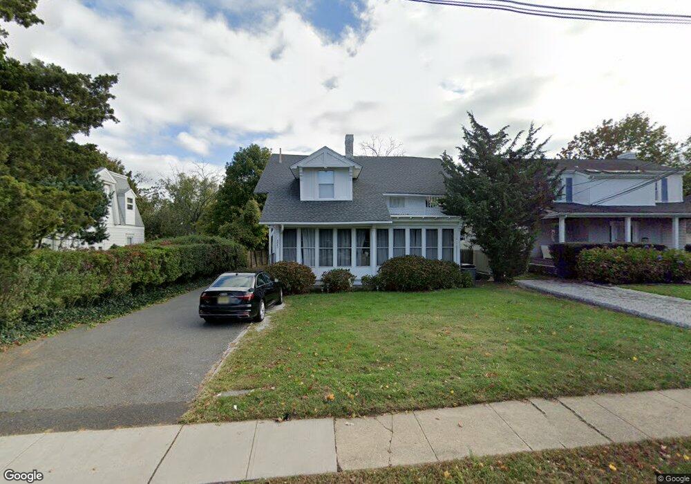
1043 Norwood Ave Unit 1 Long Branch, NJ 07740
Estimated Value: $1,025,000 - $1,768,000
3
Beds
2
Baths
2,797
Sq Ft
$541/Sq Ft
Est. Value
About This Home
This home is located at 1043 Norwood Ave Unit 1, Long Branch, NJ 07740 and is currently estimated at $1,512,796, approximately $540 per square foot. 1043 Norwood Ave Unit 1 is a home located in Monmouth County with nearby schools including Long Branch High School, Bet Yaakov of the Jersey Shore, and Ma'or Yeshiva High School for Boys.
Ownership History
Date
Name
Owned For
Owner Type
Purchase Details
Closed on
Apr 5, 2000
Sold by
Olen Anita
Bought by
Barnathan Joseph and Barnathan Shirley
Current Estimated Value
Home Financials for this Owner
Home Financials are based on the most recent Mortgage that was taken out on this home.
Original Mortgage
$63,000
Interest Rate
7.7%
Mortgage Type
Commercial
Create a Home Valuation Report for This Property
The Home Valuation Report is an in-depth analysis detailing your home's value as well as a comparison with similar homes in the area
Home Values in the Area
Average Home Value in this Area
Purchase History
| Date | Buyer | Sale Price | Title Company |
|---|---|---|---|
| Barnathan Joseph | $213,000 | -- |
Source: Public Records
Mortgage History
| Date | Status | Borrower | Loan Amount |
|---|---|---|---|
| Previous Owner | Barnathan Joseph | $63,000 |
Source: Public Records
Tax History Compared to Growth
Tax History
| Year | Tax Paid | Tax Assessment Tax Assessment Total Assessment is a certain percentage of the fair market value that is determined by local assessors to be the total taxable value of land and additions on the property. | Land | Improvement |
|---|---|---|---|---|
| 2025 | $14,508 | $1,009,000 | $682,300 | $326,700 |
| 2024 | $13,401 | $943,900 | $646,300 | $297,600 |
| 2023 | $13,401 | $862,900 | $578,800 | $284,100 |
| 2022 | $12,228 | $703,600 | $387,700 | $315,900 |
| 2021 | $12,228 | $611,100 | $324,700 | $286,400 |
| 2020 | $11,986 | $573,500 | $288,700 | $284,800 |
| 2019 | $9,694 | $461,200 | $189,700 | $271,500 |
| 2018 | $9,407 | $445,000 | $183,400 | $261,600 |
| 2017 | $9,106 | $441,800 | $185,200 | $256,600 |
| 2016 | $8,795 | $435,200 | $185,200 | $250,000 |
| 2015 | $9,636 | $432,700 | $178,900 | $253,800 |
| 2014 | $8,541 | $404,200 | $178,900 | $225,300 |
Source: Public Records
Map
Nearby Homes
- 1039 Norwood Ave
- 206 S Lincoln Ave
- 1001 Norwood Ave Unit 5
- 1001 Norwood Ave Unit 6
- 24 Berger Ave
- 271 Jerome Ave
- 101 Lincoln Ave
- 267 Roosevelt Ave
- 328 Elberon Blvd
- 2 Jim Lynch Dr
- 296 Garfield Ave
- 0 Overbrook Ave
- 210 Larchwood Ave
- 0 Adams Ave
- 100 Adams Ave
- 306 Roosevelt Ave
- 103 Poplar Ave
- 889 Red Oaks Dr
- 881 Red Oaks Dr
- 251 Highland Ave
- 1043 Norwood Ave
- 1043 Norwood Ave Unit WINTER
- 1049 Norwood Ave
- 1049 Norwood Ave Unit SUMMER
- 1049 Norwood Ave Unit Winter
- 1049 Norwood Ave Unit ANNUAL
- 1049 Norwood Ave Unit s
- 1039 Norwood Ave Unit 1
- 1039 Norwood Ave Unit 4
- 1039 Norwood Ave Unit 3
- 1039 Norwood Ave Unit 5
- 263 S Lincoln Ave
- 1040 Norwood Ave
- 245 S Lincoln Ave
- 1036 Norwood Ave
- 1048 Norwood Ave
- 1037 Norwood Ave
- 1034 Norwood Ave
- 3 Browns Ln
- 209 S Lincoln Ave