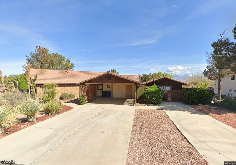
1043 Smoke Tree St Saint George, UT 84790
Bloomington Hills NeighborhoodEstimated Value: $426,000 - $452,000
3
Beds
2
Baths
1,598
Sq Ft
$274/Sq Ft
Est. Value
About This Home
This home is located at 1043 Smoke Tree St, Saint George, UT 84790 and is currently estimated at $438,548, approximately $274 per square foot. 1043 Smoke Tree St is a home located in Washington County with nearby schools including Bloomington Hills Elementary School, Desert Hills Middle School, and Sunrise Ridge Intermediate School.
Ownership History
Date
Name
Owned For
Owner Type
Purchase Details
Closed on
Jan 27, 2010
Sold by
Federal Home Loan Mortgage Corporation
Bought by
Batey Thomas E and Simpson Batey Kimberly
Current Estimated Value
Home Financials for this Owner
Home Financials are based on the most recent Mortgage that was taken out on this home.
Original Mortgage
$120,000
Outstanding Balance
$79,420
Interest Rate
5.03%
Mortgage Type
New Conventional
Estimated Equity
$359,128
Purchase Details
Closed on
Oct 21, 2009
Sold by
Tudman Daniel
Bought by
Federal Home Loan Mortgage Corp
Purchase Details
Closed on
Jun 1, 2006
Sold by
Hlavka Edward E and Hlavka Tamalynn S
Bought by
Tudman Daniel
Home Financials for this Owner
Home Financials are based on the most recent Mortgage that was taken out on this home.
Original Mortgage
$208,000
Interest Rate
7.37%
Mortgage Type
Adjustable Rate Mortgage/ARM
Create a Home Valuation Report for This Property
The Home Valuation Report is an in-depth analysis detailing your home's value as well as a comparison with similar homes in the area
Home Values in the Area
Average Home Value in this Area
Purchase History
| Date | Buyer | Sale Price | Title Company |
|---|---|---|---|
| Batey Thomas E | -- | First American Union Heights | |
| Federal Home Loan Mortgage Corp | $230,227 | None Available | |
| Tudman Daniel | -- | Guardian Title Co |
Source: Public Records
Mortgage History
| Date | Status | Borrower | Loan Amount |
|---|---|---|---|
| Open | Batey Thomas E | $120,000 | |
| Previous Owner | Tudman Daniel | $208,000 |
Source: Public Records
Tax History Compared to Growth
Tax History
| Year | Tax Paid | Tax Assessment Tax Assessment Total Assessment is a certain percentage of the fair market value that is determined by local assessors to be the total taxable value of land and additions on the property. | Land | Improvement |
|---|---|---|---|---|
| 2025 | $263 | $419,800 | $114,000 | $305,800 |
| 2023 | $85 | $428,300 | $133,000 | $295,300 |
| 2022 | $549 | $426,200 | $95,000 | $331,200 |
| 2021 | $2,768 | $319,000 | $80,800 | $238,200 |
| 2020 | $2,417 | $262,300 | $66,500 | $195,800 |
| 2019 | $2,375 | $251,800 | $60,000 | $191,800 |
| 2018 | $2,308 | $223,100 | $0 | $0 |
| 2017 | $2,160 | $208,800 | $0 | $0 |
| 2016 | $2,150 | $192,200 | $0 | $0 |
| 2015 | $2,068 | $177,300 | $0 | $0 |
| 2014 | $1,977 | $170,600 | $0 | $0 |
Source: Public Records
Map
Nearby Homes
- 1050 E Brigham Rd Unit 64
- 3239 S 840 E Unit 20
- 2974 Pear Cir
- 1135 Redwood Tree St
- 3155 S Hidden Valley Dr Unit 331
- 3155 S Hidden Valley Dr Unit 237
- 3155 S Hidden Valley Dr Unit 219
- 3155 S Hidden Valley Dr Unit 271
- 3155 S Hidden Valley Dr Unit 211
- 2958 Palmetto Cir
- 1045 Hemlock Cir
- 2942 Alder Cir
- 3523 Desert Hills Dr
- 3439 S Barcelona Dr Unit 68
- 3439 S Barcelona Dr Unit 31
- 3010 S Sweetgum Cir
- 1660 Evergreen Dr
- 376 E Calgary Dr
- 367 Calgary Dr S
- 1630 E 2450 S Unit 281
- 1043 E Smoke Tree
- 3087 S Chestnut
- 3087 Chestnut Cir
- 1051 Smoke Tree St
- 1046 Smoke Tree St
- 1046 E Smoketree
- 3088 Spruce Cir
- 1035 Smoke Tree St
- 3102 Spruce Cir
- 3079 Chestnut Cir
- 3076 Chestnut Cir
- 3078 Spruce Cir
- 1032 Smoke Tree St
- 3125 Chestnut Cir
- 3125 S Chestnut
- 3122 Spruce Cir
- 3066 Chestnut Cir
- 3079 S Walnut
- 1025 Smoke Tree St
- 3065 Chestnut Cir