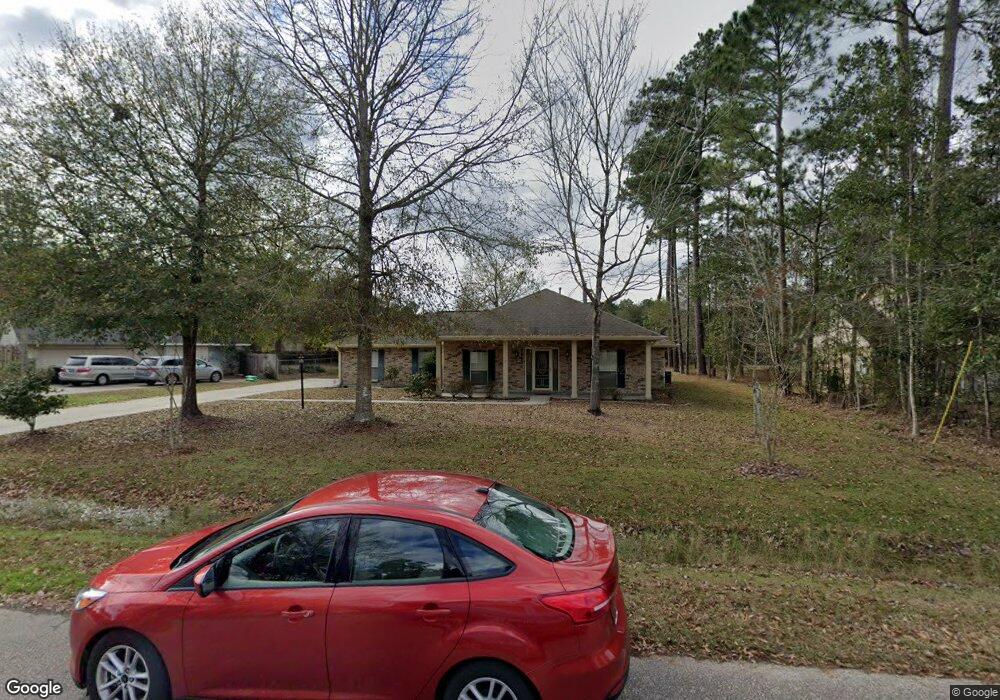
1043 Sullivan Place Pearl River, LA 70452
Estimated Value: $269,998 - $285,000
4
Beds
2
Baths
1,869
Sq Ft
$149/Sq Ft
Est. Value
About This Home
This home is located at 1043 Sullivan Place, Pearl River, LA 70452 and is currently estimated at $278,750, approximately $149 per square foot. 1043 Sullivan Place is a home located in St. Tammany Parish with nearby schools including Little Pearl Elementary School, Riverside Elementary School, and Creekside Junior High School.
Ownership History
Date
Name
Owned For
Owner Type
Purchase Details
Closed on
Mar 18, 2009
Sold by
Schroeder Clyde N
Bought by
Kahl Joseph C and Kahl Amanda Royston
Current Estimated Value
Home Financials for this Owner
Home Financials are based on the most recent Mortgage that was taken out on this home.
Original Mortgage
$147,000
Outstanding Balance
$93,868
Interest Rate
5.21%
Mortgage Type
New Conventional
Estimated Equity
$184,882
Create a Home Valuation Report for This Property
The Home Valuation Report is an in-depth analysis detailing your home's value as well as a comparison with similar homes in the area
Home Values in the Area
Average Home Value in this Area
Purchase History
| Date | Buyer | Sale Price | Title Company |
|---|---|---|---|
| Kahl Joseph C | $197,000 | None Available |
Source: Public Records
Mortgage History
| Date | Status | Borrower | Loan Amount |
|---|---|---|---|
| Open | Kahl Joseph C | $147,000 |
Source: Public Records
Tax History Compared to Growth
Tax History
| Year | Tax Paid | Tax Assessment Tax Assessment Total Assessment is a certain percentage of the fair market value that is determined by local assessors to be the total taxable value of land and additions on the property. | Land | Improvement |
|---|---|---|---|---|
| 2024 | $779 | $12,848 | $1,800 | $11,048 |
| 2023 | $817 | $12,848 | $1,800 | $11,048 |
| 2022 | $85,013 | $12,848 | $1,800 | $11,048 |
| 2021 | $900 | $12,848 | $1,800 | $11,048 |
| 2020 | $904 | $12,848 | $1,800 | $11,048 |
| 2019 | $2,080 | $12,848 | $1,800 | $11,048 |
| 2018 | $2,087 | $12,848 | $1,800 | $11,048 |
| 2017 | $2,100 | $12,848 | $1,800 | $11,048 |
| 2016 | $2,145 | $12,848 | $1,800 | $11,048 |
| 2015 | $994 | $12,848 | $1,800 | $11,048 |
| 2014 | $941 | $12,848 | $1,800 | $11,048 |
| 2013 | -- | $12,848 | $1,800 | $11,048 |
Source: Public Records
Map
Nearby Homes
- 232 Old Mill Loop
- 216 Old Mill Loop
- 64097 James Crosby Rd
- 64367 Hwy 41 Hwy
- 154 Old Mill Loop
- 0 Louisiana 41
- 999 Louisiana 41
- 147 Windsong Place
- 39092 Mcqueen Rd
- +/- 10.093 Hwy 11 & Hwy 41 Hwy
- 63534 Bolden Rd
- 5 Acs
- 5 Acs None
- Charles Plan at Taylor Pointe
- Audubon Plan at Taylor Pointe
- 39075 Taylor St
- Lasalle Plan at Taylor Pointe
- Esplanade at Taylor Pointe
- The St. Ann Farmhouse Collection (F1) Plan at Taylor Pointe
- 1047 Sullivan Place
- 1039 Sullivan Place
- 224 Old Mill Loop
- 228 Old Mill Loop
- 1051 Sullivan Place
- 1044 Sullivan Place
- 1040 Sullivan Place Other
- 1035 Sullivan Place
- 1035 Sullivan Place
- 224 Old Mill Loop
- 236 Old Mill Loop
- 1040 Sullivan Place
- 1048 Sullivan Place
- 229 Old Mill Loop None
- 229 Old Mill Loop
- 225 Old Mill Loop
- 1055 Sullivan Place
- 240 Old Mill Loop
- 225 N Old Mill Loop Other
- 1031 Sullivan Place