Estimated Value: $264,244 - $322,000
4
Beds
2
Baths
1,983
Sq Ft
$148/Sq Ft
Est. Value
About This Home
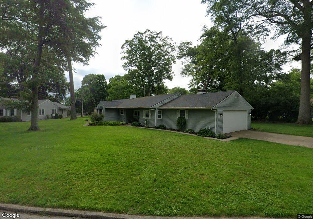
This home is located at 1043 Summit Ave, Troy, OH 45373 and is currently estimated at $292,561, approximately $147 per square foot. 1043 Summit Ave is a home located in Miami County with nearby schools including Heywood Elementary School, Van Cleve Elementary School, and Troy Junior High School.
Ownership History
Date
Name
Owned For
Owner Type
Purchase Details
Closed on
Jan 16, 2009
Sold by
Rasmussen Louis and Rasmussen Virginia
Bought by
Harmon Julie K
Current Estimated Value
Home Financials for this Owner
Home Financials are based on the most recent Mortgage that was taken out on this home.
Original Mortgage
$162,011
Outstanding Balance
$100,212
Interest Rate
5.19%
Mortgage Type
FHA
Estimated Equity
$192,349
Purchase Details
Closed on
Nov 1, 1985
Bought by
Welbaum Margaret Ann
Create a Home Valuation Report for This Property
The Home Valuation Report is an in-depth analysis detailing your home's value as well as a comparison with similar homes in the area
Home Values in the Area
Average Home Value in this Area
Purchase History
| Date | Buyer | Sale Price | Title Company |
|---|---|---|---|
| Harmon Julie K | $165,000 | -- | |
| Welbaum Margaret Ann | $82,000 | -- |
Source: Public Records
Mortgage History
| Date | Status | Borrower | Loan Amount |
|---|---|---|---|
| Open | Harmon Julie K | $162,011 |
Source: Public Records
Tax History
| Year | Tax Paid | Tax Assessment Tax Assessment Total Assessment is a certain percentage of the fair market value that is determined by local assessors to be the total taxable value of land and additions on the property. | Land | Improvement |
|---|---|---|---|---|
| 2025 | $2,942 | $83,590 | $18,800 | $64,790 |
| 2024 | $2,942 | $66,930 | $19,570 | $47,360 |
| 2023 | $2,581 | $66,930 | $19,570 | $47,360 |
| 2022 | $2,159 | $66,930 | $19,570 | $47,360 |
| 2021 | $1,818 | $53,520 | $15,650 | $37,870 |
| 2020 | $1,820 | $53,520 | $15,650 | $37,870 |
| 2019 | $1,837 | $53,520 | $15,650 | $37,870 |
| 2018 | $2,074 | $58,110 | $16,910 | $41,200 |
| 2017 | $2,095 | $58,110 | $16,910 | $41,200 |
| 2016 | $2,066 | $58,110 | $16,910 | $41,200 |
| 2015 | $1,941 | $53,800 | $15,650 | $38,150 |
| 2014 | $1,941 | $53,800 | $15,650 | $38,150 |
| 2013 | $1,953 | $53,800 | $15,650 | $38,150 |
Source: Public Records
Map
Nearby Homes
- 0 Ohio 55
- 1426 Paul Revere Way Unit B
- 1426 Paul Revere Way Unit D
- 1479 Lantern Ln Unit 1479
- 1481 Lantern Ln
- 507 Lake St
- 385 W Ross St
- 405 Lake St
- 510 Drury Ln
- 1141 Dickerson Dr
- 410 Armand Dr
- 302 Pennsylvania Ave
- 920 Old Nursery Trail
- 517 S Cherry St
- 339 Lincoln Ave
- 504 S Market St
- 67 W Dakota St
- 721 Mckaig Ave
- 408 S Market St
- 219 S Elm St
- 1025 Summit Ave
- 1137 Westridge Dr
- 1195 Westridge Dr
- 1133 Westridge Dr
- 1171 Westridge Dr
- 1207 Ridgewood Dr
- 617 Summit Ave
- 1208 Ridgewood Dr
- 1134 Westridge Dr
- 1128 Westridge Dr
- 1222 Ridgewood Dr
- 1142 Westridge Dr
- 1190 Westridge Dr
- 1180 Westridge Dr
- 1150 Westridge Dr
- 1110 Summit Ave
- 613 Summit Ave
- 1125 Westridge Dr
- 1162 Westridge Dr
- 1253 Ridgewood Dr
Your Personal Tour Guide
Ask me questions while you tour the home.