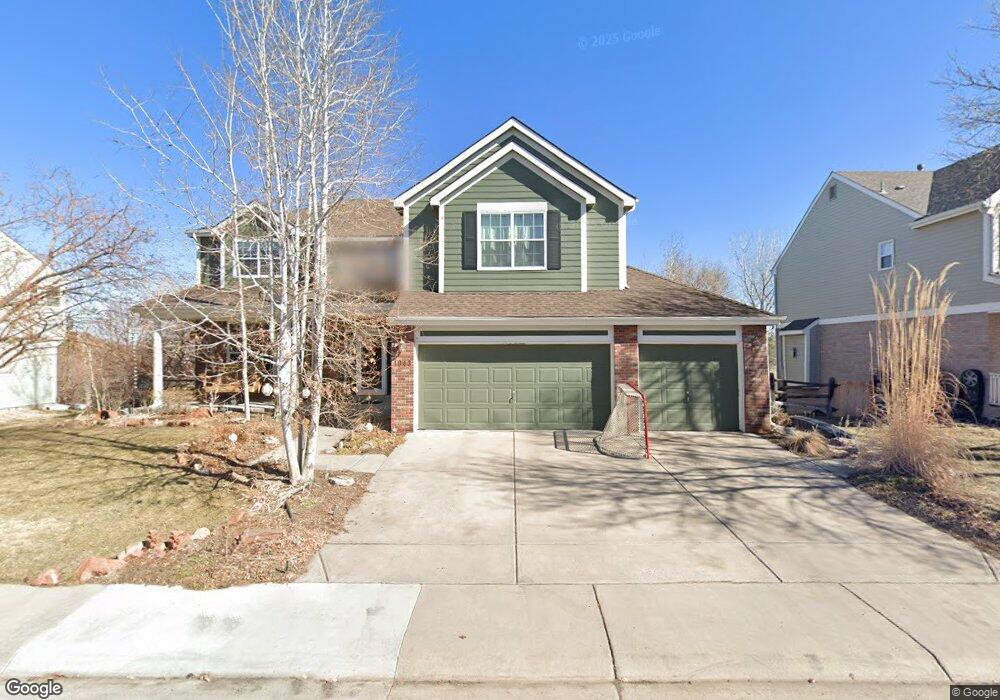
1043 W 124th Dr Denver, CO 80234
Home Farm NeighborhoodEstimated Value: $845,000 - $929,000
4
Beds
4
Baths
4,539
Sq Ft
$193/Sq Ft
Est. Value
About This Home
This home is located at 1043 W 124th Dr, Denver, CO 80234 and is currently estimated at $874,861, approximately $192 per square foot. 1043 W 124th Dr is a home located in Adams County with nearby schools including Arapahoe Ridge Elementary School, Silver Hills Middle School, and Mountain Range High School.
Ownership History
Date
Name
Owned For
Owner Type
Purchase Details
Closed on
Nov 19, 2009
Sold by
Lontine Karry L
Bought by
Gehring Paul and Gehring Barbara
Current Estimated Value
Home Financials for this Owner
Home Financials are based on the most recent Mortgage that was taken out on this home.
Original Mortgage
$347,920
Outstanding Balance
$226,363
Interest Rate
4.93%
Mortgage Type
New Conventional
Estimated Equity
$648,498
Purchase Details
Closed on
Aug 5, 2005
Sold by
Lontine Michael D and Lontine Karry L
Bought by
Lontine Karry L
Purchase Details
Closed on
Feb 25, 2000
Sold by
And Doiel Dennis R and Doiel Gina M
Bought by
Lontine Michael D and Lontine Karry L
Home Financials for this Owner
Home Financials are based on the most recent Mortgage that was taken out on this home.
Original Mortgage
$320,000
Interest Rate
8.31%
Purchase Details
Closed on
Jun 7, 1996
Sold by
Colorado North Company Llc
Bought by
Doiel Dennis R and Doiel Gina M
Home Financials for this Owner
Home Financials are based on the most recent Mortgage that was taken out on this home.
Original Mortgage
$170,000
Interest Rate
7.99%
Create a Home Valuation Report for This Property
The Home Valuation Report is an in-depth analysis detailing your home's value as well as a comparison with similar homes in the area
Home Values in the Area
Average Home Value in this Area
Purchase History
| Date | Buyer | Sale Price | Title Company |
|---|---|---|---|
| Gehring Paul | $434,900 | Stewart Title | |
| Lontine Karry L | -- | -- | |
| Lontine Michael D | $400,000 | First American Heritage Titl | |
| Doiel Dennis R | $254,445 | -- |
Source: Public Records
Mortgage History
| Date | Status | Borrower | Loan Amount |
|---|---|---|---|
| Open | Gehring Paul | $347,920 | |
| Previous Owner | Lontine Michael D | $320,000 | |
| Previous Owner | Doiel Dennis R | $170,000 |
Source: Public Records
Tax History Compared to Growth
Tax History
| Year | Tax Paid | Tax Assessment Tax Assessment Total Assessment is a certain percentage of the fair market value that is determined by local assessors to be the total taxable value of land and additions on the property. | Land | Improvement |
|---|---|---|---|---|
| 2024 | $5,315 | $50,750 | $9,000 | $41,750 |
| 2023 | $5,258 | $57,700 | $9,740 | $47,960 |
| 2022 | $4,545 | $43,240 | $10,010 | $33,230 |
| 2021 | $4,695 | $43,240 | $10,010 | $33,230 |
| 2020 | $4,122 | $38,720 | $10,300 | $28,420 |
| 2019 | $4,130 | $38,720 | $10,300 | $28,420 |
| 2018 | $4,045 | $36,690 | $7,200 | $29,490 |
| 2017 | $3,650 | $36,690 | $7,200 | $29,490 |
| 2016 | $3,565 | $34,740 | $6,770 | $27,970 |
| 2015 | $3,560 | $34,740 | $6,770 | $27,970 |
| 2014 | $3,471 | $32,830 | $5,890 | $26,940 |
Source: Public Records
Map
Nearby Homes
- 12671 Home Farm Ln
- 12705 Kalamath Ct
- 12705 Home Farm Dr
- 930 W 128th Place
- 920 W 128th Place
- 975 W 128th Place
- 935 W 128th Place
- 931 W 128th Place
- 834 W 128th Place
- 851 W 128th Place
- 811 W 128th Place
- 12173 Melody Dr Unit 303
- 12151 Melody Dr Unit 202
- 12141 Melody Dr Unit 302
- 12901 Galapago St
- 12166 Melody Dr Unit 202
- 12172 Melody Dr Unit 302
- 12186 Melody Dr Unit 104
- 12133 Melody Dr Unit 204
- 12131 Melody Dr Unit 201
- 1063 W 124th Dr
- 1023 W 124th Dr
- 1083 W 124th Dr
- 12497 Lipan Ct
- 12498 Mariposa Ct
- 1013 W 124th Dr
- 1093 W 124th Dr
- 12488 Mariposa Ct
- 1003 W 124th Dr
- 12487 Lipan Ct
- 12499 Mariposa Ct
- 12496 Lipan Ct
- 12478 Mariposa Ct
- 1104 W 124th Ct
- 993 W 124th Dr
- 12489 Mariposa Ct
- 12486 Lipan Ct
- 12477 Lipan Ct
- 12495 Kalamath Ct
- 1103 W 124th Ct