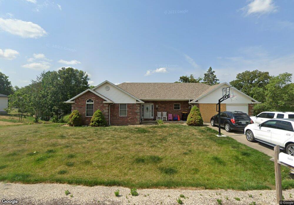
10435 Pinecrest St New Bloomfield, MO 65063
Estimated Value: $340,782 - $424,000
3
Beds
3
Baths
2,370
Sq Ft
$159/Sq Ft
Est. Value
About This Home
This home is located at 10435 Pinecrest St, New Bloomfield, MO 65063 and is currently estimated at $376,196, approximately $158 per square foot. 10435 Pinecrest St is a home located in Callaway County with nearby schools including New Bloomfield Elementary School and New Bloomfield High School.
Ownership History
Date
Name
Owned For
Owner Type
Purchase Details
Closed on
Nov 4, 2011
Sold by
Kegley Lea C and Kegley Michael S
Bought by
Wells Fargo Bank Na
Current Estimated Value
Purchase Details
Closed on
Jan 3, 2007
Sold by
Theroff Kentde and Theroff Susan L
Bought by
Center Brian and Center Kathy
Home Financials for this Owner
Home Financials are based on the most recent Mortgage that was taken out on this home.
Original Mortgage
$185,000
Interest Rate
5.94%
Mortgage Type
New Conventional
Purchase Details
Closed on
Jun 3, 2005
Sold by
Lowry Brad and Lowry Frances
Bought by
Theroff L Kenton and Theroff Susan L
Home Financials for this Owner
Home Financials are based on the most recent Mortgage that was taken out on this home.
Original Mortgage
$135,920
Interest Rate
5.78%
Mortgage Type
New Conventional
Create a Home Valuation Report for This Property
The Home Valuation Report is an in-depth analysis detailing your home's value as well as a comparison with similar homes in the area
Home Values in the Area
Average Home Value in this Area
Purchase History
| Date | Buyer | Sale Price | Title Company |
|---|---|---|---|
| Wells Fargo Bank Na | -- | None Available | |
| Center Brian | -- | None Available | |
| Theroff L Kenton | -- | -- |
Source: Public Records
Mortgage History
| Date | Status | Borrower | Loan Amount |
|---|---|---|---|
| Previous Owner | Center Brian | $185,000 | |
| Previous Owner | Theroff L Kenton | $135,920 |
Source: Public Records
Tax History Compared to Growth
Tax History
| Year | Tax Paid | Tax Assessment Tax Assessment Total Assessment is a certain percentage of the fair market value that is determined by local assessors to be the total taxable value of land and additions on the property. | Land | Improvement |
|---|---|---|---|---|
| 2024 | $2,257 | $39,851 | $0 | $0 |
| 2023 | $2,257 | $39,376 | $0 | $0 |
| 2022 | $2,225 | $39,376 | $3,420 | $35,956 |
| 2021 | $2,226 | $39,376 | $3,420 | $35,956 |
| 2020 | $2,228 | $39,376 | $3,420 | $35,956 |
| 2019 | $2,179 | $39,376 | $3,420 | $35,956 |
| 2018 | $2,188 | $39,376 | $3,420 | $35,956 |
| 2017 | $2,184 | $39,376 | $3,420 | $35,956 |
| 2016 | $2,018 | $36,310 | $0 | $0 |
| 2015 | $2,007 | $36,310 | $0 | $0 |
| 2014 | -- | $36,310 | $0 | $0 |
Source: Public Records
Map
Nearby Homes
- 10407 County Road 497
- 10431 County Road 497
- 133 Manview Ln
- 57 Kirk Dr
- 63 Kirk Dr
- 65 Kirk Dr
- 56 Kirk Dr
- 64 Kirk Dr
- 55 Kirk Dr
- 54 Kirk Dr
- 10879 Country Aire Meadows Ct
- 10871 Mallard Ct
- 10884 Country Aire Meadows Ct
- 10890 Country Aire Meadows Ct
- 10896 Country Aire Meadows Ct
- 3 Eagle View
- 2962 County Road 496
- 734 Vine Dr
- 135 Sommer Ct
- 2943 State Road Tt
- 0 Pinecrest St
- 10441 Pinecrest St
- 2435 Stoney Creek Rd
- 2437 Stoney Creek Rd
- 2437 Stoney Creek Rd
- 10434 Pinecrest St
- 10442 Pinecrest St
- 2441 Stoney Creek Rd
- 10443 Pinecrest St
- 10426 Pinecrest St
- 2431 Stoney Creek Rd
- 10416 Pinecrest St
- 10444 Pinecrest St
- 2436 Stoney Creek Rd
- 2438 Stoney Creek Rd
- 2434 Stoney Creek Rd
- 10447 Pinecrest St
- 2440 Stoney Creek Rd
- 2430 Stoney Creek Rd
- 2432 Stoney Creek Rd Unit LOT 28