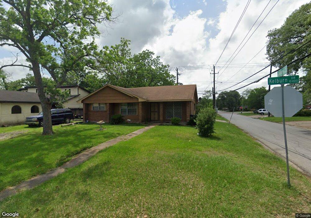
10437 Kelburn Dr Houston, TX 77016
East Little York NeighborhoodEstimated Value: $171,457 - $191,000
3
Beds
1
Bath
1,299
Sq Ft
$137/Sq Ft
Est. Value
About This Home
This home is located at 10437 Kelburn Dr, Houston, TX 77016 and is currently estimated at $178,364, approximately $137 per square foot. 10437 Kelburn Dr is a home located in Harris County with nearby schools including Shadydale Elementary School, Forest Brook Middle, and North Forest High School.
Ownership History
Date
Name
Owned For
Owner Type
Purchase Details
Closed on
Oct 31, 2005
Sold by
Walker Laura
Bought by
Walker Darryl
Current Estimated Value
Home Financials for this Owner
Home Financials are based on the most recent Mortgage that was taken out on this home.
Original Mortgage
$58,650
Outstanding Balance
$36,217
Interest Rate
8.2%
Mortgage Type
Fannie Mae Freddie Mac
Estimated Equity
$142,147
Purchase Details
Closed on
Feb 8, 2005
Sold by
Washington Wilma R
Bought by
Walker Laura
Create a Home Valuation Report for This Property
The Home Valuation Report is an in-depth analysis detailing your home's value as well as a comparison with similar homes in the area
Home Values in the Area
Average Home Value in this Area
Purchase History
| Date | Buyer | Sale Price | Title Company |
|---|---|---|---|
| Walker Darryl | -- | New Frontier Title | |
| Walker Laura | -- | -- |
Source: Public Records
Mortgage History
| Date | Status | Borrower | Loan Amount |
|---|---|---|---|
| Open | Walker Darryl | $58,650 |
Source: Public Records
Tax History Compared to Growth
Tax History
| Year | Tax Paid | Tax Assessment Tax Assessment Total Assessment is a certain percentage of the fair market value that is determined by local assessors to be the total taxable value of land and additions on the property. | Land | Improvement |
|---|---|---|---|---|
| 2025 | $1,027 | $150,003 | $52,797 | $97,206 |
| 2024 | $1,027 | $143,522 | $52,797 | $90,725 |
| 2023 | $1,027 | $157,081 | $43,694 | $113,387 |
| 2022 | $1,904 | $126,665 | $36,412 | $90,253 |
| 2021 | $1,832 | $109,332 | $27,309 | $82,023 |
| 2020 | $1,730 | $99,287 | $18,934 | $80,353 |
| 2019 | $1,644 | $90,796 | $12,453 | $78,343 |
| 2018 | $900 | $72,626 | $12,453 | $60,173 |
| 2017 | $1,358 | $72,626 | $12,453 | $60,173 |
| 2016 | $1,234 | $72,626 | $12,453 | $60,173 |
| 2015 | $653 | $54,110 | $12,453 | $41,657 |
| 2014 | $653 | $44,271 | $12,453 | $31,818 |
Source: Public Records
Map
Nearby Homes
- 10430 Royal Oaks Dr
- 7226 Gore Dr
- 10317 Kelburn Dr
- 10526 Hollyglen Dr
- 10535 Hollyglen Dr
- 7210 Colton St
- 10313 Blades St
- 10434 Envoy St
- 7818 Laurel Gem Dr
- 7827 Laurel Gem Dr
- 7823 Laurel Gem Dr
- 7821 Laurel Gem Dr
- 7812 Laurel Gem Dr
- 7830 Laurel Gem Dr
- 7824 Laurel Gem Dr
- 7819 Laurel Gem Dr
- 7815 Laurel Gem Dr
- 10201 Homestead Rd
- 7234 Boggess Rd
- 7449 Gleason Rd
- 10433 Kelburn Dr
- 10438 Homestead Rd
- 10429 Kelburn Dr
- 10501 Kelburn Dr
- 10434 Homestead Rd
- 7201 Gleason Rd
- 10430 Homestead Rd
- 10502 Homestead Rd
- 10425 Kelburn Dr
- 10505 Kelburn Dr
- 7202 Saunders Rd
- 7205 Gleason Rd
- 10426 Homestead Rd
- 10506 Homestead Rd
- 10426 Kelburn Dr
- 10421 Kelburn Dr
- 7206 Saunders Rd
- 10422 Homestead Rd
- 7209 Gleason Rd
- 10422 Kelburn Dr