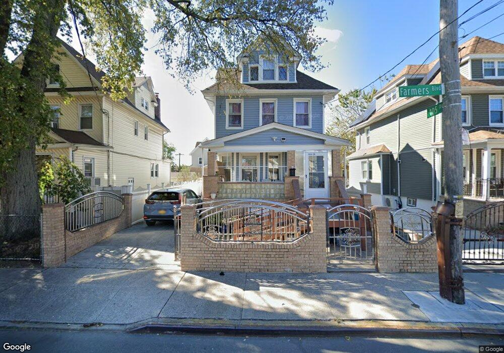
10438 Farmers Blvd Saint Albans, NY 11412
Hollis NeighborhoodEstimated Value: $658,000 - $818,000
--
Bed
--
Bath
1,789
Sq Ft
$399/Sq Ft
Est. Value
About This Home
This home is located at 10438 Farmers Blvd, Saint Albans, NY 11412 and is currently estimated at $713,724, approximately $398 per square foot. 10438 Farmers Blvd is a home located in Queens County with nearby schools including P.S. 118 Lorraine Hansberry, I.S. 192 The Linden, and Wellspring Elementary & Middle.
Ownership History
Date
Name
Owned For
Owner Type
Purchase Details
Closed on
Oct 26, 2010
Sold by
James Bernadette Athalene
Bought by
Elliott Karen and Peterkin Myrna
Current Estimated Value
Purchase Details
Closed on
Jul 26, 1999
Sold by
James Bernadette and Ali Lynette Z
Bought by
James Bernadette
Purchase Details
Closed on
Mar 24, 1999
Sold by
Ali Lynette Z
Bought by
James Bernadette and Ali Lynette Z
Purchase Details
Closed on
Mar 6, 1998
Sold by
Roberts Orin and Roberts Ingrid
Bought by
Ali Lynette Z
Home Financials for this Owner
Home Financials are based on the most recent Mortgage that was taken out on this home.
Original Mortgage
$145,500
Interest Rate
6.96%
Create a Home Valuation Report for This Property
The Home Valuation Report is an in-depth analysis detailing your home's value as well as a comparison with similar homes in the area
Home Values in the Area
Average Home Value in this Area
Purchase History
| Date | Buyer | Sale Price | Title Company |
|---|---|---|---|
| Elliott Karen | -- | -- | |
| Elliott Karen | -- | -- | |
| James Bernadette | -- | Commonwealth Land Title Ins | |
| James Bernadette | -- | Commonwealth Land Title Ins | |
| James Bernadette | -- | Commonwealth Land Title Ins | |
| James Bernadette | -- | Commonwealth Land Title Ins | |
| Ali Lynette Z | $150,000 | Fidelity National Title Ins | |
| Ali Lynette Z | $150,000 | Fidelity National Title Ins |
Source: Public Records
Mortgage History
| Date | Status | Borrower | Loan Amount |
|---|---|---|---|
| Previous Owner | Ali Lynette Z | $145,500 |
Source: Public Records
Tax History Compared to Growth
Tax History
| Year | Tax Paid | Tax Assessment Tax Assessment Total Assessment is a certain percentage of the fair market value that is determined by local assessors to be the total taxable value of land and additions on the property. | Land | Improvement |
|---|---|---|---|---|
| 2025 | $5,284 | $27,708 | $10,013 | $17,695 |
| 2024 | $4,202 | $27,708 | $10,344 | $17,364 |
| 2023 | $4,205 | $27,494 | $9,056 | $18,438 |
| 2022 | $4,891 | $39,480 | $14,940 | $24,540 |
| 2021 | $4,854 | $33,000 | $14,940 | $18,060 |
| 2020 | $4,591 | $34,800 | $14,940 | $19,860 |
| 2019 | $4,537 | $35,580 | $14,940 | $20,640 |
| 2018 | $4,373 | $22,912 | $10,009 | $12,903 |
| 2017 | $4,107 | $21,616 | $11,934 | $9,682 |
| 2016 | $3,767 | $21,616 | $11,934 | $9,682 |
| 2015 | $2,240 | $19,242 | $12,482 | $6,760 |
| 2014 | $2,240 | $19,242 | $13,226 | $6,016 |
Source: Public Records
Map
Nearby Homes
- 10533 Farmers Blvd
- 19027 109th Rd
- 104-11 188th St
- 10532 192nd St
- 187-23 Brinkerhoff Ave
- 190-30 103rd Ave
- 193-21 109th Rd
- 102-35 187th St
- 10220 189th St
- 104-40 194th St
- 19319 109th Rd
- 194-10 Hollis Ave
- 10211 187th St
- 183-67 Dunlop Ave
- 188-31 Jordan Ave
- 111-06 Farmers Blvd
- 19404 110th Rd
- 187-44 Jordan Ave
- 186-16 Hilburn Ave
- 19022 111th Rd
- 104-34 Farmers Blvd
- 10440 Farmers Blvd
- 10434 Farmers Blvd
- 10430 Farmers Blvd
- 104-30 Farmers Blvd Unit 1
- 104-30 Farmers Blvd
- 10425 189th St
- 10429 189th St
- 10416 Farmers Blvd
- 10417 189th St
- 10412 Farmers Blvd
- 10514 Farmers Blvd
- 10413 189th St
- 18910 Ludlum Ave
- 10412 Farmers Blvd
- 10412 Farmers Blvd
- 18910 Ludlum Ave
- 10501 Farmers Blvd
- 10435 Farmers Blvd
- 104-35 Farmers Blvd