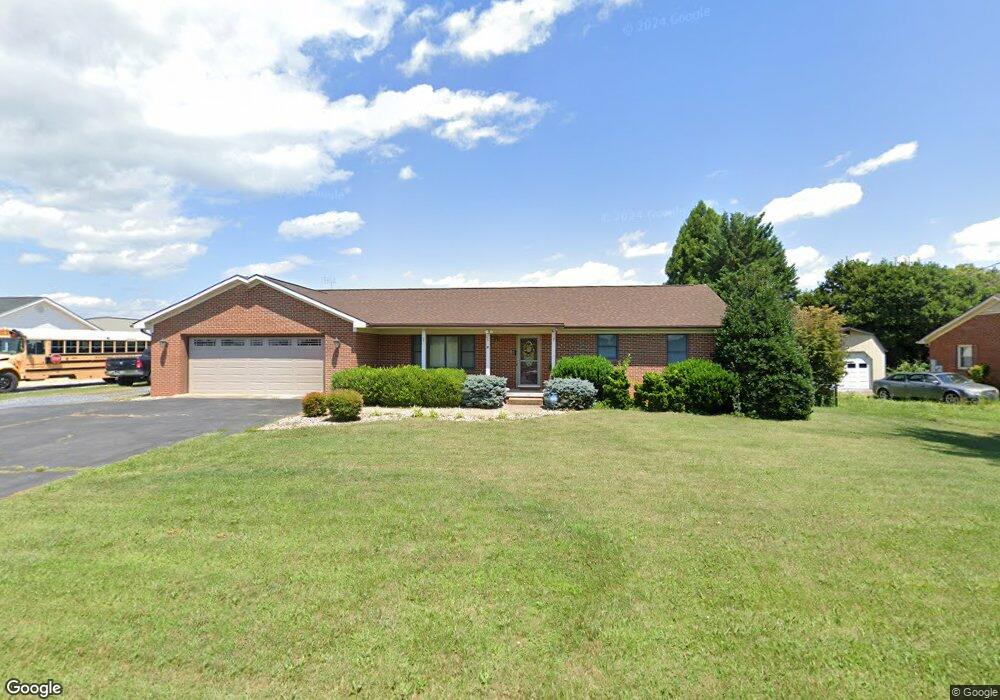
1044 Airport Rd Bridgewater, VA 22812
Estimated Value: $399,742 - $446,000
3
Beds
3
Baths
1,745
Sq Ft
$246/Sq Ft
Est. Value
About This Home
This home is located at 1044 Airport Rd, Bridgewater, VA 22812 and is currently estimated at $428,686, approximately $245 per square foot. 1044 Airport Rd is a home located in Rockingham County with nearby schools including John W. Wayland Elementary School, Wilbur S. Pence Middle School, and Turner Ashby High School.
Ownership History
Date
Name
Owned For
Owner Type
Purchase Details
Closed on
Mar 26, 2025
Sold by
1044 Llc
Bought by
Rockingham Aviation Corp
Current Estimated Value
Home Financials for this Owner
Home Financials are based on the most recent Mortgage that was taken out on this home.
Original Mortgage
$7,500,000
Outstanding Balance
$7,467,977
Interest Rate
6.85%
Mortgage Type
Construction
Estimated Equity
-$7,039,291
Purchase Details
Closed on
Aug 2, 2017
Sold by
Sechler Michael N and Sechler Cynthia L
Bought by
1044 Llc
Create a Home Valuation Report for This Property
The Home Valuation Report is an in-depth analysis detailing your home's value as well as a comparison with similar homes in the area
Home Values in the Area
Average Home Value in this Area
Purchase History
| Date | Buyer | Sale Price | Title Company |
|---|---|---|---|
| Rockingham Aviation Corp | -- | None Listed On Document | |
| Rockingham Aviation Corp | -- | None Listed On Document | |
| 1044 Llc | $289,000 | None Available |
Source: Public Records
Mortgage History
| Date | Status | Borrower | Loan Amount |
|---|---|---|---|
| Open | Rockingham Aviation Corp | $7,500,000 |
Source: Public Records
Tax History Compared to Growth
Tax History
| Year | Tax Paid | Tax Assessment Tax Assessment Total Assessment is a certain percentage of the fair market value that is determined by local assessors to be the total taxable value of land and additions on the property. | Land | Improvement |
|---|---|---|---|---|
| 2025 | $2,135 | $314,000 | $45,000 | $269,000 |
| 2024 | $2,135 | $314,000 | $45,000 | $269,000 |
| 2023 | $2,135 | $314,000 | $45,000 | $269,000 |
| 2022 | $2,135 | $314,000 | $45,000 | $269,000 |
| 2021 | $1,669 | $225,500 | $45,000 | $180,500 |
| 2020 | $1,669 | $225,500 | $45,000 | $180,500 |
| 2019 | $1,669 | $225,500 | $45,000 | $180,500 |
| 2018 | $1,669 | $225,500 | $45,000 | $180,500 |
| 2017 | $1,638 | $221,300 | $45,000 | $176,300 |
| 2016 | $1,549 | $221,300 | $45,000 | $176,300 |
| 2015 | $1,483 | $221,300 | $45,000 | $176,300 |
| 2014 | $1,416 | $221,300 | $45,000 | $176,300 |
Source: Public Records
Map
Nearby Homes
- 120 Old Bridgewater Rd
- 255 S Main St
- 113 S Main St
- 30 Field Ct
- 29 Barnyard Cir
- 25 Barnyard Cir
- 13 Barnyard Cir
- 9 Barnyard Cir
- 5 Barnyard Cir
- 1 Barnyard Cir
- 107 Wheatland Dr
- 370 Friedens Church Rd
- 1529 Mount Crawford Ave
- 2769 Airport Rd
- 102 Bridgeport Dr
- 111 S Main St
- 104 W College St
- 100 Sunbright Dr
- 1299 N River Rd
- 3390 Spring Creek Rd
- 1022 Airport Rd
- 1056 Airport Rd
- 984 Airport Rd
- 1080 Airport Rd
- 966 Airport Rd
- 1114 Airport Rd
- 936 Airport Rd
- 1158 Airport Rd
- 7643 Wise Hollow Rd
- 879 Airport Rd
- 834 Airport Rd
- 1238 Airport Rd
- 792 Airport Rd
- 1260 Airport Rd
- 1272 Airport Rd
- 760 Airport Rd
- 1290 Airport Rd
- 732 Airport Rd
- 710 Airport Rd
- 686 Airport Rd