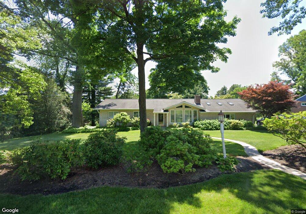
1044 George Rd Jenkintown, PA 19046
Lower Moreland NeighborhoodEstimated Value: $574,000 - $653,000
4
Beds
4
Baths
2,107
Sq Ft
$290/Sq Ft
Est. Value
About This Home
This home is located at 1044 George Rd, Jenkintown, PA 19046 and is currently estimated at $611,708, approximately $290 per square foot. 1044 George Rd is a home located in Montgomery County with nearby schools including Pine Road Elementary School, Murray Avenue School, and Lower Moreland High School.
Ownership History
Date
Name
Owned For
Owner Type
Purchase Details
Closed on
Jan 27, 2012
Sold by
Synnestvedt Susan C and Singer Susan C
Bought by
Singer Susan C
Current Estimated Value
Home Financials for this Owner
Home Financials are based on the most recent Mortgage that was taken out on this home.
Original Mortgage
$255,000
Outstanding Balance
$175,286
Interest Rate
3.96%
Estimated Equity
$436,422
Purchase Details
Closed on
Apr 17, 2002
Sold by
Strong Remer L
Bought by
Synnestvedt Paul B and Synnestvedt Susan C
Create a Home Valuation Report for This Property
The Home Valuation Report is an in-depth analysis detailing your home's value as well as a comparison with similar homes in the area
Home Values in the Area
Average Home Value in this Area
Purchase History
| Date | Buyer | Sale Price | Title Company |
|---|---|---|---|
| Singer Susan C | -- | None Available | |
| Synnestvedt Paul B | $235,000 | -- |
Source: Public Records
Mortgage History
| Date | Status | Borrower | Loan Amount |
|---|---|---|---|
| Open | Singer Susan C | $255,000 |
Source: Public Records
Tax History Compared to Growth
Tax History
| Year | Tax Paid | Tax Assessment Tax Assessment Total Assessment is a certain percentage of the fair market value that is determined by local assessors to be the total taxable value of land and additions on the property. | Land | Improvement |
|---|---|---|---|---|
| 2025 | $9,827 | $194,640 | -- | -- |
| 2024 | $9,827 | $194,640 | -- | -- |
| 2023 | $9,393 | $194,640 | $0 | $0 |
| 2022 | $9,116 | $194,640 | $0 | $0 |
| 2021 | $8,929 | $194,640 | $0 | $0 |
| 2020 | $8,663 | $194,640 | $0 | $0 |
| 2019 | $8,534 | $194,640 | $0 | $0 |
| 2018 | $1,854 | $194,640 | $0 | $0 |
| 2017 | $8,048 | $194,640 | $0 | $0 |
| 2016 | $7,972 | $194,640 | $0 | $0 |
| 2015 | $7,490 | $194,640 | $0 | $0 |
| 2014 | $7,490 | $194,640 | $0 | $0 |
Source: Public Records
Map
Nearby Homes
- 1047 Welsh Rd
- 1025 Welsh Rd
- 1930 Valley Rd
- 926 Manor Ave
- 2261 Valley Rd
- 1121 Jefferson Ln
- 1106 Herkness Dr
- 1434 Holcomb Rd
- 506 Carson Terrace
- 429 Carson Terrace
- 305 Carson Terrace
- 207 Carson Terrace
- 523 Carson Terrace
- 548 Carson Terrace
- 423 Carson Terrace
- 554 Carson Terrace
- 254 Carson Terrace
- 2560 Fetters Mill Rd
- 2440 Walton Rd
- 1680 Huntingdon Pike Unit CONDO 235
- 1056 George Rd
- 2040 Robert Rd
- 2050 Robert Rd
- 1045 Frederick Rd
- 1049 George Rd
- 1027 Frederick Rd
- 1059 Frederick Rd
- 1035 George Rd
- 1068 George Rd
- 1061 George Rd
- 1023 George Rd
- 1071 Frederick Rd
- 2043 Robert Rd
- 1073 George Rd
- 1010 George Rd
- 1080 George Rd
- 1040 Welsh Rd
- 1052 Welsh Rd
- 1009 Frederick Rd
- 1028 Welsh Rd