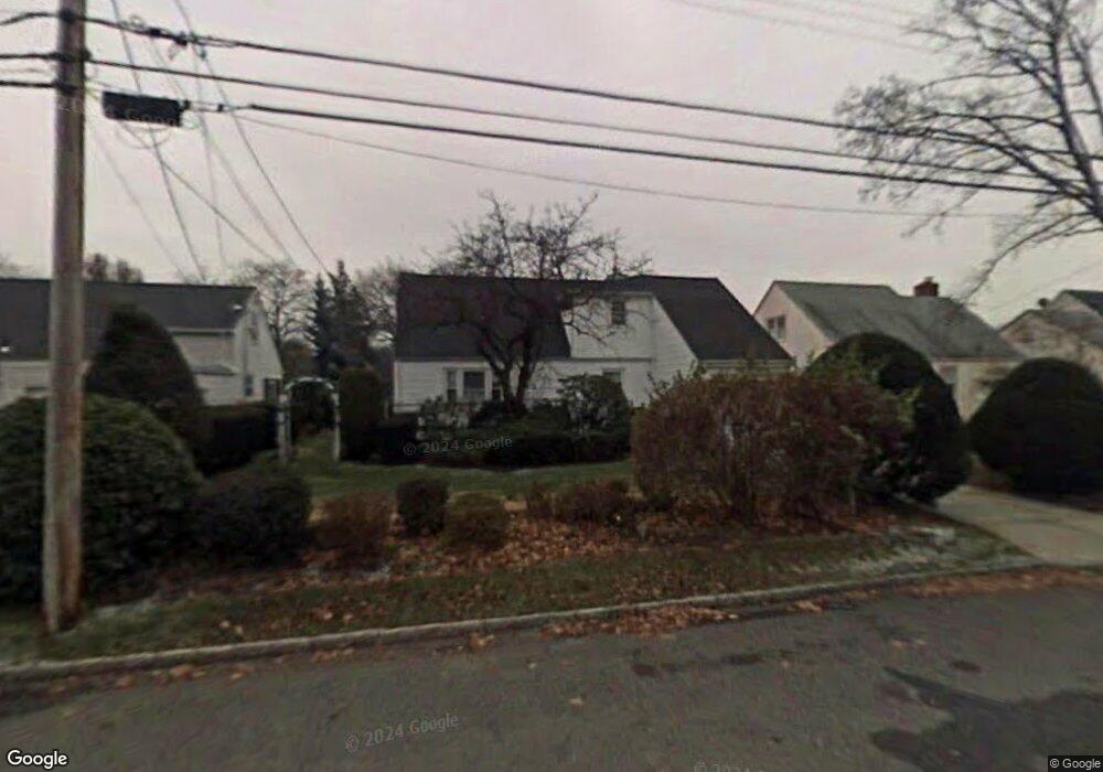
1044 Henhawk Rd North Baldwin, NY 11510
Estimated Value: $686,000 - $718,109
--
Bed
--
Bath
1,546
Sq Ft
$454/Sq Ft
Est. Value
About This Home
This home is located at 1044 Henhawk Rd, North Baldwin, NY 11510 and is currently estimated at $702,055, approximately $454 per square foot. 1044 Henhawk Rd is a home located in Nassau County with nearby schools including Baldwin Senior High School and Roosevelt Children's Academy.
Ownership History
Date
Name
Owned For
Owner Type
Purchase Details
Closed on
May 15, 2018
Sold by
Francois Lesly Jean and Francois Marie Jean
Bought by
Larosa Vargas Pablo De and Vargas Juan Perez
Current Estimated Value
Home Financials for this Owner
Home Financials are based on the most recent Mortgage that was taken out on this home.
Original Mortgage
$384,750
Outstanding Balance
$331,282
Interest Rate
4.4%
Mortgage Type
New Conventional
Estimated Equity
$370,773
Purchase Details
Closed on
Jan 31, 2005
Sold by
Moussignac Herbert
Bought by
Jean-Francois Lesly
Create a Home Valuation Report for This Property
The Home Valuation Report is an in-depth analysis detailing your home's value as well as a comparison with similar homes in the area
Home Values in the Area
Average Home Value in this Area
Purchase History
| Date | Buyer | Sale Price | Title Company |
|---|---|---|---|
| Larosa Vargas Pablo De | $405,000 | -- | |
| Jean-Francois Lesly | $375,000 | -- | |
| Jean-Francois Lesly | $375,000 | -- |
Source: Public Records
Mortgage History
| Date | Status | Borrower | Loan Amount |
|---|---|---|---|
| Open | Larosa Vargas Pablo De | $384,750 |
Source: Public Records
Tax History Compared to Growth
Tax History
| Year | Tax Paid | Tax Assessment Tax Assessment Total Assessment is a certain percentage of the fair market value that is determined by local assessors to be the total taxable value of land and additions on the property. | Land | Improvement |
|---|---|---|---|---|
| 2025 | $13,046 | $440 | $213 | $227 |
| 2024 | $3,192 | $440 | $213 | $227 |
| 2023 | $11,283 | $440 | $213 | $227 |
| 2022 | $11,283 | $435 | $160 | $275 |
| 2021 | $14,479 | $435 | $160 | $275 |
| 2020 | $11,079 | $510 | $500 | $10 |
| 2019 | $8,048 | $510 | $451 | $59 |
| 2018 | $8,048 | $544 | $0 | $0 |
| 2017 | $5,303 | $565 | $387 | $178 |
| 2016 | $8,026 | $565 | $387 | $178 |
| 2015 | $3,339 | $730 | $500 | $230 |
| 2014 | $3,339 | $730 | $500 | $230 |
| 2013 | $3,127 | $730 | $500 | $230 |
Source: Public Records
Map
Nearby Homes
- 1020 Henhawk Rd
- 36 Alhambra Rd
- 7 Mayfair Rd
- 1009 Centennial Ave
- 62 Alhambra Rd
- 31 Cedar St
- 1459 Prince St
- 1070 Cramer Ct
- 242 W Centennial Ave
- 1154 Cramer Ct
- 1091 Cramer Ct
- 1245 Lynne St
- 1109 Cramer Ct
- 1284 Forest Ave
- 959 Cramer Ct
- 1476 Kingston Ave
- 156 Brookside Ave
- 3 Maple Dr
- 36 John St
- 1014 Kings Pkwy
- 1044 Henhawk Rd
- 1038 Henhawk Rd
- 1054 Henhawk Rd
- 1032 Henhawk Rd
- 1043 Mayfair Rd
- 1049 Mayfair Rd
- 10 Henhawk Rd
- 1047 Henhawk Rd
- 1037 Mayfair Rd
- 1041 Henhawk Rd
- 4 Circle Dr E
- 31 Henhawk Rd
- 22 Henhawk Rd
- 1035 Henhawk Rd
- 1031 Mayfair Rd
- 33 Henhawk Rd
- 6 Circle Dr E
- 1029 Henhawk Rd
- 1025 Mayfair Rd
- 35 Henhawk Rd