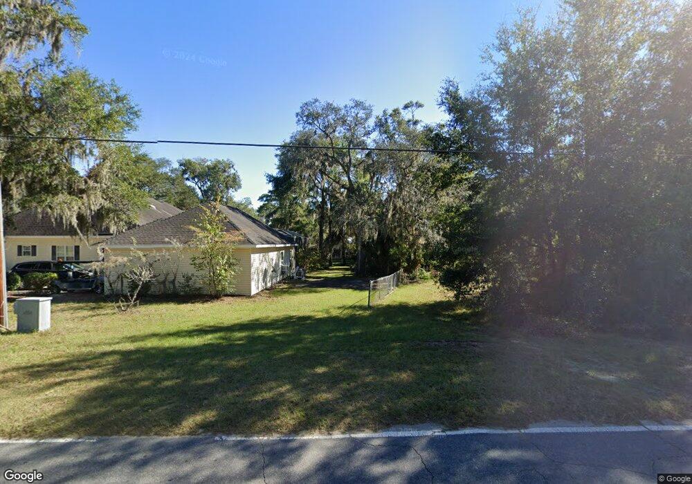
1044 Julienton Landing NE Townsend, GA 31331
Estimated Value: $517,000 - $747,000
4
Beds
5
Baths
3,640
Sq Ft
$165/Sq Ft
Est. Value
About This Home
This home is located at 1044 Julienton Landing NE, Townsend, GA 31331 and is currently estimated at $600,522, approximately $164 per square foot. 1044 Julienton Landing NE is a home located in McIntosh County with nearby schools including Todd Grant Elementary School, McIntosh County Middle School, and McIntosh County Academy.
Ownership History
Date
Name
Owned For
Owner Type
Purchase Details
Closed on
Aug 14, 2008
Sold by
Gordon Raymond
Bought by
Ryle Christina
Current Estimated Value
Home Financials for this Owner
Home Financials are based on the most recent Mortgage that was taken out on this home.
Original Mortgage
$274,438
Outstanding Balance
$179,057
Interest Rate
6.21%
Mortgage Type
New Conventional
Estimated Equity
$421,465
Purchase Details
Closed on
May 2, 2002
Sold by
Todd Luther H
Bought by
Gordon Raymond S
Create a Home Valuation Report for This Property
The Home Valuation Report is an in-depth analysis detailing your home's value as well as a comparison with similar homes in the area
Home Values in the Area
Average Home Value in this Area
Purchase History
| Date | Buyer | Sale Price | Title Company |
|---|---|---|---|
| Ryle Christina | $304,000 | -- | |
| Gordon Raymond S | $110,000 | -- | |
| Todd Luther H | $140,000 | -- |
Source: Public Records
Mortgage History
| Date | Status | Borrower | Loan Amount |
|---|---|---|---|
| Open | Ryle Christina | $274,438 |
Source: Public Records
Tax History Compared to Growth
Tax History
| Year | Tax Paid | Tax Assessment Tax Assessment Total Assessment is a certain percentage of the fair market value that is determined by local assessors to be the total taxable value of land and additions on the property. | Land | Improvement |
|---|---|---|---|---|
| 2024 | $2,462 | $166,840 | $20,000 | $146,840 |
| 2023 | $2,470 | $162,400 | $20,000 | $142,400 |
| 2022 | $2,470 | $138,200 | $20,000 | $118,200 |
| 2021 | $2,822 | $106,200 | $20,000 | $86,200 |
| 2020 | $2,497 | $105,480 | $20,000 | $85,480 |
| 2019 | $2,376 | $103,880 | $20,000 | $83,880 |
| 2018 | $2,761 | $103,880 | $20,000 | $83,880 |
| 2017 | $2,913 | $97,320 | $20,000 | $77,320 |
| 2016 | $2,376 | $97,320 | $20,000 | $77,320 |
| 2015 | $2,357 | $96,065 | $6,000 | $90,066 |
| 2014 | $2,525 | $96,066 | $6,000 | $90,066 |
Source: Public Records
Map
Nearby Homes
- 1207 Cherry Laurel Dr NE
- 1234 Hg Miles Dr NE
- 1234 Miles Ln
- 1112 Blue Marlin Dr NE
- 1090 Blue Marlin Dr NE
- 1076 Blue Marlin Dr NE
- 1031 Journey St NE
- 1077 Polson Cir NE
- 1067 Polson Cir NE
- 1329 Coopers Landing Dr NE
- 2153 Sutherland Rd
- 7389 Shellman Bluff Rd NE
- 23 & 23A Dallas Bluff Dr
- 1069 Shellman Hammock Dr NE
- 1653 Hawthorne Rd NE
- 7272 Shellman Bluff Rd NE Unit 14
- 7272 Shellman Bluff Rd NE Unit 21
- 7272 Shellman Bluff Rd NE
- 7272 Shellman Bluff Rd NE Unit 17
- xx Sapelo Park Dr NE
- 1014 Julienton Landing NE
- 1884 Dallas Bluff Rd NE
- 1110 Julienton Landing NE
- 1059 Julienton Landing NE
- 1073 Pine St NE
- 1085 Pine St NE
- 19 Acres Gould Branch Church Rd
- 1091 Pine St NE
- 1136 Julienton Landing NE
- 1030 Gould Branch Church Rd NE
- 1101 Julienton Landing NE
- 1060 Pine St NE
- 1113 Orange St NE
- 1109 Pine St NE
- 1835 Dallas Bluff Rd NE
- 1982 Dallas Bluff Rd NE
- 1116 Orange St NE
- 1027 Cherry St NE
- 1091 Cherry St NE
- 1965 Dallas Bluff Rd NE
