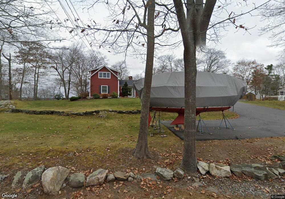
1044 Mere Point Rd Brunswick, ME 04011
Estimated Value: $1,242,000 - $1,496,000
4
Beds
3
Baths
2,702
Sq Ft
$497/Sq Ft
Est. Value
About This Home
This home is located at 1044 Mere Point Rd, Brunswick, ME 04011 and is currently estimated at $1,343,643, approximately $497 per square foot. 1044 Mere Point Rd is a home located in Cumberland County with nearby schools including Priest Elementary-Middle School, Kate Furbish Elementary School, and Brunswick Jr High School.
Ownership History
Date
Name
Owned For
Owner Type
Purchase Details
Closed on
Nov 15, 2010
Sold by
All Pars Llc
Bought by
Ramsay Glen and Ramsay Jean
Current Estimated Value
Create a Home Valuation Report for This Property
The Home Valuation Report is an in-depth analysis detailing your home's value as well as a comparison with similar homes in the area
Home Values in the Area
Average Home Value in this Area
Purchase History
| Date | Buyer | Sale Price | Title Company |
|---|---|---|---|
| Ramsay Glen | -- | -- |
Source: Public Records
Mortgage History
| Date | Status | Borrower | Loan Amount |
|---|---|---|---|
| Previous Owner | Ramsay Glen | $68,600 | |
| Previous Owner | Ramsay Glen | $417,000 | |
| Previous Owner | Ramsay Glen | $400,000 |
Source: Public Records
Tax History Compared to Growth
Tax History
| Year | Tax Paid | Tax Assessment Tax Assessment Total Assessment is a certain percentage of the fair market value that is determined by local assessors to be the total taxable value of land and additions on the property. | Land | Improvement |
|---|---|---|---|---|
| 2024 | $14,095 | $591,000 | $291,000 | $300,000 |
| 2023 | $13,762 | $590,900 | $291,000 | $299,900 |
| 2022 | $12,769 | $588,700 | $291,000 | $297,700 |
| 2021 | $12,280 | $588,700 | $291,000 | $297,700 |
| 2020 | $11,992 | $588,700 | $291,000 | $297,700 |
| 2019 | $11,254 | $570,700 | $276,400 | $294,300 |
| 2018 | $10,245 | $567,500 | $276,400 | $291,100 |
| 2017 | $10,425 | $567,500 | $276,400 | $291,100 |
| 2016 | $9,556 | $325,600 | $173,800 | $151,800 |
| 2015 | $9,234 | $325,600 | $173,800 | $151,800 |
| 2014 | $8,615 | $325,600 | $173,800 | $151,800 |
| 2013 | -- | $305,100 | $173,800 | $131,300 |
Source: Public Records
Map
Nearby Homes
- 46 Blackstone Club Rd
- 853 Mere Point Rd
- Map 80 Lot 18-0 White Island
- 83 Central Ave
- 0 Gundalo Gap Rd Unit 1638108
- 34 Newfield Rd
- 270 Harpswell Neck Rd
- Lot 129 Harpswell Neck Rd
- 57 Crestview Ln
- 71 Merganser Way
- Lot 2A Allen Point Rd
- Lot 2B Allen Point Rd
- 5 Round Hill Ln
- 41 Spruce Brook Dr
- 46 Casco Rd
- 206 Woodside Rd
- 250 Mere Point Rd
- 6 Chebeague Ln
- 49 Gleed Dr
- 1 Mallard Pond Rd
- 1036 Mere Point Rd
- 1052 Mere Point Rd
- 10 Westview Ln
- 1024 Mere Point Rd
- 1028 Mere Point Rd
- 11 High View Ln
- 1062 Mere Point Rd
- 1016 Mere Point Rd
- 1070 Mere Point Rd
- 1014 Mere Point Rd
- 35 Blackstone Club Rd
- 17 Blackstone Club Rd
- 1081 Mere Point Rd
- 50, 48 Blackstone Club Rd
- 57 Gallows Island Rd
- 53 Gallows Island Rd
- 50 Blackstone Club Rd
- 50 Blackstone Club Rd
- 50 Blackstone Club Rd
- 50 Blackstone Club Rd