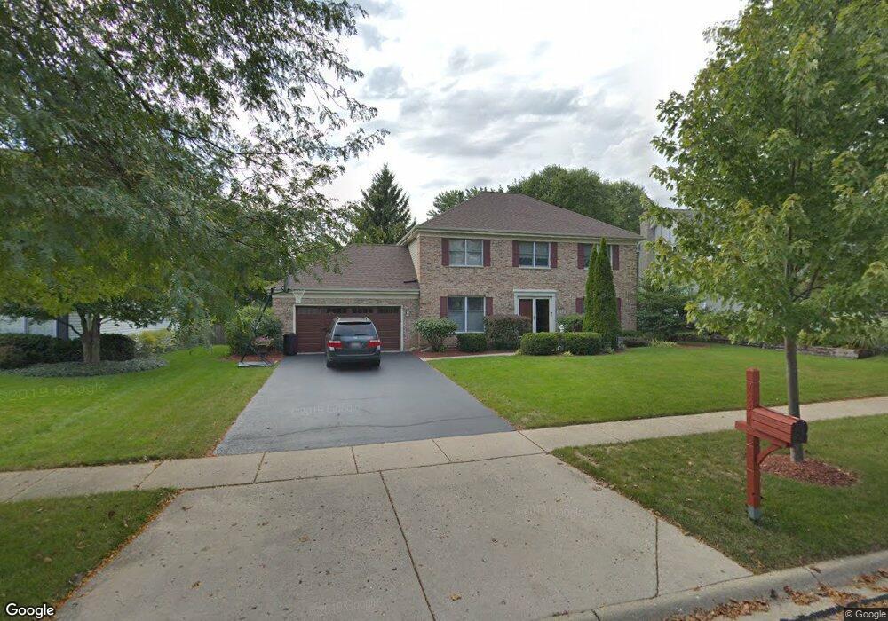
1044 Pember Cir West Dundee, IL 60118
Estimated Value: $430,474 - $479,000
4
Beds
--
Bath
2,346
Sq Ft
$197/Sq Ft
Est. Value
About This Home
This home is located at 1044 Pember Cir, West Dundee, IL 60118 and is currently estimated at $461,869, approximately $196 per square foot. 1044 Pember Cir is a home located in Kane County with nearby schools including Dundee Highlands Elementary School, Dundee Middle School, and Harry D Jacobs High School.
Ownership History
Date
Name
Owned For
Owner Type
Purchase Details
Closed on
Apr 16, 2001
Sold by
Gregory Ronald J and Gregory Kristina
Bought by
Payne John C and Payne Jana M
Current Estimated Value
Home Financials for this Owner
Home Financials are based on the most recent Mortgage that was taken out on this home.
Original Mortgage
$190,000
Interest Rate
7.23%
Purchase Details
Closed on
Jun 9, 2000
Sold by
Hazelhurst Thomas and Hazelhurst Linda S
Bought by
Gregory Ronald J
Home Financials for this Owner
Home Financials are based on the most recent Mortgage that was taken out on this home.
Original Mortgage
$156,000
Interest Rate
7%
Create a Home Valuation Report for This Property
The Home Valuation Report is an in-depth analysis detailing your home's value as well as a comparison with similar homes in the area
Home Values in the Area
Average Home Value in this Area
Purchase History
| Date | Buyer | Sale Price | Title Company |
|---|---|---|---|
| Payne John C | $275,000 | First American Title Ins | |
| Gregory Ronald J | $256,000 | -- |
Source: Public Records
Mortgage History
| Date | Status | Borrower | Loan Amount |
|---|---|---|---|
| Previous Owner | Payne John C | $190,000 | |
| Previous Owner | Gregory Ronald J | $156,000 |
Source: Public Records
Tax History Compared to Growth
Tax History
| Year | Tax Paid | Tax Assessment Tax Assessment Total Assessment is a certain percentage of the fair market value that is determined by local assessors to be the total taxable value of land and additions on the property. | Land | Improvement |
|---|---|---|---|---|
| 2024 | $9,687 | $126,842 | $25,730 | $101,112 |
| 2023 | $9,082 | $114,128 | $23,151 | $90,977 |
| 2022 | $9,255 | $111,046 | $23,151 | $87,895 |
| 2021 | $8,932 | $104,849 | $21,859 | $82,990 |
| 2020 | $8,767 | $102,492 | $21,368 | $81,124 |
| 2019 | $8,487 | $97,297 | $20,285 | $77,012 |
| 2018 | $8,802 | $98,288 | $19,883 | $78,405 |
| 2017 | $8,384 | $91,944 | $18,600 | $73,344 |
| 2016 | $8,444 | $88,018 | $23,811 | $64,207 |
| 2015 | -- | $82,476 | $22,312 | $60,164 |
| 2014 | -- | $80,199 | $21,696 | $58,503 |
| 2013 | -- | $82,654 | $22,360 | $60,294 |
Source: Public Records
Map
Nearby Homes
- 1601 Higgins Rd
- 812 Lindsay Ln
- 816 Lindsay Ln
- 822 Lindsay Ln
- 825 Lindsay Ln
- 818 Lindsay Ln
- 814 Lindsay Ln
- Charlotte Plan at Hickory Glen
- Marianne Plan at Hickory Glen
- 1715 W Main St
- 829 Lindsay Ln
- 906 Shagbark Ln
- 902 Shagbark Ln
- 916 Shagbark Ln
- 823 Lindsay Ln
- 904 Shagbark Ln
- 910 Shagbark Ln Unit 1601
- 2622 Chesire Ct
- 315 Spring Point Dr Unit 18315
- 2622 Wessex Dr
- 1038 Pember Cir
- 1056 Pember Cir
- 2256 Spaulding Ave
- 2242 Spaulding Ave
- 2268 Spaulding Ave
- 1026 Pember Cir
- 1033 Pember Cir
- 1041 Pember Cir
- 2238 Spaulding Ave
- 1102 Pember Cir Unit 2
- 1012 Pember Cir
- 2224 Spaulding Ave
- 2109 Kittridge Dr
- 2313 Kittridge Dr Unit 2
- 1103 Pember Cir Unit 2
- 1003 Pember Cir
- 1012 Brewer Ct
- 2243 Spaulding Ave
- 2218 Spaulding Ave
- 1006 Pember Cir