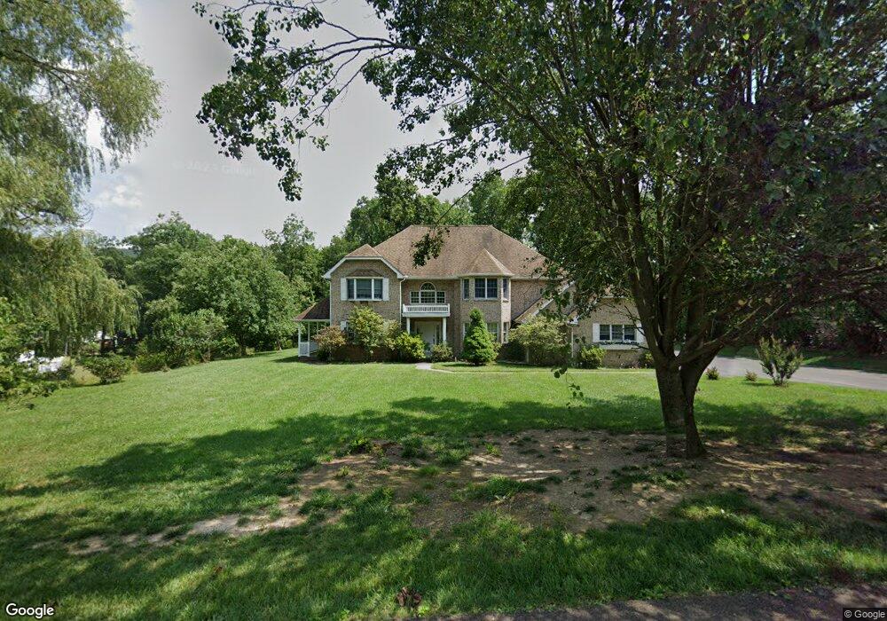
1044 Weires Ave Cumberland, MD 21502
Estimated Value: $418,000 - $551,000
--
Bed
2
Baths
3,320
Sq Ft
$146/Sq Ft
Est. Value
About This Home
This home is located at 1044 Weires Ave, Cumberland, MD 21502 and is currently estimated at $484,774, approximately $146 per square foot. 1044 Weires Ave is a home located in Allegany County with nearby schools including Parkside Elementary School, Braddock Middle School, and Allegany High School.
Ownership History
Date
Name
Owned For
Owner Type
Purchase Details
Closed on
Jun 26, 2000
Sold by
Leibman Daniel and Leibman Deborah
Bought by
Levasseur Ronald J and Levasseur Linda Walker
Current Estimated Value
Purchase Details
Closed on
Mar 16, 1998
Sold by
Bolt Thomas G and Bolt Deborah A
Bought by
Rahman M Shakil Huma
Purchase Details
Closed on
May 27, 1992
Sold by
Bolt Thomas G Jr-Deborah A
Bought by
Leibman Daniel-Deborah
Home Financials for this Owner
Home Financials are based on the most recent Mortgage that was taken out on this home.
Original Mortgage
$184,500
Interest Rate
8.53%
Create a Home Valuation Report for This Property
The Home Valuation Report is an in-depth analysis detailing your home's value as well as a comparison with similar homes in the area
Home Values in the Area
Average Home Value in this Area
Purchase History
| Date | Buyer | Sale Price | Title Company |
|---|---|---|---|
| Levasseur Ronald J | $285,000 | -- | |
| Rahman M Shakil Huma | $53,000 | -- | |
| Leibman Daniel-Deborah | $42,000 | -- |
Source: Public Records
Mortgage History
| Date | Status | Borrower | Loan Amount |
|---|---|---|---|
| Previous Owner | Leibman Daniel-Deborah | $184,500 |
Source: Public Records
Tax History Compared to Growth
Tax History
| Year | Tax Paid | Tax Assessment Tax Assessment Total Assessment is a certain percentage of the fair market value that is determined by local assessors to be the total taxable value of land and additions on the property. | Land | Improvement |
|---|---|---|---|---|
| 2025 | $4,676 | $410,833 | $0 | $0 |
| 2024 | $4,676 | $385,800 | $53,300 | $332,500 |
| 2023 | $4,089 | $376,133 | $0 | $0 |
| 2022 | $4,442 | $366,467 | $0 | $0 |
| 2021 | $4,321 | $356,800 | $53,300 | $303,500 |
| 2020 | $4,360 | $356,800 | $53,300 | $303,500 |
| 2019 | $4,324 | $356,800 | $53,300 | $303,500 |
| 2018 | $4,658 | $387,500 | $53,300 | $334,200 |
| 2017 | $4,654 | $387,500 | $0 | $0 |
| 2016 | -- | $387,500 | $0 | $0 |
| 2015 | -- | $393,100 | $0 | $0 |
| 2014 | -- | $393,100 | $0 | $0 |
Source: Public Records
Map
Nearby Homes
- 1064 Pine St
- 15 Warfield Place
- 1073 National Hwy
- Lot 4 Yeoman Ct
- Lot 4 Yeoman Ct
- 1023 National Hwy
- 982 National Hwy
- 0 Atlantic Ave
- 17 Richard Way
- 13 S Woodlawn Ave
- 0 Mckenzie Rd
- 14 Clubhouse Rd
- 806 Valley View Dr
- 807 Valley View Dr
- 23 Oaklawn Ave
- 107 Holly Ave
- 0 Winchester Rd Unit MDAL2012680
- 438 Carr Dr
- 1320 National Hwy
- 0 0 Sunset Drive Extended #2
- 1046 Weires Ave
- 1042 Weires Ave
- 1048 Weires Ave
- 20 Helman Dr
- 1040 Weires Ave
- 1101 Weires Ave
- 35 Helman Dr
- 18 Helman Dr
- 25 Helman Dr
- 1036 Weires Ave
- 1105 Weires Ave
- 1057 Weires Ave
- 1015 Weires Ave
- 1034 Weires Ave
- 16 Helman Dr
- 19 Helman Dr
- 1065 Spruce St
- 3 Shady Ridge Dr
- 1032 Weires Ave
- 1211 National Hwy