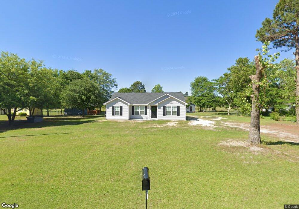
1044 Welsh Poppy Cir Manning, SC 29102
Estimated Value: $130,000 - $284,000
--
Bed
--
Bath
1,269
Sq Ft
$154/Sq Ft
Est. Value
About This Home
This home is located at 1044 Welsh Poppy Cir, Manning, SC 29102 and is currently estimated at $194,914, approximately $153 per square foot. 1044 Welsh Poppy Cir is a home with nearby schools including Manning Early Childhood Center, Manning Primary School, and Manning Elementary School.
Ownership History
Date
Name
Owned For
Owner Type
Purchase Details
Closed on
Jan 25, 2022
Sold by
Valdez Maria D
Bought by
Valdez Maria D and Valdez Luis A
Current Estimated Value
Home Financials for this Owner
Home Financials are based on the most recent Mortgage that was taken out on this home.
Original Mortgage
$169,840
Interest Rate
3.56%
Mortgage Type
Construction
Purchase Details
Closed on
Mar 29, 2018
Sold by
Hyman Frances T and Tucker James E
Bought by
Valdez Maria D
Create a Home Valuation Report for This Property
The Home Valuation Report is an in-depth analysis detailing your home's value as well as a comparison with similar homes in the area
Home Values in the Area
Average Home Value in this Area
Purchase History
| Date | Buyer | Sale Price | Title Company |
|---|---|---|---|
| Valdez Maria D | -- | Gray Law Firm Llc | |
| Valdez Maria D | $5,000 | -- |
Source: Public Records
Mortgage History
| Date | Status | Borrower | Loan Amount |
|---|---|---|---|
| Closed | Valdez Maria D | $169,840 |
Source: Public Records
Tax History Compared to Growth
Tax History
| Year | Tax Paid | Tax Assessment Tax Assessment Total Assessment is a certain percentage of the fair market value that is determined by local assessors to be the total taxable value of land and additions on the property. | Land | Improvement |
|---|---|---|---|---|
| 2024 | $3,241 | $8,133 | $345 | $7,788 |
| 2023 | $1,042 | $5,512 | $320 | $5,192 |
| 2022 | $132 | $345 | $345 | $0 |
| 2021 | $104 | $300 | $300 | $0 |
| 2020 | $104 | $300 | $0 | $0 |
| 2019 | $100 | $300 | $0 | $0 |
| 2018 | $106 | $330 | $0 | $0 |
| 2017 | $86 | $274 | $0 | $0 |
| 2016 | $85 | $274 | $0 | $0 |
| 2015 | $74 | $238 | $238 | $0 |
| 2014 | $73 | $238 | $238 | $0 |
| 2013 | -- | $238 | $238 | $0 |
Source: Public Records
Map
Nearby Homes
- TBD Old Georgetown Rd @ I95
- 1111 Foxbrook Ln
- 2695 Paxville Hwy
- 1000 Carolina Way
- 416 Thames St
- 406 Thames St
- 409 W Boyce St
- TBD Branchview Dr
- TBD Barnwell St
- 107 Sumter St
- 101 Sumter St
- 250 Dyson St
- 22 W End St
- 200 W Boyce St
- W Huggins St
- 40 W Rigby St
- 204 Drayton St
- 387 Drayton St
- 5301 Cypress Pointe #D301
- 633 Sykes St
- 1092 Welsh Poppy Cir
- 1014 Welsh Poppy Cir
- 1098 Welsh Poppy Cir
- 1201 Tansy St
- 1217 Tansy St
- 1159 Tansy St
- 2769 Old Georgetown Rd
- 1293 Tansy St
- 2799 Old Georgetown Rd
- 2899 Old Georgetown Rd
- 2046 Crossroads Church Rd
- 2138 Crossroads Church Rd
- 2138 S-14-126
- 1893 Crossroads Church Rd
- 1812 S-14-126
- 3065 Old Georgetown Rd
- 2509 Old Georgetown Rd
- 2169 Crossroads Church Rd
- 2169 S-14-126
- 2225 Crossroads Church Rd