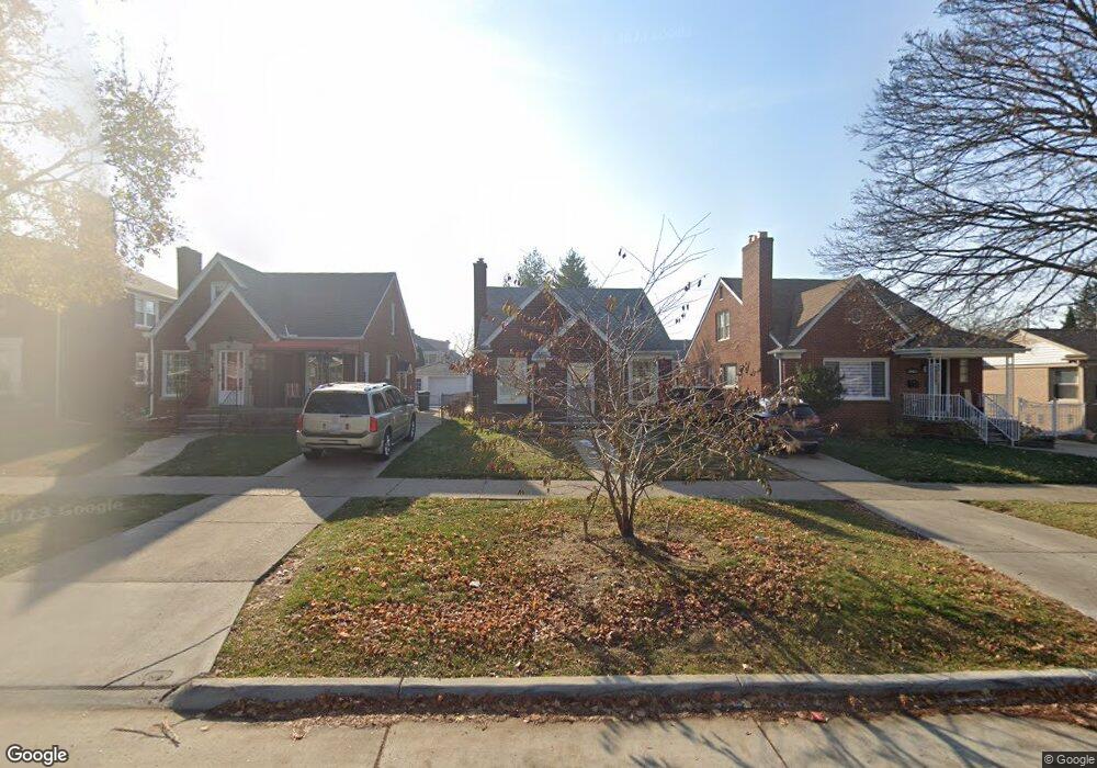
10445 S Morrow Cir Dearborn, MI 48126
Aviation NeighborhoodEstimated Value: $270,809 - $302,000
3
Beds
3
Baths
1,448
Sq Ft
$200/Sq Ft
Est. Value
About This Home
This home is located at 10445 S Morrow Cir, Dearborn, MI 48126 and is currently estimated at $289,202, approximately $199 per square foot. 10445 S Morrow Cir is a home located in Wayne County with nearby schools including McDonald Elementary School, McCollough-Unis School, and Fordson High School.
Ownership History
Date
Name
Owned For
Owner Type
Purchase Details
Closed on
Oct 29, 2007
Sold by
Fannie Mae
Bought by
Hajalie Hilal
Current Estimated Value
Purchase Details
Closed on
Dec 5, 2006
Sold by
Mortgage Electronic Registration Systems
Bought by
Federal National Mortgage Association
Purchase Details
Closed on
Oct 19, 2006
Sold by
Ajamy Jihad and Ajamy Rania
Bought by
Mortgage Electronic Registration Systems
Purchase Details
Closed on
Jul 14, 2000
Sold by
Ajami Jihad
Bought by
Ajami Jihad
Purchase Details
Closed on
Dec 13, 1996
Sold by
Far Allie Hamood and Far Ghada
Bought by
Jihad Ajami
Create a Home Valuation Report for This Property
The Home Valuation Report is an in-depth analysis detailing your home's value as well as a comparison with similar homes in the area
Home Values in the Area
Average Home Value in this Area
Purchase History
| Date | Buyer | Sale Price | Title Company |
|---|---|---|---|
| Hajalie Hilal | $108,000 | Greco | |
| Federal National Mortgage Association | -- | Enterprise Title | |
| Mortgage Electronic Registration Systems | $156,393 | None Available | |
| Ajami Jihad | -- | -- | |
| Jihad Ajami | $105,000 | -- |
Source: Public Records
Tax History Compared to Growth
Tax History
| Year | Tax Paid | Tax Assessment Tax Assessment Total Assessment is a certain percentage of the fair market value that is determined by local assessors to be the total taxable value of land and additions on the property. | Land | Improvement |
|---|---|---|---|---|
| 2025 | $2,951 | $120,900 | $0 | $0 |
| 2024 | $2,951 | $113,900 | $0 | $0 |
| 2023 | $2,625 | $96,600 | $0 | $0 |
| 2022 | $3,022 | $80,100 | $0 | $0 |
| 2021 | $3,096 | $75,300 | $0 | $0 |
| 2019 | $3,054 | $67,000 | $0 | $0 |
| 2018 | $2,650 | $62,600 | $0 | $0 |
| 2017 | $624 | $55,200 | $0 | $0 |
| 2011 | -- | $42,350 | $0 | $0 |
Source: Public Records
Map
Nearby Homes
- 7312 Theisen St
- 7361 Pinehurst St
- 7653 Pinehurst St
- 12800 S Morrow Cir
- 7741 Miller Rd
- 7642 Normile St
- 7651 Appoline St
- 7900 Middlepointe St
- 7925 Pinehurst St
- 10339 Tireman Ave
- 8511 Lonyo St
- 7929 Normile St
- 7841 Wyoming St
- 7857 Esper Blvd
- 7870 Oakman Blvd
- 8043 E Morrow Cir
- 10132 Tireman St
- 6840 Oakman Blvd
- 7261 Reuter St
- 8100 Middlepoint St
- 10451 S Morrow Cir
- 10437 S Morrow Cir
- 10427 S Morrow Cir
- 10461 S Morrow Cir
- 7337 Middlepointe St
- 7336 Theisen St
- 7329 Middlepointe St
- 7330 Theisen St
- 7321 Middlepointe St
- 7320 Theisen St
- 7323 Theisen St
- 10395 S Morrow Cir
- 10511 S Morrow Cir
- 10450 S Morrow Cir
- 10436 S Morrow Cir
- 7315 Middlepointe St
- 10460 S Morrow Cir
- 10426 S Morrow Cir
- 7304 Theisen St
- 7339 Theisen St