Estimated Value: $771,856 - $908,000
3
Beds
3
Baths
2,409
Sq Ft
$356/Sq Ft
Est. Value
About This Home
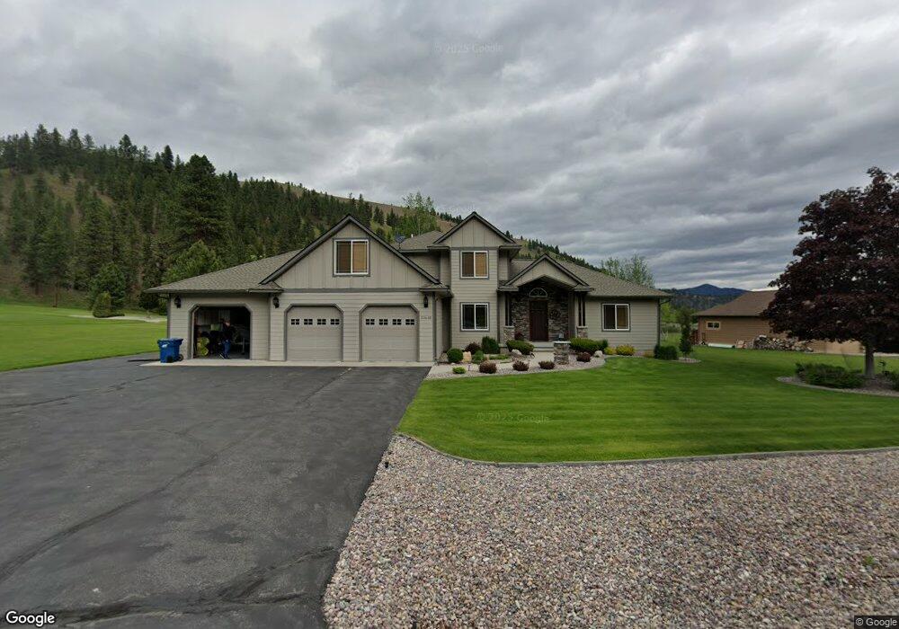
This home is located at 10446 Nez Perce Loop, Lolo, MT 59847 and is currently estimated at $858,214, approximately $356 per square foot. 10446 Nez Perce Loop is a home located in Missoula County with nearby schools including Lolo Elementary School, Lolo Middle School, and Sentinel High School.
Ownership History
Date
Name
Owned For
Owner Type
Purchase Details
Closed on
Jun 29, 2005
Sold by
Senestraro John and Senestraro Sally
Bought by
Wyman Gordon E and Wyman Judith M
Current Estimated Value
Create a Home Valuation Report for This Property
The Home Valuation Report is an in-depth analysis detailing your home's value as well as a comparison with similar homes in the area
Purchase History
| Date | Buyer | Sale Price | Title Company |
|---|---|---|---|
| Wyman Gordon E | -- | First American Title Company |
Source: Public Records
Tax History
| Year | Tax Paid | Tax Assessment Tax Assessment Total Assessment is a certain percentage of the fair market value that is determined by local assessors to be the total taxable value of land and additions on the property. | Land | Improvement |
|---|---|---|---|---|
| 2025 | $6,194 | $843,000 | $210,670 | $632,330 |
| 2024 | $8,373 | $725,000 | $139,602 | $585,398 |
| 2023 | $7,150 | $725,000 | $139,602 | $585,398 |
| 2022 | $6,407 | $542,200 | $0 | $0 |
| 2021 | $5,708 | $542,200 | $0 | $0 |
| 2020 | $5,344 | $494,400 | $0 | $0 |
| 2019 | $5,310 | $494,400 | $0 | $0 |
| 2018 | $4,544 | $433,500 | $0 | $0 |
| 2017 | $4,580 | $433,500 | $0 | $0 |
| 2016 | $4,074 | $389,500 | $0 | $0 |
| 2015 | $3,905 | $389,500 | $0 | $0 |
| 2014 | $4,049 | $224,826 | $0 | $0 |
Source: Public Records
Map
Nearby Homes
- Nhn Nez Perce Loop
- 12196 Cowcatcher Dr
- 10636 Nez Perce Loop
- 10131 Barns Ct
- 10596 Nez Perce Loop
- 9883 Hatton Ln
- 9745 U S 12
- 11625 Highway 12 W
- 11327 Sleeman Ln
- 8350 Vann Dr
- 9280 Mormon Creek Rd
- 10200 Sleeman Creek Rd
- 10972 Stella Blue Dr
- 12326 Nature Ct
- 12458 Nature Ct
- 12819 Anchor Rd
- 430 Claremont St
- 15100 Rock Ridge Rd
- 6896 Jack Pine Ct
- 261 Capdevilla
- 10430 Nez Perce Loop
- 12565 Claimstake Ct
- 12567 Conestoga Way
- 10515 Nez Perce Loop
- 12721 Conestoga Way
- 0 Lot 22 Nez Perce Loop Unit 22214694
- 11 Conestoga Way
- LOT 9 Conestoga Way
- LOT 29 Conestoga Way
- 12498 Conestoga Way
- 12610 Conestoga Way
- 10533 Nez Perce Loop
- 12584 Claimstake Ct
- 12741 Conestoga Way
- 12646 Conestoga Way
- 12670 Conestoga Way
- 12499 Claimstake Ct
- 10516 Nez Perce Loop
- 12538 Claimstake Ct
- Lot 22 Nez Perce Loop
Your Personal Tour Guide
Ask me questions while you tour the home.