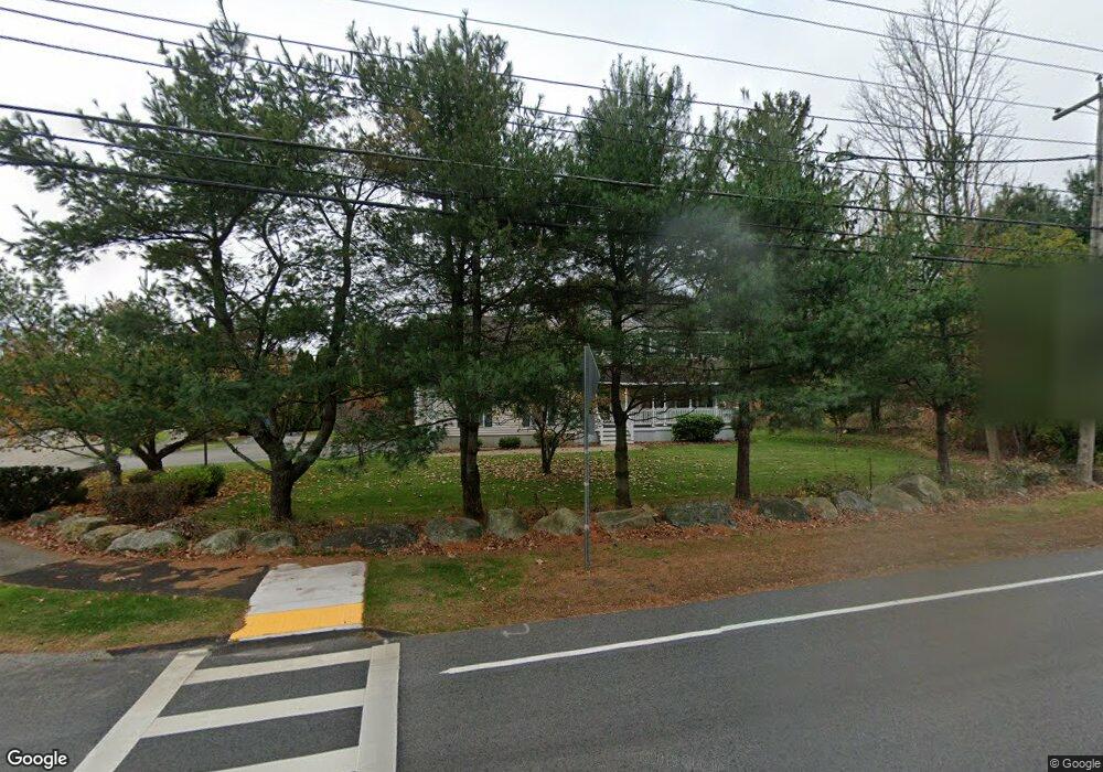
1045 Andover St Tewksbury, MA 01876
Estimated Value: $830,000 - $903,000
3
Beds
3
Baths
2,500
Sq Ft
$349/Sq Ft
Est. Value
About This Home
This home is located at 1045 Andover St, Tewksbury, MA 01876 and is currently estimated at $873,405, approximately $349 per square foot. 1045 Andover St is a home located in Middlesex County with nearby schools including John F. Ryan Elementary School, John W. Wynn Middle School, and Tewksbury Memorial High School.
Ownership History
Date
Name
Owned For
Owner Type
Purchase Details
Closed on
Sep 30, 2003
Sold by
Mills Dianne M and Mills Edward A
Bought by
Harrington Mariella T and Harrington Richard J
Current Estimated Value
Purchase Details
Closed on
May 31, 1996
Sold by
Lj Dipalma Inc
Bought by
Mills Edward A and Mills Dianne
Purchase Details
Closed on
Jan 24, 1989
Sold by
Whelan Michael G
Bought by
Decarolis Armando
Create a Home Valuation Report for This Property
The Home Valuation Report is an in-depth analysis detailing your home's value as well as a comparison with similar homes in the area
Home Values in the Area
Average Home Value in this Area
Purchase History
| Date | Buyer | Sale Price | Title Company |
|---|---|---|---|
| Harrington Mariella T | $490,000 | -- | |
| Mills Edward A | $224,900 | -- | |
| Decarolis Armando | $170,000 | -- |
Source: Public Records
Mortgage History
| Date | Status | Borrower | Loan Amount |
|---|---|---|---|
| Open | Decarolis Armando | $290,000 | |
| Closed | Decarolis Armando | $290,000 |
Source: Public Records
Tax History Compared to Growth
Tax History
| Year | Tax Paid | Tax Assessment Tax Assessment Total Assessment is a certain percentage of the fair market value that is determined by local assessors to be the total taxable value of land and additions on the property. | Land | Improvement |
|---|---|---|---|---|
| 2025 | $10,230 | $773,800 | $351,100 | $422,700 |
| 2024 | $10,005 | $747,200 | $334,500 | $412,700 |
| 2023 | $9,706 | $688,400 | $304,000 | $384,400 |
| 2022 | $9,217 | $606,400 | $264,400 | $342,000 |
| 2021 | $6,953 | $573,500 | $240,500 | $333,000 |
| 2020 | $8,798 | $550,900 | $229,100 | $321,800 |
| 2019 | $8,091 | $510,800 | $217,800 | $293,000 |
| 2018 | $5,494 | $475,400 | $217,800 | $257,600 |
| 2017 | $7,915 | $485,300 | $217,800 | $267,500 |
| 2016 | $7,577 | $463,400 | $217,800 | $245,600 |
| 2015 | $7,371 | $450,300 | $214,300 | $236,000 |
| 2014 | $6,998 | $434,400 | $217,800 | $216,600 |
Source: Public Records
Map
Nearby Homes
- 9 Cobleigh Dr
- 110 Longmeadow Dr
- 115 Edgewood St
- 1220 Andover St
- 5 Lawn Ave
- 241 Remington St
- 65 Martin Rd
- 186 Burnham Rd
- 188 Poland Ave
- 149 Merrimack Meadows Ln Unit 149
- 198 Trull Ln E
- 70 Enfield St
- 210 River Rd
- 103 Westwind Rd
- 15 Sharyn Cir
- 512 Merrimack Ave
- 26 Luce St
- 34 Geana Ln
- 154 Parkview Ave
- 821 Merrimack Ave
- 21 Waterford Meadow Dr
- 1067 Andover St
- 1044 Andover St
- 1056 Andover St
- 20 Waterford Meadow Dr
- 31 Waterford Meadow Dr
- 1032 Andover St
- 1066 Andover St
- 1075 Andover St
- 30 Waterford Meadow Dr
- 20 Blacksmith Ln
- 21 Blacksmith Ln
- 41 Waterford Meadow Dr
- 50 Waterford Meadow Dr
- 1085 Andover St
- 10 Cooney Rd
- 15 Sandpiper Ln
- 30 Blacksmith Ln
- 1091 Andover St
- 30 Cooney Rd