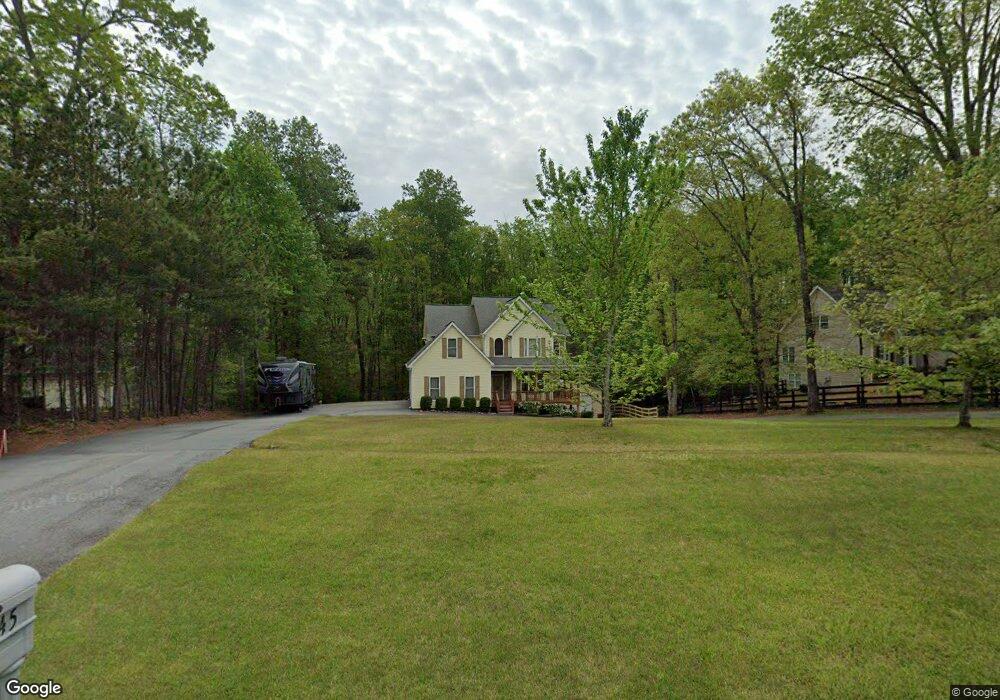
1045 Carlisle Rd Dawsonville, GA 30534
Dawson County NeighborhoodEstimated Value: $417,000 - $588,000
4
Beds
3
Baths
2,160
Sq Ft
$227/Sq Ft
Est. Value
About This Home
This home is located at 1045 Carlisle Rd, Dawsonville, GA 30534 and is currently estimated at $490,167, approximately $226 per square foot. 1045 Carlisle Rd is a home located in Dawson County with nearby schools including Kilough Elementary School, Dawson County Middle School, and Dawson County Junior High School.
Ownership History
Date
Name
Owned For
Owner Type
Purchase Details
Closed on
Jun 14, 2024
Sold by
Waag Stuart
Bought by
Roughton Tim Wayne and Roughton Deena Leigh
Current Estimated Value
Purchase Details
Closed on
Dec 20, 2013
Sold by
Shirley Kenneth Shane
Bought by
Waag Stuart
Home Financials for this Owner
Home Financials are based on the most recent Mortgage that was taken out on this home.
Original Mortgage
$164,835
Interest Rate
3.37%
Mortgage Type
FHA
Purchase Details
Closed on
Mar 12, 2002
Sold by
Shirley Kenneth Shane and Shirley Holly
Bought by
Shirley Kenneth Shane
Purchase Details
Closed on
Jun 13, 2001
Sold by
Abercrombie Upton S and Jo Ann
Bought by
Shirley Kenneth Shane and Holly Maria
Create a Home Valuation Report for This Property
The Home Valuation Report is an in-depth analysis detailing your home's value as well as a comparison with similar homes in the area
Home Values in the Area
Average Home Value in this Area
Purchase History
| Date | Buyer | Sale Price | Title Company |
|---|---|---|---|
| Roughton Tim Wayne | -- | None Listed On Document | |
| Roughton Tim Wayne | -- | None Listed On Document | |
| Waag Stuart | $180,000 | -- | |
| Shirley Kenneth Shane | -- | -- | |
| Shirley Kenneth Shane | $25,000 | -- |
Source: Public Records
Mortgage History
| Date | Status | Borrower | Loan Amount |
|---|---|---|---|
| Previous Owner | Waag Stuart | $164,835 |
Source: Public Records
Tax History Compared to Growth
Tax History
| Year | Tax Paid | Tax Assessment Tax Assessment Total Assessment is a certain percentage of the fair market value that is determined by local assessors to be the total taxable value of land and additions on the property. | Land | Improvement |
|---|---|---|---|---|
| 2024 | $3,148 | $194,520 | $30,000 | $164,520 |
| 2023 | $3,131 | $191,360 | $30,000 | $161,360 |
| 2022 | $3,122 | $147,720 | $20,000 | $127,720 |
| 2021 | $2,918 | $130,960 | $20,000 | $110,960 |
| 2020 | $3,013 | $129,320 | $20,000 | $109,320 |
| 2019 | $2,835 | $120,800 | $20,000 | $100,800 |
| 2018 | $2,841 | $120,800 | $20,000 | $100,800 |
| 2017 | $2,256 | $96,317 | $10,032 | $86,285 |
| 2016 | $2,238 | $95,558 | $10,032 | $85,526 |
| 2015 | $2,147 | $88,995 | $9,120 | $79,875 |
| 2014 | $1,685 | $68,122 | $9,120 | $59,002 |
| 2013 | -- | $58,128 | $9,120 | $49,008 |
Source: Public Records
Map
Nearby Homes
- 157 Highland Pointe Cir E
- 208 Highland Pointe Cir E
- 18 Greenfield Dr
- 161 Oakmont Dr
- 157 Northfield Cir
- 55 Summittrail Ln
- 454 Summit Overlook Dr
- 5 Cantrell Rd
- 4 Cantrell Rd
- 3 Cantrell Rd
- 2 Cantrell Rd
- 1 Cantrell Rd
- Grenbrier Plan at Castleberry Pointe
- Cambridge Plan at Castleberry Pointe
- Oglethorpe Plan at Castleberry Pointe
- Springdale Plan at Castleberry Pointe
- Addison Plan at Castleberry Pointe
- Brookfield Plan at Castleberry Pointe
- Sweetbriar Plan at Castleberry Pointe
- 0 Whitmire Dr Unit 10454771
- 1021 Carlisle Rd
- 1061 Carlisle Rd
- 987 Carlisle Rd
- 1113 Carlisle Rd
- 1342 Blue Ridge Overlook
- 130 Highland Point E
- 124 Highland Pointe Cir E Unit E
- 124 Highland Pointe Cir E
- 124 Highland Pointe Cir E Unit 69
- 130 Highland Pointe Cir E
- 1264 Blue Ridge Overlook
- 136 Highland Pointe Cir E
- 114 Highland Pointe Cir E
- 144 Highland Pointe Cir E
- 112 Highland Pointe Cir E
- 150 Highland Pointe Cir E
- 156 Highland Pointe Cir E
- 106 Highland Pointe Cir E
- 20 Oakmont Dr
- 170 Highland Pointe Cir E Unit 75