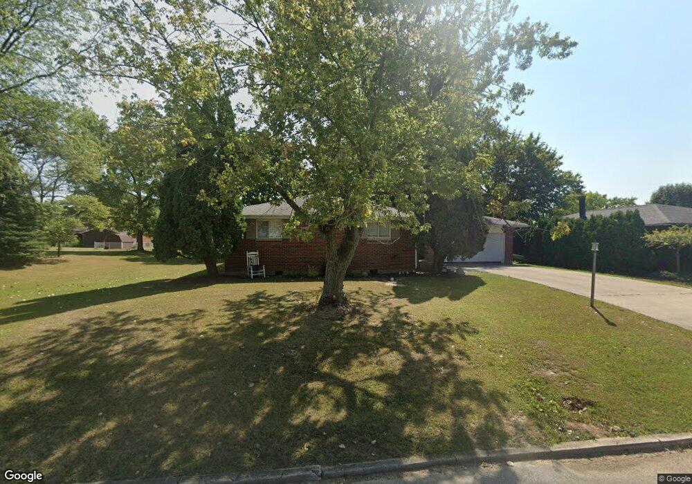
1045 Caroline Ave Union City, IN 47390
Estimated Value: $143,000 - $178,000
3
Beds
2
Baths
1,510
Sq Ft
$106/Sq Ft
Est. Value
About This Home
This home is located at 1045 Caroline Ave, Union City, IN 47390 and is currently estimated at $159,480, approximately $105 per square foot. 1045 Caroline Ave is a home located in Randolph County with nearby schools including North Side Elementary School and Union City Community Jr/Sr High School.
Ownership History
Date
Name
Owned For
Owner Type
Purchase Details
Closed on
Nov 29, 2018
Sold by
Heuss Herman Allan and Heuss Helen
Bought by
Jessup Bradley W
Current Estimated Value
Home Financials for this Owner
Home Financials are based on the most recent Mortgage that was taken out on this home.
Original Mortgage
$104,193
Outstanding Balance
$91,796
Interest Rate
4.8%
Mortgage Type
VA
Estimated Equity
$67,684
Purchase Details
Closed on
Dec 6, 2013
Sold by
Heuss Herman A and Heuss Helen A
Bought by
Heuss Herman Allan and Heuss Helen
Create a Home Valuation Report for This Property
The Home Valuation Report is an in-depth analysis detailing your home's value as well as a comparison with similar homes in the area
Home Values in the Area
Average Home Value in this Area
Purchase History
| Date | Buyer | Sale Price | Title Company |
|---|---|---|---|
| Jessup Bradley W | $11,292,018 | None Available | |
| Heuss Herman Allan | -- | None Available |
Source: Public Records
Mortgage History
| Date | Status | Borrower | Loan Amount |
|---|---|---|---|
| Open | Jessup Bradley W | $104,193 |
Source: Public Records
Tax History Compared to Growth
Tax History
| Year | Tax Paid | Tax Assessment Tax Assessment Total Assessment is a certain percentage of the fair market value that is determined by local assessors to be the total taxable value of land and additions on the property. | Land | Improvement |
|---|---|---|---|---|
| 2024 | $1,013 | $101,300 | $14,900 | $86,400 |
| 2023 | $1,028 | $101,400 | $14,900 | $86,500 |
| 2022 | $1,095 | $104,700 | $14,900 | $89,800 |
| 2021 | $985 | $94,100 | $14,800 | $79,300 |
| 2020 | $999 | $97,900 | $14,800 | $83,100 |
| 2019 | $999 | $98,000 | $14,800 | $83,200 |
| 2018 | $809 | $76,300 | $10,400 | $65,900 |
| 2017 | $802 | $75,600 | $10,400 | $65,200 |
| 2016 | $837 | $78,900 | $9,900 | $69,000 |
| 2014 | $762 | $74,200 | $9,900 | $64,300 |
| 2013 | $762 | $71,900 | $9,900 | $62,000 |
Source: Public Records
Map
Nearby Homes
- 1013 Caroline Ave
- 402 Charles St
- 1210 W Hickory St
- 1103 W Oak St
- 508 N High St
- LOT 19 & 20 Governor Isaac P Gray Add
- LOT 9 Governor P Isaac Add
- 504 Leahey St
- LOT 25 Governor Isaac P Gray Add
- LOT 18 Governor Isaac P Gray Add
- 612 N Howard St
- 507 N Howard St
- 509 Indiana 28
- 800 W Chestnut St
- 299 S Willow Dr Unit 61
- 299 S Willow Dr Unit Lot 63
- 0 W Deerfield Rd Unit 23016117
- 0 W Deerfield Rd Unit 837795
- 0 W Deerfield Rd
- 207 Allen Dr
- 1049 Caroline Ave
- 1037 Caroline Ave
- 1053 Caroline Ave
- 1048 Debolt Ave
- 1040 Debolt Ave
- 1052 Debolt Ave
- 1033 Caroline Ave
- 1057 Caroline Ave
- 1052 Caroline Ave
- Lot 15 Debolt Ave
- 1056 Debolt Ave
- 1022 Caroline Ave
- 1056 Caroline Ave
- 1029 Caroline Ave
- 1061 Caroline Ave
- 1028 Debolt Ave
- 1060 Debolt Ave
- 1060 Caroline Ave
- 1010 Caroline Ave
- 1008 Caroline Ave Unit Avenure