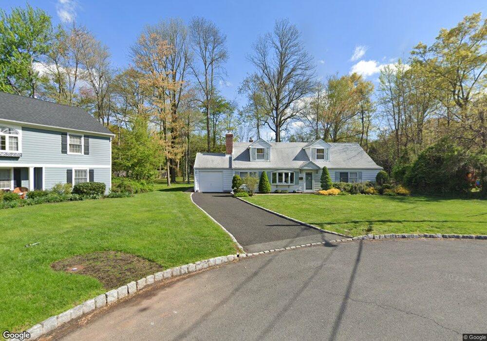
1045 Harding St Westfield, NJ 07090
Estimated Value: $965,378 - $1,103,000
--
Bed
--
Bath
2,240
Sq Ft
$454/Sq Ft
Est. Value
About This Home
This home is located at 1045 Harding St, Westfield, NJ 07090 and is currently estimated at $1,017,845, approximately $454 per square foot. 1045 Harding St is a home located in Union County with nearby schools including Washington Elementary School, Edison Intermediate School, and Westfield Senior High School.
Ownership History
Date
Name
Owned For
Owner Type
Purchase Details
Closed on
Aug 13, 2020
Sold by
Gillhaus Craig M and Estate Of Patricia B Gillhaus
Bought by
Gillhaus Craig M and Ronald C Gilihaus Special Need
Current Estimated Value
Purchase Details
Closed on
Jul 12, 2018
Sold by
Gillhaus Frank J and Gillhaus Patricia B
Bought by
Gillhaus Patricia B
Purchase Details
Closed on
Oct 28, 1976
Bought by
Gillhaus Frank J and Gillhaus Patricia
Create a Home Valuation Report for This Property
The Home Valuation Report is an in-depth analysis detailing your home's value as well as a comparison with similar homes in the area
Home Values in the Area
Average Home Value in this Area
Purchase History
| Date | Buyer | Sale Price | Title Company |
|---|---|---|---|
| Gillhaus Craig M | -- | Prestige Title Agency Inc | |
| Gillhaus Patricia B | -- | None Available | |
| Gillhaus Frank J | -- | -- |
Source: Public Records
Tax History Compared to Growth
Tax History
| Year | Tax Paid | Tax Assessment Tax Assessment Total Assessment is a certain percentage of the fair market value that is determined by local assessors to be the total taxable value of land and additions on the property. | Land | Improvement |
|---|---|---|---|---|
| 2025 | $12,715 | $564,600 | $496,400 | $68,200 |
| 2024 | $12,455 | $564,600 | $496,400 | $68,200 |
| 2023 | $12,455 | $564,600 | $496,400 | $68,200 |
| 2022 | $12,195 | $564,600 | $496,400 | $68,200 |
| 2021 | $12,212 | $564,600 | $496,400 | $68,200 |
| 2020 | $12,184 | $564,600 | $496,400 | $68,200 |
| 2019 | $12,139 | $564,600 | $496,400 | $68,200 |
| 2018 | $12,867 | $138,400 | $70,700 | $67,700 |
| 2017 | $12,796 | $138,400 | $70,700 | $67,700 |
| 2016 | $12,496 | $138,400 | $70,700 | $67,700 |
| 2015 | $11,997 | $138,400 | $70,700 | $67,700 |
| 2014 | $11,593 | $138,400 | $70,700 | $67,700 |
Source: Public Records
Map
Nearby Homes
- 806 Saint Marks Ave
- 684 Gallows Hill Rd
- 7 Folkstone Dr
- 820 E Broad St
- 131 Wells St
- 128 Woodland Ave
- 4 Cedar St
- 203 Beech St
- 529 Benson Place
- 764 Fairacres Ave
- 401 Brookside Place
- 41 C Sandra Cir Unit C3
- 223 5th Ave
- 2 Brown Terrace
- 34 Woodbrook Cir
- 305 Cedar St
- 58 Sandra Cir Unit B-3
- 114 Beech St
- 519 3rd Ave
- 5 Penn Rd
- 1041 Harding St
- 1044 Harding St
- 1037 Harding St
- 260 Gallows Hill Rd
- 1040 Harding St
- 1033 Harding St
- 1036 Harding St
- 1029 Harding St
- 1032 Harding St
- 1055 Coolidge St
- 1051 Coolidge St
- 1028 Harding St
- 1049 Coolidge St
- 1025 Harding St
- 1059 Coolidge St
- 1045 Coolidge St
- 1024 Harding St
- 1037 Coolidge St
- 1021 Harding St
- 1033 Coolidge St