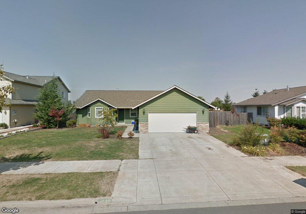
1045 Heckart Ln Harrisburg, OR 97446
Estimated Value: $437,622 - $448,000
3
Beds
2
Baths
1,598
Sq Ft
$277/Sq Ft
Est. Value
About This Home
This home is located at 1045 Heckart Ln, Harrisburg, OR 97446 and is currently estimated at $442,811, approximately $277 per square foot. 1045 Heckart Ln is a home located in Linn County with nearby schools including Harrisburg Elementary School, Harrisburg Middle School, and Harrisburg High School.
Ownership History
Date
Name
Owned For
Owner Type
Purchase Details
Closed on
Dec 16, 2004
Sold by
Harriswood Properties Inc
Bought by
Pelkey Curtis D and Pelkey Sally J
Current Estimated Value
Home Financials for this Owner
Home Financials are based on the most recent Mortgage that was taken out on this home.
Original Mortgage
$126,800
Outstanding Balance
$63,375
Interest Rate
5.7%
Mortgage Type
Unknown
Estimated Equity
$379,436
Create a Home Valuation Report for This Property
The Home Valuation Report is an in-depth analysis detailing your home's value as well as a comparison with similar homes in the area
Home Values in the Area
Average Home Value in this Area
Purchase History
| Date | Buyer | Sale Price | Title Company |
|---|---|---|---|
| Pelkey Curtis D | $158,500 | Ticor Title |
Source: Public Records
Mortgage History
| Date | Status | Borrower | Loan Amount |
|---|---|---|---|
| Open | Pelkey Curtis D | $126,800 |
Source: Public Records
Tax History Compared to Growth
Tax History
| Year | Tax Paid | Tax Assessment Tax Assessment Total Assessment is a certain percentage of the fair market value that is determined by local assessors to be the total taxable value of land and additions on the property. | Land | Improvement |
|---|---|---|---|---|
| 2024 | $3,984 | $218,570 | -- | -- |
| 2023 | $3,875 | $212,210 | $0 | $0 |
| 2022 | $3,789 | $206,030 | $0 | $0 |
| 2021 | $3,678 | $200,030 | $0 | $0 |
| 2020 | $3,632 | $194,210 | $0 | $0 |
| 2019 | $3,540 | $188,560 | $0 | $0 |
| 2018 | $3,103 | $183,070 | $0 | $0 |
| 2017 | $2,977 | $177,740 | $0 | $0 |
| 2016 | $2,757 | $172,570 | $0 | $0 |
| 2015 | $2,681 | $167,550 | $0 | $0 |
| 2014 | $2,661 | $162,670 | $0 | $0 |
Source: Public Records
Map
Nearby Homes
- 1033 Sommerville Loop
- 1033 Sommerville Lp
- 1001 Sommerville Loop
- 961 S 9th St
- 1025 S 6th St Unit 25
- 1025 S 6th St
- 1025 S 6th St Unit 83
- 888 S 9th St
- 30540 Priceboro Dr
- 970 Lasalle St
- 950 Lasalle St
- 855 Spurlock St
- Lot 7 Territorial St
- 22461 Coburg Rd
- 340 Moore St
- 190 N 1st St
- 735 N Periander
- 741 N Periander
- 881 Arrow Leaf Place
- 24315 Peoria Rd
- 1047 Heckart Ln
- 1041 Heckart Ln
- 1049 Heckart Ln
- 1052 Heckart Ln
- 1050 Heckart Ln
- 1054 Heckart Ln
- 1048 Heckart Ln
- 1040 Heckart Ln
- 1051 Heckart Ln
- 1042 Heckart Ln
- 1046 Heckart Ln
- 1087 Siuslaw St
- 1089 Siuslaw St
- 1025 Heckart Ln
- 1044 Heckart Ln
- 1085 Siuslaw St
- 1091 Siuslaw St
- 1055 S 11th St
- 1083 Siuslaw St
- 1057 S 11th St