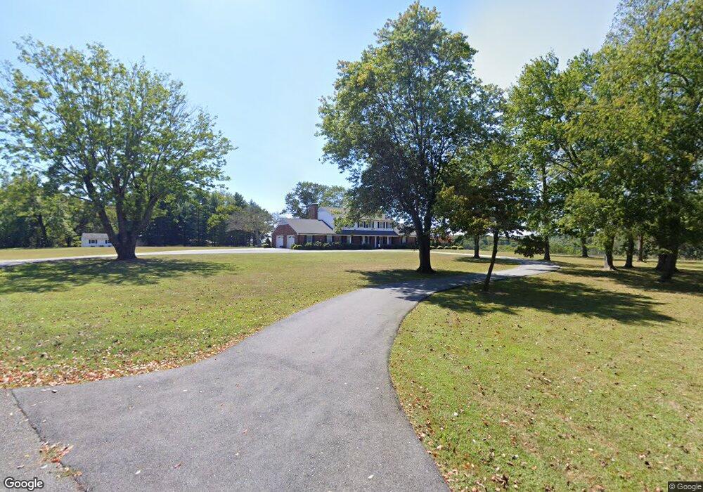
1045 Monolith Ln Forest, VA 24551
Estimated Value: $647,000 - $794,982
4
Beds
4
Baths
3,635
Sq Ft
$206/Sq Ft
Est. Value
About This Home
This home is located at 1045 Monolith Ln, Forest, VA 24551 and is currently estimated at $750,496, approximately $206 per square foot. 1045 Monolith Ln is a home located in Bedford County with nearby schools including Boonsboro Elementary School, Forest Middle School, and Jefferson Forest High School.
Ownership History
Date
Name
Owned For
Owner Type
Purchase Details
Closed on
Jun 16, 2025
Sold by
Carter David A and Carter Teresa W
Bought by
David A Carter Revocable Trust and Teresa W Carter Revocable Trust
Current Estimated Value
Purchase Details
Closed on
Oct 28, 2019
Sold by
Addison Betty B and Addison Leslie W
Bought by
Carter David A and Carter Teresa W
Home Financials for this Owner
Home Financials are based on the most recent Mortgage that was taken out on this home.
Original Mortgage
$400,000
Interest Rate
3.7%
Create a Home Valuation Report for This Property
The Home Valuation Report is an in-depth analysis detailing your home's value as well as a comparison with similar homes in the area
Purchase History
| Date | Buyer | Sale Price | Title Company |
|---|---|---|---|
| David A Carter Revocable Trust | -- | None Listed On Document | |
| Carter David A | $496,000 | Reliance Title & Stlmnt Llc |
Source: Public Records
Mortgage History
| Date | Status | Borrower | Loan Amount |
|---|---|---|---|
| Previous Owner | Carter David A | $400,000 |
Source: Public Records
Tax History
| Year | Tax Paid | Tax Assessment Tax Assessment Total Assessment is a certain percentage of the fair market value that is determined by local assessors to be the total taxable value of land and additions on the property. | Land | Improvement |
|---|---|---|---|---|
| 2025 | $2,853 | $695,800 | $193,700 | $502,100 |
| 2024 | $2,853 | $695,800 | $193,700 | $502,100 |
| 2023 | $2,853 | $347,900 | $0 | $0 |
| 2022 | $2,481 | $248,100 | $0 | $0 |
| 2021 | $2,481 | $496,200 | $173,700 | $322,500 |
| 2020 | $2,481 | $496,200 | $173,700 | $322,500 |
| 2019 | $1,383 | $496,200 | $173,700 | $322,500 |
| 2018 | $2,259 | $434,500 | $125,000 | $309,500 |
| 2017 | $2,259 | $434,500 | $125,000 | $309,500 |
| 2016 | $2,259 | $434,500 | $125,000 | $309,500 |
| 2015 | $2,259 | $434,500 | $125,000 | $309,500 |
| 2014 | $2,230 | $428,900 | $120,000 | $308,900 |
Source: Public Records
Map
Nearby Homes
- 1079 High Oaks Dr
- 1110 Adam Hill Ct
- 103 Brockenbrough Place
- 1148 Val Terrace Ct
- 0 Gilfield Dr
- 1547 Gilfield Dr
- 118 Sailview Dr
- 0 Lejack Cir
- 0 Lejack Cir Unit 333233
- 1450 Lejack Cir
- 112 Haines Point Terrace
- 1118 Carnegie Place
- 1343 Smartview Ln
- 1300 Stoney Ridge Blvd Unit 208
- 2212 Deer Run
- 1301 Stoney Ridge Blvd
- 2223 Cottontown Rd
- 2199 Cottontown Rd
- 464 Oak Point Rd
- 1111 Lejack Cir
- 1072 Monolith Ln
- 4123 Cottontown Rd
- 1192 Monolith Ln
- 1018 Maddie Ln
- 1034 Maddie Ln
- 4064 Cottontown Rd
- 1076 Maddie Ln
- 1015 Maddie Ln
- 1033 Maddie Ln
- 1090 Abalone Bluff Dr
- 1036 Abalone Bluff Dr
- 1050 Abalone Bluff Dr
- 1063 Maddie Ln
- 1055 Autumn Run Dr
- 4042 Cottontown Rd
- 1078 Abalone Bluff Dr
- 1088 Maddie Ln
- 3938 Cottontown Rd
- 1087 Maddie Ln
- 1106 Abalone Bluff Dr
Your Personal Tour Guide
Ask me questions while you tour the home.