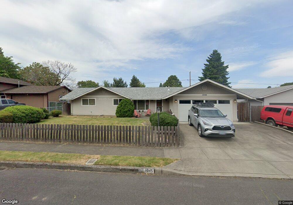
1045 SE 226th Ave Gresham, OR 97030
North Central NeighborhoodEstimated Value: $390,000 - $408,000
3
Beds
1
Bath
1,182
Sq Ft
$340/Sq Ft
Est. Value
About This Home
This home is located at 1045 SE 226th Ave, Gresham, OR 97030 and is currently estimated at $401,877, approximately $339 per square foot. 1045 SE 226th Ave is a home located in Multnomah County with nearby schools including Highland Elementary School, Clear Creek Middle School, and Gresham High School.
Ownership History
Date
Name
Owned For
Owner Type
Purchase Details
Closed on
Mar 2, 2016
Sold by
Cummings Robert E
Bought by
Westrell Nancy Lee
Current Estimated Value
Home Financials for this Owner
Home Financials are based on the most recent Mortgage that was taken out on this home.
Original Mortgage
$255,650
Outstanding Balance
$202,868
Interest Rate
3.81%
Mortgage Type
New Conventional
Estimated Equity
$199,009
Purchase Details
Closed on
Oct 30, 2013
Sold by
Cummings Robert E
Bought by
Cummings Robert E and Cummings Roberta M
Home Financials for this Owner
Home Financials are based on the most recent Mortgage that was taken out on this home.
Original Mortgage
$86,700
Interest Rate
4.46%
Mortgage Type
New Conventional
Create a Home Valuation Report for This Property
The Home Valuation Report is an in-depth analysis detailing your home's value as well as a comparison with similar homes in the area
Home Values in the Area
Average Home Value in this Area
Purchase History
We collect this data history from publicly available records. To have your information removed, we recommend requesting removal directly through your county’s website.
| Date | Buyer | Sale Price | Title Company |
|---|---|---|---|
| Westrell Nancy Lee | $249,802 | Fidelity Natl Title Co Of Or | |
| Cummings Robert E | -- | Wfg Title | |
| Cummings Robert E | -- | Wfg Title |
Source: Public Records
Mortgage History
We collect this data history from publicly available records. To have your information removed, we recommend requesting removal directly through your county’s website.
| Date | Status | Borrower | Loan Amount |
|---|---|---|---|
| Open | Westrell Nancy Lee | $255,650 | |
| Previous Owner | Cummings Robert E | $86,700 |
Source: Public Records
Tax History
| Year | Tax Paid | Tax Assessment Tax Assessment Total Assessment is a certain percentage of the fair market value that is determined by local assessors to be the total taxable value of land and additions on the property. | Land | Improvement |
|---|---|---|---|---|
| 2025 | $4,287 | $210,690 | -- | -- |
| 2024 | $4,104 | $204,560 | -- | -- |
| 2023 | $3,739 | $198,610 | $0 | $0 |
| 2022 | $3,635 | $192,830 | $0 | $0 |
| 2021 | $3,543 | $187,220 | $0 | $0 |
| 2020 | $3,334 | $181,770 | $0 | $0 |
| 2019 | $3,247 | $176,480 | $0 | $0 |
| 2018 | $3,096 | $171,340 | $0 | $0 |
| 2017 | $2,970 | $166,350 | $0 | $0 |
| 2016 | $2,619 | $161,510 | $0 | $0 |
| 2015 | $2,562 | $156,810 | $0 | $0 |
| 2014 | $2,500 | $152,250 | $0 | $0 |
Source: Public Records
Map
Nearby Homes
- 1035 SE 225th Ave
- 450 NE 22nd St
- 535 NE 24th St
- 2750 NE Elliott Ave
- 1783 1791 NE Beech Place
- 812 NE 28th St
- 1207 SE 217th Ave
- 892 NE 28th St
- 21532 SE Alder St
- 105 NW 13th St
- 1304 NW Victoria Ave
- 1675 NE Juniper Ave
- 21936 NE Couch St
- 830 NW Council Dr
- 21525 SE Oak St
- 1546 NE Cleveland Ave Unit 1568
- 21553 SE Ankeny Terrace
- 1211 SE 212th Ave
- 21260 SE Stark St
- 1926 NE Vista Ave
- 1035 SE 226th Ave
- 1115 SE 226th Ave
- 1050 SE 225th Ave
- 1036 SE 225th Ave
- 1112 SE 225th Ave
- 1019 SE 226th Ave
- 1127 SE 226th Ave
- 1044 SE 226th Ave
- 1110 SE 226th Ave
- 1022 SE 225th Ave
- 1120 SE 225th Ave
- 1032 SE 226th Ave
- 1124 SE 226th Ave
- 1005 SE 226th Ave
- 1141 SE 226th Ave
- 1018 SE 226th Ave
- 1010 SE 225th Ave
- 1136 SE 226th Ave
- 1047 SE 225th Ave
- 1130 SE 225th Ave
Your Personal Tour Guide
Ask me questions while you tour the home.