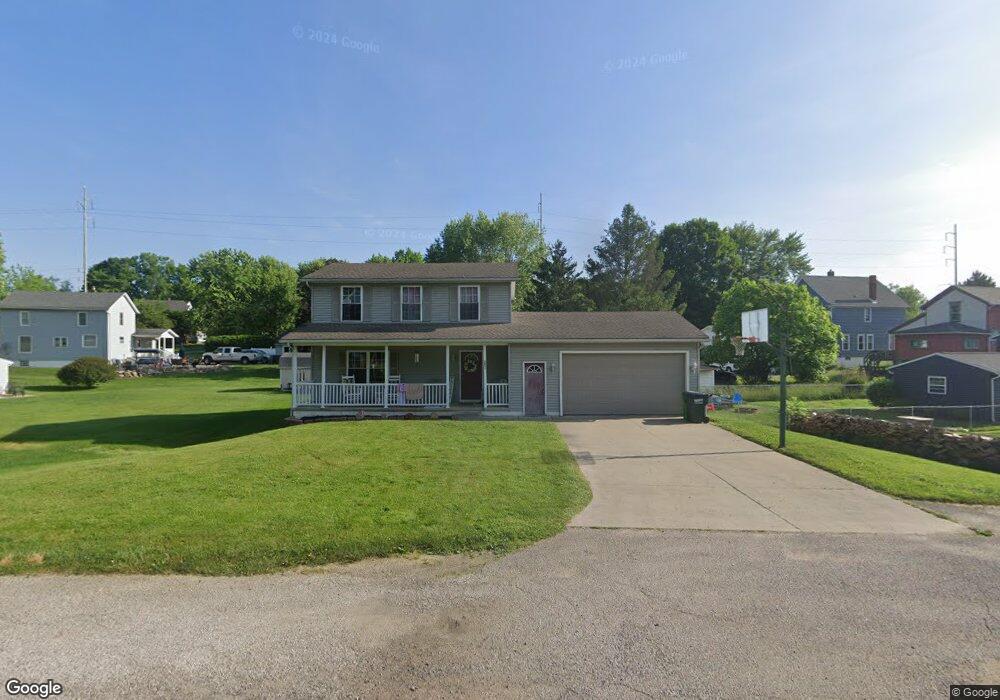
1045 Spring St Barberton, OH 44203
Columbia Lake NeighborhoodEstimated Value: $132,000 - $246,000
3
Beds
2
Baths
1,296
Sq Ft
$151/Sq Ft
Est. Value
About This Home
This home is located at 1045 Spring St, Barberton, OH 44203 and is currently estimated at $196,013, approximately $151 per square foot. 1045 Spring St is a home located in Summit County with nearby schools including Barberton Middle School, Barberton High School, and St Augustine Elementary School.
Ownership History
Date
Name
Owned For
Owner Type
Purchase Details
Closed on
Feb 11, 2004
Sold by
Muffet Fredrick J and Muffet Sandra L
Bought by
Mapel Neil C and Mapel Cheryl L
Current Estimated Value
Home Financials for this Owner
Home Financials are based on the most recent Mortgage that was taken out on this home.
Original Mortgage
$115,200
Outstanding Balance
$50,518
Interest Rate
4.9%
Mortgage Type
Purchase Money Mortgage
Estimated Equity
$145,495
Purchase Details
Closed on
Nov 1, 2002
Sold by
Herold Paul E and Herold Patricia L
Bought by
Muffet Fredrick J and Muffet Sandra L
Purchase Details
Closed on
Oct 10, 1995
Sold by
Frank Markovich Trst
Bought by
Herold Paul E
Home Financials for this Owner
Home Financials are based on the most recent Mortgage that was taken out on this home.
Original Mortgage
$65,951
Interest Rate
7.91%
Mortgage Type
FHA
Create a Home Valuation Report for This Property
The Home Valuation Report is an in-depth analysis detailing your home's value as well as a comparison with similar homes in the area
Home Values in the Area
Average Home Value in this Area
Purchase History
| Date | Buyer | Sale Price | Title Company |
|---|---|---|---|
| Mapel Neil C | $144,000 | Approved Statewide Title Age | |
| Muffet Fredrick J | $13,000 | C & J Title Agency Inc | |
| Herold Paul E | $66,000 | -- |
Source: Public Records
Mortgage History
| Date | Status | Borrower | Loan Amount |
|---|---|---|---|
| Open | Mapel Neil C | $115,200 | |
| Previous Owner | Herold Paul E | $65,951 | |
| Closed | Mapel Neil C | $28,800 |
Source: Public Records
Tax History Compared to Growth
Tax History
| Year | Tax Paid | Tax Assessment Tax Assessment Total Assessment is a certain percentage of the fair market value that is determined by local assessors to be the total taxable value of land and additions on the property. | Land | Improvement |
|---|---|---|---|---|
| 2025 | $2,704 | $54,089 | $8,120 | $45,969 |
| 2024 | $2,704 | $54,089 | $8,120 | $45,969 |
| 2023 | $2,704 | $54,089 | $8,120 | $45,969 |
| 2022 | $1,899 | $32,942 | $4,921 | $28,021 |
| 2021 | $1,897 | $32,942 | $4,921 | $28,021 |
| 2020 | $1,856 | $32,940 | $4,920 | $28,020 |
| 2019 | $2,196 | $35,280 | $5,360 | $29,920 |
| 2018 | $2,162 | $35,280 | $5,360 | $29,920 |
| 2017 | $2,190 | $35,280 | $5,360 | $29,920 |
| 2016 | $2,195 | $35,280 | $5,360 | $29,920 |
| 2015 | $2,190 | $35,280 | $5,360 | $29,920 |
| 2014 | $2,179 | $35,280 | $5,360 | $29,920 |
| 2013 | $3,094 | $51,960 | $5,360 | $46,600 |
Source: Public Records
Map
Nearby Homes
- 376 Hillsdale Ave
- 243 19th St NW
- 1080 Belleview Ave
- 243 27th St NW
- 139 24th St NW
- 524 Long Dr
- 96 Helen St
- 3193 Trotter Rd
- 38 24th St NW
- 1084 Wooster Rd W
- 108 30th St NW
- 679 Wooster Rd W
- 673 Wooster Rd W
- 2676 Pinegate Dr
- 610 Creedmore Ave
- 583 Creedmore Ave
- 564 W Hopocan Ave
- 21 29th St SW
- 1364 Wooster Rd W
- 32 29th St SW
- 264 21st St NW
- 268 21st St NW
- 260 21st St NW
- 270 21st St NW
- 1039 Spring St
- 373 Hillsdale Ave
- 377 Hillsdale Ave
- 276 21st St NW
- 252 21st St NW
- 1052 Spring St
- 1052 Spring St
- 1056 Spring St
- 367 Hillsdale Ave
- 244 21st St NW
- 1044 W Hopocan Ave
- 1038 W Hopocan Ave
- 1030 W Hopocan Ave
- 259 22nd St NW
- 262 22nd St NW
- 1026 W Hopocan Ave