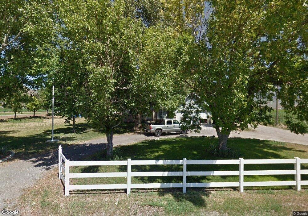
10450 N 4400 W Tremonton, UT 84337
Estimated Value: $485,025 - $538,000
3
Beds
2
Baths
1,500
Sq Ft
$344/Sq Ft
Est. Value
About This Home
This home is located at 10450 N 4400 W, Tremonton, UT 84337 and is currently estimated at $515,256, approximately $343 per square foot. 10450 N 4400 W is a home located in Box Elder County with nearby schools including McKinley School, Bear River Middle School, and Alice C. Harris Intermediate School.
Ownership History
Date
Name
Owned For
Owner Type
Purchase Details
Closed on
Apr 15, 2024
Sold by
Robert And Dixie Hess Trust and Hess Robert B
Bought by
Hess Dixie
Current Estimated Value
Purchase Details
Closed on
Sep 14, 2018
Sold by
Lay Mark S and Lay Frances O
Bought by
Betournay Michael W and Betournay Jessica O
Home Financials for this Owner
Home Financials are based on the most recent Mortgage that was taken out on this home.
Original Mortgage
$181,818
Interest Rate
4.6%
Mortgage Type
New Conventional
Purchase Details
Closed on
Mar 31, 2017
Sold by
Lay Mark S and Lay Frances O
Bought by
Lay Mark S and Lay Frances O
Purchase Details
Closed on
Sep 7, 2016
Sold by
Grover Bobbie A
Bought by
Lay Mary
Home Financials for this Owner
Home Financials are based on the most recent Mortgage that was taken out on this home.
Original Mortgage
$135,000
Interest Rate
3.45%
Mortgage Type
New Conventional
Purchase Details
Closed on
Jan 25, 2010
Sold by
Wangsgard Jeff
Bought by
Grover Bobbie A
Home Financials for this Owner
Home Financials are based on the most recent Mortgage that was taken out on this home.
Original Mortgage
$161,100
Interest Rate
4.78%
Mortgage Type
New Conventional
Purchase Details
Closed on
Nov 19, 2009
Sold by
Younger Michael
Bought by
Wangsgard Jeff
Home Financials for this Owner
Home Financials are based on the most recent Mortgage that was taken out on this home.
Original Mortgage
$85,000
Interest Rate
4.99%
Mortgage Type
Purchase Money Mortgage
Purchase Details
Closed on
Jan 29, 2007
Sold by
Day Donald E and Day Ella E
Bought by
Younger Michael
Home Financials for this Owner
Home Financials are based on the most recent Mortgage that was taken out on this home.
Original Mortgage
$136,800
Interest Rate
1%
Mortgage Type
Adjustable Rate Mortgage/ARM
Purchase Details
Closed on
Aug 2, 2006
Sold by
Newman Tommy Ray
Bought by
Day Donald E and Day Ella E
Create a Home Valuation Report for This Property
The Home Valuation Report is an in-depth analysis detailing your home's value as well as a comparison with similar homes in the area
Home Values in the Area
Average Home Value in this Area
Purchase History
| Date | Buyer | Sale Price | Title Company |
|---|---|---|---|
| Hess Dixie | -- | Northern Title Company | |
| Betournay Michael W | -- | American Secure Title Tremon | |
| Lay Mark S | -- | None Available | |
| Lay Mary | -- | Stewart Title Insurance Agen | |
| Grover Bobbie A | -- | -- | |
| Wangsgard Jeff | $118,500 | -- | |
| Younger Michael | -- | Phillips Hansesn Land Title | |
| Day Donald E | -- | None Available |
Source: Public Records
Mortgage History
| Date | Status | Borrower | Loan Amount |
|---|---|---|---|
| Previous Owner | Betournay Michael W | $181,818 | |
| Previous Owner | Lay Mary | $135,000 | |
| Previous Owner | Grover Bobbie A | $161,100 | |
| Previous Owner | Wangsgard Jeff | $85,000 | |
| Previous Owner | Younger Michael | $136,800 |
Source: Public Records
Tax History Compared to Growth
Tax History
| Year | Tax Paid | Tax Assessment Tax Assessment Total Assessment is a certain percentage of the fair market value that is determined by local assessors to be the total taxable value of land and additions on the property. | Land | Improvement |
|---|---|---|---|---|
| 2025 | $2,163 | $456,002 | $130,000 | $326,002 |
| 2024 | $2,163 | $462,031 | $128,000 | $334,031 |
| 2023 | $2,257 | $491,991 | $135,000 | $356,991 |
| 2022 | $2,069 | $230,265 | $26,675 | $203,590 |
| 2021 | $1,600 | $207,230 | $48,500 | $158,730 |
| 2020 | $1,197 | $207,230 | $48,500 | $158,730 |
| 2019 | $1,100 | $99,329 | $26,035 | $73,294 |
| 2018 | $1,174 | $99,329 | $26,035 | $73,294 |
| 2017 | $1,217 | $180,598 | $26,035 | $133,262 |
| 2016 | $1,207 | $95,839 | $26,035 | $69,804 |
| 2015 | $1,109 | $89,493 | $26,035 | $63,458 |
| 2014 | $1,109 | $86,471 | $26,035 | $60,436 |
| 2013 | -- | $86,471 | $26,035 | $60,436 |
Source: Public Records
Map
Nearby Homes
- 4693 W 9120 N
- 9449 N Powerline Rd Unit 2
- 10135 N Highway 38
- 137 N 870 W Unit 28
- 9605 N Highway 38
- 839 E 180 N Unit 30
- 9480 N 5600 W
- 4979 W 12000 N
- 11560 N 3400 W
- 11990 N 4800 W
- 9835 N Highway 38 Unit 11
- 9791 N Highway 38 Unit 10
- 9743 N Highway 38 Unit 8
- Auburn Plan at River's Edge - Tremonton
- Aberdeen Plan at River's Edge - Tremonton
- Glendale Plan at River's Edge - Tremonton
- Lyndhurst Plan at River's Edge - Tremonton
- Sumac Plan at River's Edge - Tremonton
- Redwood Plan at River's Edge - Tremonton
- Summerlyn Plan at River's Edge - Tremonton