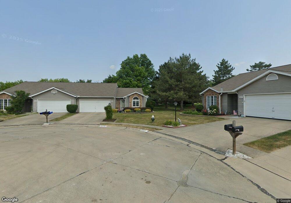
10450 Royal Oak Dr Strongsville, OH 44136
Estimated Value: $256,475 - $277,000
2
Beds
2
Baths
1,445
Sq Ft
$185/Sq Ft
Est. Value
About This Home
This home is located at 10450 Royal Oak Dr, Strongsville, OH 44136 and is currently estimated at $266,869, approximately $184 per square foot. 10450 Royal Oak Dr is a home located in Cuyahoga County with nearby schools including Strongsville High School, Sts Joseph & John Interparochial School, and Royal Redeemer Lutheran School.
Ownership History
Date
Name
Owned For
Owner Type
Purchase Details
Closed on
Aug 16, 2019
Sold by
Honson John C and Honson Jeanne S
Bought by
Hobson John Blake and Mikut Richard
Current Estimated Value
Purchase Details
Closed on
Apr 14, 1993
Sold by
Hobson John C
Bought by
Hobson John C
Purchase Details
Closed on
Sep 17, 1992
Sold by
Peters Helen
Bought by
Hobson John C
Purchase Details
Closed on
Jan 1, 1991
Bought by
Peters Helen
Create a Home Valuation Report for This Property
The Home Valuation Report is an in-depth analysis detailing your home's value as well as a comparison with similar homes in the area
Home Values in the Area
Average Home Value in this Area
Purchase History
| Date | Buyer | Sale Price | Title Company |
|---|---|---|---|
| Hobson John Blake | -- | None Available | |
| Hobson John C | -- | -- | |
| Hobson John C | $108,000 | -- | |
| Peters Helen | -- | -- |
Source: Public Records
Tax History Compared to Growth
Tax History
| Year | Tax Paid | Tax Assessment Tax Assessment Total Assessment is a certain percentage of the fair market value that is determined by local assessors to be the total taxable value of land and additions on the property. | Land | Improvement |
|---|---|---|---|---|
| 2024 | $3,205 | $78,050 | $14,525 | $63,525 |
| 2023 | $3,207 | $60,380 | $13,300 | $47,080 |
| 2022 | $3,209 | $60,375 | $13,300 | $47,075 |
| 2021 | $3,184 | $60,380 | $13,300 | $47,080 |
| 2020 | $2,926 | $50,720 | $11,170 | $39,550 |
| 2019 | $2,840 | $144,900 | $31,900 | $113,000 |
| 2018 | $2,577 | $50,720 | $11,170 | $39,550 |
| 2017 | $2,318 | $43,690 | $8,510 | $35,180 |
| 2016 | $2,299 | $43,690 | $8,510 | $35,180 |
| 2015 | $2,390 | $43,690 | $8,510 | $35,180 |
| 2014 | $2,390 | $44,560 | $8,680 | $35,880 |
Source: Public Records
Map
Nearby Homes
- 10369 Council Bluff
- 9945 Twelve Oaks Cir
- 16519 Albion Rd
- 15485 Albion Rd
- 9890 Webster Rd
- 10010 Chevy Chase
- 0 Webster Rd
- 9129 Tahoe Cir
- 12101 The Bluffs
- 11650 River Moss Rd
- 14069 Basswood Cir
- 9531 Nicole Cir
- 14298 Calderdale Ln
- 14584 Baywood Ln
- 14557 Baywood Ln
- 14644 Baywood Ln
- 14236 Calderdale Ln
- 17945 Cliffside Dr
- 18433 Whitney Rd
- 18203 Broxton Dr
- 10478 Royal Oak Dr
- 10471 Royal Oak Dr
- 10499 Royal Oak Dr
- 10499 Royal Oak Dr Unit 37-A
- 10534 Royal Oak Dr
- 10534 Royal Oak Dr Unit 41-A
- 16129 N Laguardia Pkwy
- 16161 N Laguardia Pkwy
- 10497 Decatur Dr
- 10562 Royal Oak Dr
- 10519 Decatur Dr
- 10519 Decatur Dr Unit 45-A
- 10555 Royal Oak Dr
- 10555 Royal Oak Dr Unit 36-A
- 10583 Royal Oak Dr
- 10583 Royal Oak Dr Unit 35-A
- 10453 Decatur Dr
- 10453 Decatur Dr Unit 47-A
- 16193 N Laguardia Pkwy
- 10541 Decatur Dr