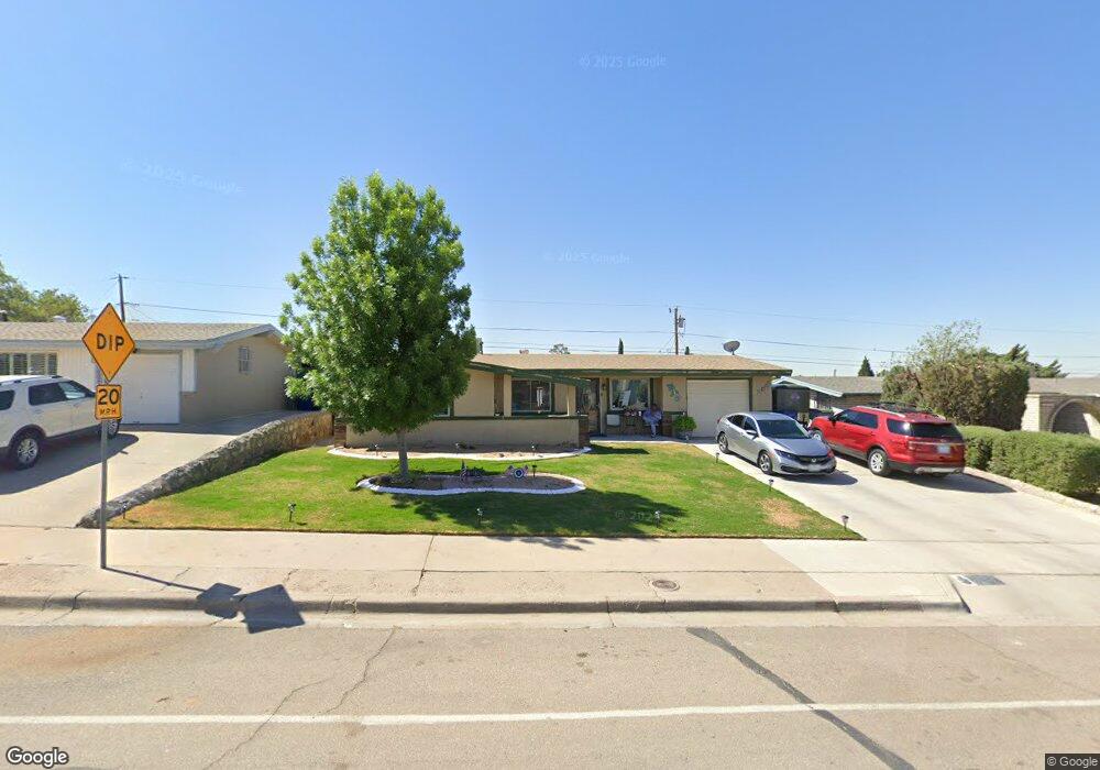
10452 Springwood Dr El Paso, TX 79925
Travis White NeighborhoodEstimated Value: $187,117 - $259,000
--
Bed
2
Baths
1,189
Sq Ft
$183/Sq Ft
Est. Value
About This Home
This home is located at 10452 Springwood Dr, El Paso, TX 79925 and is currently estimated at $218,029, approximately $183 per square foot. 10452 Springwood Dr is a home located in El Paso County with nearby schools including Eastwood Heights Elementary School, Eastwood High School, and St. Raphael School.
Ownership History
Date
Name
Owned For
Owner Type
Purchase Details
Closed on
Mar 1, 2001
Sold by
Telles Luis and Telles Guadalupe C
Bought by
Burciaga Ramiro and Burciaga Blanca
Current Estimated Value
Home Financials for this Owner
Home Financials are based on the most recent Mortgage that was taken out on this home.
Original Mortgage
$66,800
Outstanding Balance
$24,633
Interest Rate
7.19%
Mortgage Type
VA
Estimated Equity
$193,396
Purchase Details
Closed on
Mar 31, 1995
Sold by
Cruikshank Evelyn and Cruikshank Evelyn Jane
Bought by
Telles Luis and Telles Guadalupe C
Home Financials for this Owner
Home Financials are based on the most recent Mortgage that was taken out on this home.
Original Mortgage
$59,850
Interest Rate
8.66%
Create a Home Valuation Report for This Property
The Home Valuation Report is an in-depth analysis detailing your home's value as well as a comparison with similar homes in the area
Home Values in the Area
Average Home Value in this Area
Purchase History
| Date | Buyer | Sale Price | Title Company |
|---|---|---|---|
| Burciaga Ramiro | -- | -- | |
| Telles Luis | -- | -- |
Source: Public Records
Mortgage History
| Date | Status | Borrower | Loan Amount |
|---|---|---|---|
| Open | Burciaga Ramiro | $66,800 | |
| Previous Owner | Telles Luis | $59,850 |
Source: Public Records
Tax History Compared to Growth
Tax History
| Year | Tax Paid | Tax Assessment Tax Assessment Total Assessment is a certain percentage of the fair market value that is determined by local assessors to be the total taxable value of land and additions on the property. | Land | Improvement |
|---|---|---|---|---|
| 2025 | $2,388 | $163,700 | -- | -- |
| 2024 | $2,388 | $148,818 | -- | -- |
| 2023 | $2,388 | $135,289 | $0 | $0 |
| 2022 | $3,819 | $122,990 | $0 | $0 |
| 2021 | $3,634 | $111,809 | $20,762 | $91,047 |
| 2020 | $3,263 | $103,316 | $15,971 | $87,345 |
| 2018 | $3,188 | $102,509 | $15,971 | $86,538 |
| 2017 | $3,164 | $103,511 | $15,971 | $87,540 |
| 2016 | $3,164 | $103,511 | $15,971 | $87,540 |
| 2015 | $2,444 | $103,511 | $15,971 | $87,540 |
| 2014 | $2,444 | $104,510 | $15,971 | $88,539 |
Source: Public Records
Map
Nearby Homes
- 10463 Davwood Ln
- 10533 Springwood Dr
- 10481 Deepwood Ct
- 10412 Chinaberry Dr
- 10212 Garwood Ct
- 7936 Dogwood St
- 7921 Candlewood Ave
- 10233 Byway Dr
- 10313 Byway Dr
- 10617 Candlewood Ave
- 1207 Bois d Arc Dr
- 1909 Crow Dr
- 9801 Eastridge Dr
- 10304 Woodruff Ct
- 10309 Woodruff Ct
- 10145 Camwood Dr
- 10844 Sombra Verde Dr
- 1649 Lomaland Dr
- 9917 Honolulu Dr
- 1730 Bara Dr
- 10454 Springwood Dr
- 10450 Springwood Dr
- 10453 Tomwood Ave
- 10451 Tomwood Ave
- 10455 Tomwood Ave
- 10448 Springwood Dr
- 10456 Springwood Dr
- 10449 Tomwood Ave
- 10457 Tomwood Ave
- 10446 Springwood Dr
- 10447 Tomwood Ave
- 10444 Springwood Dr
- 10500 Springwood Dr
- 10454 Tomwood Ave
- 10456 Tomwood Ave
- 10452 Tomwood Ave
- 10445 Tomwood Ave
- 10501 Tomwood Ave
- 10458 Tomwood Ave
- 10450 Tomwood Ave