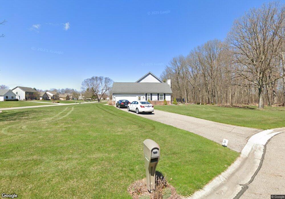
10465 Abrams Fork Unit Bldg-Unit Brighton, MI 48114
Estimated Value: $493,109 - $554,000
4
Beds
3
Baths
2,364
Sq Ft
$220/Sq Ft
Est. Value
About This Home
This home is located at 10465 Abrams Fork Unit Bldg-Unit, Brighton, MI 48114 and is currently estimated at $520,777, approximately $220 per square foot. 10465 Abrams Fork Unit Bldg-Unit is a home located in Livingston County with nearby schools including Hartland High School, Maple Tree Montessori Academy, and Cornerstone Christian School.
Ownership History
Date
Name
Owned For
Owner Type
Purchase Details
Closed on
Aug 4, 2022
Sold by
Butuza and Carmen
Bought by
Studebaker Jeffery T and Studebaker Emily T
Current Estimated Value
Purchase Details
Closed on
Jul 30, 2018
Sold by
Horning John M and Horning Rosanne
Bought by
Butuza Daniel and Butuza Carmen
Home Financials for this Owner
Home Financials are based on the most recent Mortgage that was taken out on this home.
Original Mortgage
$232,000
Interest Rate
4.6%
Mortgage Type
New Conventional
Purchase Details
Closed on
Jun 28, 1999
Sold by
Dalrymple Robert W and Dalrymple Stephanie M
Bought by
Horning John M and Horning Rosanne
Create a Home Valuation Report for This Property
The Home Valuation Report is an in-depth analysis detailing your home's value as well as a comparison with similar homes in the area
Home Values in the Area
Average Home Value in this Area
Purchase History
| Date | Buyer | Sale Price | Title Company |
|---|---|---|---|
| Studebaker Jeffery T | $430,000 | Reputation First Title | |
| Butuza Daniel | $290,000 | New Title Company Name | |
| Horning John M | $250,000 | Title Office |
Source: Public Records
Mortgage History
| Date | Status | Borrower | Loan Amount |
|---|---|---|---|
| Previous Owner | Butuza Daniel | $232,000 |
Source: Public Records
Tax History
| Year | Tax Paid | Tax Assessment Tax Assessment Total Assessment is a certain percentage of the fair market value that is determined by local assessors to be the total taxable value of land and additions on the property. | Land | Improvement |
|---|---|---|---|---|
| 2025 | $2,892 | $225,700 | $0 | $0 |
| 2024 | $2,811 | $222,300 | $0 | $0 |
| 2023 | $2,686 | $200,300 | $0 | $0 |
| 2022 | $5,031 | $153,200 | $0 | $0 |
| 2021 | $5,031 | $163,200 | $0 | $0 |
| 2020 | $5,014 | $155,300 | $0 | $0 |
| 2019 | $4,683 | $153,200 | $0 | $0 |
| 2018 | $3,672 | $127,500 | $0 | $0 |
| 2017 | $3,105 | $127,500 | $0 | $0 |
| 2016 | $3,071 | $128,000 | $0 | $0 |
| 2014 | $2,587 | $125,120 | $0 | $0 |
| 2012 | $2,587 | $110,860 | $0 | $0 |
Source: Public Records
Map
Nearby Homes
- 10493 Spring Grove
- 10056 Rosemarie Run Unit 8
- LOT 51 Rosemarie Run
- V/L Lot #2 Sweetheart Ln
- 10310 Sweetheart Ln
- 10120 Hyne Rd
- 10050 Hyne Rd
- 2702 Sligo Ln
- 00 VL Waterside
- 00 VL2 Waterside
- 2321 Pine Hollow Trail
- 11245 Guyn Dr
- 2218 Pine Hollow Trail
- 1111 S Old Us Highway 23
- 8984 S Christine Dr
- 8969 Hyne Rd
- 0 Hunter Rd
- 3638 Deer Run Dr
- 1290 Hunter Rd
- 0000 Valencia
- 10465 Abrams Fork
- 2283 Laurel Springs Unit Bldg-Unit
- 2283 Laurel Springs
- 10477 Abrams Fork
- 2259 Laurel Springs
- 10421 Abrams Fork
- 2286 Laurel Springs
- 10454 Abrams Fork
- 10480 Abrams Fork
- 2262 Laurel Springs
- 2235 Laurel Springs
- 10428 Abrams Fork
- 10402 Abrams Fork
- 2238 Laurel Springs
- 10369 Abrams Fork
- 2211 Laurel Springs Unit Bldg-Unit
- 2211 Laurel Springs
- 10376 Abrams Fork
- 2265 Cumberland Dr
- 2208 Laurel Springs
Your Personal Tour Guide
Ask me questions while you tour the home.