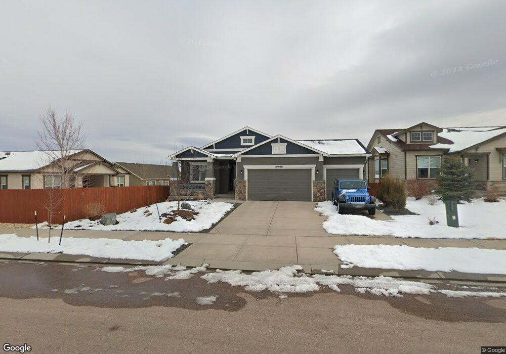
10469 Mt Emerald Dr Peyton, CO 80831
Falcon NeighborhoodEstimated Value: $514,429 - $592,000
4
Beds
4
Baths
3,049
Sq Ft
$184/Sq Ft
Est. Value
About This Home
This home is located at 10469 Mt Emerald Dr, Peyton, CO 80831 and is currently estimated at $560,607, approximately $183 per square foot. 10469 Mt Emerald Dr is a home located in El Paso County with nearby schools including Meridian Ranch Elementary School, Falcon Middle School, and Falcon High School.
Ownership History
Date
Name
Owned For
Owner Type
Purchase Details
Closed on
Dec 26, 2017
Sold by
Campbell Homes Llc
Bought by
Wibbes Matthew G and Wibbes Angela D
Current Estimated Value
Home Financials for this Owner
Home Financials are based on the most recent Mortgage that was taken out on this home.
Original Mortgage
$338,291
Outstanding Balance
$285,185
Interest Rate
3.9%
Mortgage Type
New Conventional
Estimated Equity
$275,422
Create a Home Valuation Report for This Property
The Home Valuation Report is an in-depth analysis detailing your home's value as well as a comparison with similar homes in the area
Home Values in the Area
Average Home Value in this Area
Purchase History
| Date | Buyer | Sale Price | Title Company |
|---|---|---|---|
| Wibbes Matthew G | $385,000 | Empire Title Colorado Spring |
Source: Public Records
Mortgage History
| Date | Status | Borrower | Loan Amount |
|---|---|---|---|
| Open | Wibbes Matthew G | $338,291 |
Source: Public Records
Tax History
| Year | Tax Paid | Tax Assessment Tax Assessment Total Assessment is a certain percentage of the fair market value that is determined by local assessors to be the total taxable value of land and additions on the property. | Land | Improvement |
|---|---|---|---|---|
| 2025 | $3,505 | $36,960 | -- | -- |
| 2024 | $3,378 | $37,940 | $6,420 | $31,520 |
| 2022 | $2,855 | $28,290 | $5,020 | $23,270 |
| 2021 | $2,959 | $29,100 | $5,170 | $23,930 |
| 2020 | $3,101 | $28,280 | $4,680 | $23,600 |
| 2019 | $3,084 | $28,280 | $4,680 | $23,600 |
| 2018 | $2,958 | $26,850 | $4,280 | $22,570 |
| 2017 | $1,798 | $17,260 | $17,260 | $0 |
| 2016 | $1,076 | $10,570 | $10,570 | $0 |
| 2015 | $1,076 | $10,570 | $10,570 | $0 |
| 2014 | $433 | $4,200 | $4,200 | $0 |
Source: Public Records
Map
Nearby Homes
- 12459 Handles Peak Way
- 10388 Mount Wilson Place
- 12698 Culebra Peak Dr
- 12828 Stone Valley Dr
- 12868 Stone Valley Dr
- 10704 Shavano Peak Ct
- 12803 Stone Valley Dr
- 12590 Granite Springs Place
- 10089 Golf Crest Dr
- 13256 Park Meadows Dr
- 12534 Angelina Dr
- 10775 Shavano Peak Ct
- 10603 Ross Lake Dr
- 13154 Crooked Hill Dr
- 13153 Crooked Hill Dr
- 10932 Rolling Mesa Dr
- 10877 Rolling Mesa Dr
- 10849 Rolling Mesa Dr
- 13165 Crooked Hill Dr
- 10534 Summer Ridge Dr
- 10457 Mt Emerald Dr
- 12725 Mt Harvard Dr
- 12729 Mt Harvard Dr
- 10445 Mt Emerald Dr
- 10470 Holly Springs Place
- 12737 Mt Harvard Dr
- 10450 Holly Springs Place
- 10470 Mount Emerald Dr
- 10433 Mt Emerald Dr
- 10482 Mt Emerald Dr
- 12741 Mount Harvard Dr
- 10494 Mount Emerald Dr
- 10430 Holly Springs Place
- 10446 Mt Emerald Dr
- 10421 Mt Emerald Dr
- 12726 Mount Harvard Dr
- 12730 Mt Harvard Dr
- 12734 Mt Harvard Dr
- 10434 Mt Emerald Dr
- 10410 Holly Springs Place
Your Personal Tour Guide
Ask me questions while you tour the home.