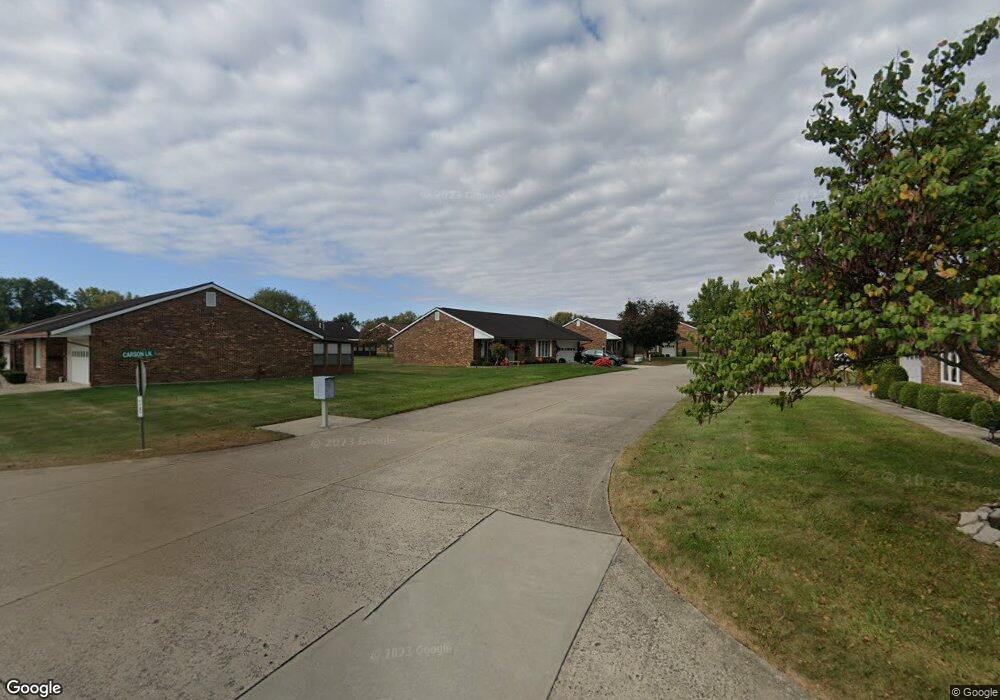
1047 Carson Ln Springfield, OH 45503
Estimated Value: $196,540 - $214,000
2
Beds
2
Baths
1,300
Sq Ft
$156/Sq Ft
Est. Value
About This Home
This home is located at 1047 Carson Ln, Springfield, OH 45503 and is currently estimated at $202,885, approximately $156 per square foot. 1047 Carson Ln is a home located in Clark County with nearby schools including Northridge Elementary School, Kenton Ridge Middle & High School, and Emmanuel Christian Academy.
Ownership History
Date
Name
Owned For
Owner Type
Purchase Details
Closed on
Aug 6, 2018
Sold by
Kabala Stanley C and Kabala Lynne A
Bought by
Mccloud Bryan D and Mccloud Deloris A
Current Estimated Value
Purchase Details
Closed on
Jul 31, 2009
Sold by
Kline Jo Ann and Jo Ann Kline Revocable Living
Bought by
Kabala Stanley C and Kabala Lynne A
Purchase Details
Closed on
Feb 29, 2008
Sold by
Brown Clara R
Bought by
Kline Jo Ann
Purchase Details
Closed on
May 16, 1996
Sold by
Trst Dianna Weller
Bought by
Brown Fay and Brown Clara R
Create a Home Valuation Report for This Property
The Home Valuation Report is an in-depth analysis detailing your home's value as well as a comparison with similar homes in the area
Home Values in the Area
Average Home Value in this Area
Purchase History
| Date | Buyer | Sale Price | Title Company |
|---|---|---|---|
| Mccloud Bryan D | $130,000 | Team Title & Closing Service | |
| Kabala Stanley C | $107,900 | Attorney | |
| Kline Jo Ann | $110,900 | Attorney | |
| Brown Fay | $90,000 | -- |
Source: Public Records
Tax History
| Year | Tax Paid | Tax Assessment Tax Assessment Total Assessment is a certain percentage of the fair market value that is determined by local assessors to be the total taxable value of land and additions on the property. | Land | Improvement |
|---|---|---|---|---|
| 2025 | $1,241 | $53,050 | $7,350 | $45,700 |
| 2024 | $1,225 | $39,050 | $6,300 | $32,750 |
| 2023 | $1,225 | $39,050 | $6,300 | $32,750 |
| 2022 | $1,418 | $39,050 | $6,300 | $32,750 |
| 2021 | $1,418 | $38,190 | $5,250 | $32,940 |
| 2020 | $1,875 | $38,190 | $5,250 | $32,940 |
| 2019 | $1,913 | $38,190 | $5,250 | $32,940 |
| 2018 | $1,595 | $30,770 | $5,570 | $25,200 |
| 2017 | $1,354 | $29,932 | $5,565 | $24,367 |
| 2016 | $1,344 | $29,932 | $5,565 | $24,367 |
| 2015 | $1,255 | $29,617 | $5,250 | $24,367 |
| 2014 | $1,254 | $29,617 | $5,250 | $24,367 |
| 2013 | $1,252 | $29,617 | $5,250 | $24,367 |
Source: Public Records
Map
Nearby Homes
- 1139 Bradford Dr
- 3052 Brixton Dr E
- 1039 Bradford Dr Unit 42
- 1136 Foxboro Rd Unit 202
- 3631 Kingsgate Ln
- 1201 Kingsgate Rd
- 1500 Kingsgate Rd Unit 19430
- 1502 Kingsgate Rd Unit 19432
- 1500 Kingsgate Rd
- 1502 Kingsgate Rd
- 1525 Providence Ave
- 3124 El Camino Dr
- 1162 Kingsgate Rd
- 1507 Kingsgate Rd
- 1503 Kingsgate Rd
- 1505 Kingsgate Rd
- 2022 Westboro Ave
- 3135 Imperial Blvd
- 2943 Tarryton Ln
- 1404 Attleboro Ave
- 1047 Carson Ln Unit 61
- 1047 Carson Ln
- 1047 Carson Ln
- 1045 Carson Ln Unit 62
- 3029 Brixton Dr E Unit 60
- 1046 Bradford Dr
- 1046 Carson Ln Unit 71
- 3027 Brixton Dr E
- 3027 Brixton Dr E
- 1044 Bradford Dr Unit 57
- 1044 Carson Ln
- 1044 Carson Ln
- 1043 Carson Ln Unit 63
- 1042 Bradford Dr
- 3030 Brixton Dr E
- 3037 Brixton Dr E Unit 172
- 3028 Brixton Dr E
- 3032 Brixton Dr E Unit 3032
- 3032 Brixton Dr E Unit 73
- 3032 Brixton Dr E
Your Personal Tour Guide
Ask me questions while you tour the home.