Estimated Value: $306,000 - $422,867
4
Beds
3
Baths
2,522
Sq Ft
$145/Sq Ft
Est. Value
About This Home
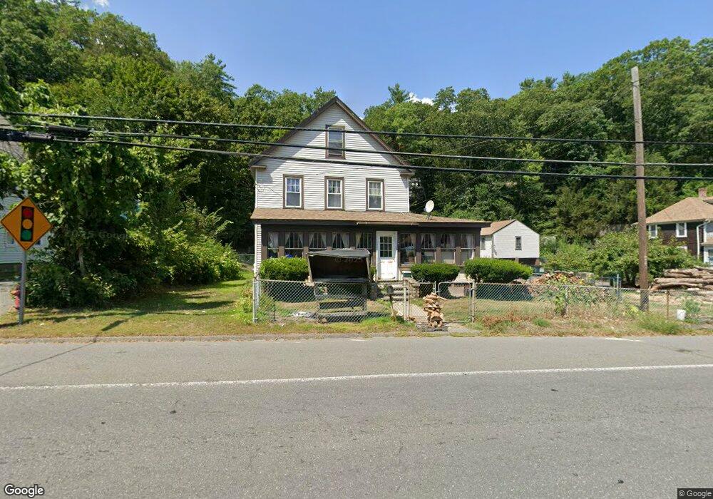
This home is located at 1047 S Main St, Athol, MA 01331 and is currently estimated at $364,467, approximately $144 per square foot. 1047 S Main St is a home located in Worcester County with nearby schools including Athol High School.
Ownership History
Date
Name
Owned For
Owner Type
Purchase Details
Closed on
Jul 29, 2005
Sold by
Herum Donald L and Herum Sue C
Bought by
Lheureux Darien P and Lheureux Sileng
Current Estimated Value
Home Financials for this Owner
Home Financials are based on the most recent Mortgage that was taken out on this home.
Original Mortgage
$188,100
Outstanding Balance
$98,875
Interest Rate
5.67%
Mortgage Type
Purchase Money Mortgage
Estimated Equity
$265,592
Create a Home Valuation Report for This Property
The Home Valuation Report is an in-depth analysis detailing your home's value as well as a comparison with similar homes in the area
Home Values in the Area
Average Home Value in this Area
Purchase History
| Date | Buyer | Sale Price | Title Company |
|---|---|---|---|
| Lheureux Darien P | $198,000 | -- |
Source: Public Records
Mortgage History
| Date | Status | Borrower | Loan Amount |
|---|---|---|---|
| Open | Lheureux Darien P | $188,100 |
Source: Public Records
Tax History Compared to Growth
Tax History
| Year | Tax Paid | Tax Assessment Tax Assessment Total Assessment is a certain percentage of the fair market value that is determined by local assessors to be the total taxable value of land and additions on the property. | Land | Improvement |
|---|---|---|---|---|
| 2025 | $4,146 | $326,200 | $41,000 | $285,200 |
| 2024 | $4,081 | $318,100 | $41,000 | $277,100 |
| 2023 | $4,084 | $290,900 | $29,600 | $261,300 |
| 2022 | $3,809 | $237,300 | $28,200 | $209,100 |
| 2021 | $3,373 | $203,100 | $25,500 | $177,600 |
| 2020 | $2,013 | $206,300 | $23,100 | $183,200 |
| 2019 | $3,277 | $187,800 | $21,900 | $165,900 |
| 2018 | $2,660 | $167,600 | $19,900 | $147,700 |
| 2017 | $3,270 | $160,300 | $19,900 | $140,400 |
| 2016 | $2,998 | $151,200 | $19,900 | $131,300 |
| 2015 | $2,877 | $151,200 | $19,900 | $131,300 |
| 2014 | $2,787 | $151,200 | $19,900 | $131,300 |
Source: Public Records
Map
Nearby Homes
- 0 Brickyard Rd
- 276 Brickyard Rd
- 340 Brickyard Rd
- 459 Fairview Ave
- 3 Chestnut St
- 31 Rosemont Ave
- Lot 1 Coolidge St
- 0000 Gage Rd
- 315 S Athol Rd
- 305 S Athol Rd
- 23 Mount Pleasant St
- 133 Harvard Ave
- 71 Wendell St
- 932 Brickyard Rd
- 551 Sanders St
- 73 Fern St
- 182 Harrison St
- 31 Benham St
- 193 Freedom St
- 31 Prescott Ln