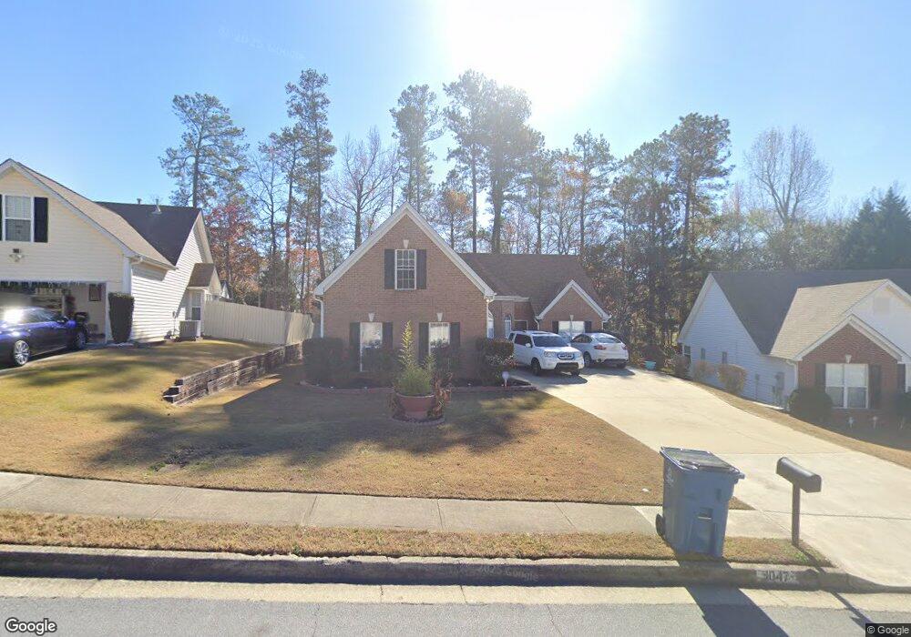
1047 Sham Pointe Dr Unit 1 Lawrenceville, GA 30043
Estimated Value: $381,000 - $402,000
3
Beds
2
Baths
1,775
Sq Ft
$219/Sq Ft
Est. Value
About This Home
This home is located at 1047 Sham Pointe Dr Unit 1, Lawrenceville, GA 30043 and is currently estimated at $388,585, approximately $218 per square foot. 1047 Sham Pointe Dr Unit 1 is a home located in Gwinnett County with nearby schools including Woodward Mill Elementary School, Twin Rivers Middle School, and Mountain View High School.
Ownership History
Date
Name
Owned For
Owner Type
Purchase Details
Closed on
Dec 12, 2005
Sold by
Gray Rodney and Gray Lydia A
Bought by
Delape Jennifer M
Current Estimated Value
Home Financials for this Owner
Home Financials are based on the most recent Mortgage that was taken out on this home.
Original Mortgage
$33,800
Outstanding Balance
$18,790
Interest Rate
6.28%
Mortgage Type
Unknown
Estimated Equity
$369,795
Purchase Details
Closed on
May 20, 1999
Sold by
G & B Builders Inc
Bought by
Gray Rodney and Gray Lydia A
Home Financials for this Owner
Home Financials are based on the most recent Mortgage that was taken out on this home.
Original Mortgage
$132,529
Interest Rate
6.94%
Mortgage Type
FHA
Create a Home Valuation Report for This Property
The Home Valuation Report is an in-depth analysis detailing your home's value as well as a comparison with similar homes in the area
Home Values in the Area
Average Home Value in this Area
Purchase History
| Date | Buyer | Sale Price | Title Company |
|---|---|---|---|
| Delape Jennifer M | $169,000 | -- | |
| Gray Rodney | $134,400 | -- |
Source: Public Records
Mortgage History
| Date | Status | Borrower | Loan Amount |
|---|---|---|---|
| Open | Delape Jennifer M | $33,800 | |
| Open | Delape Jennifer M | $135,200 | |
| Previous Owner | Gray Rodney | $132,529 |
Source: Public Records
Tax History Compared to Growth
Tax History
| Year | Tax Paid | Tax Assessment Tax Assessment Total Assessment is a certain percentage of the fair market value that is determined by local assessors to be the total taxable value of land and additions on the property. | Land | Improvement |
|---|---|---|---|---|
| 2025 | $3,814 | $145,000 | $23,920 | $121,080 |
| 2024 | $3,572 | $126,840 | $32,000 | $94,840 |
| 2023 | $3,572 | $126,840 | $32,000 | $94,840 |
| 2022 | $3,171 | $109,320 | $26,800 | $82,520 |
| 2021 | $2,830 | $90,840 | $18,400 | $72,440 |
| 2020 | $2,499 | $74,600 | $13,760 | $60,840 |
| 2019 | $2,435 | $74,600 | $13,760 | $60,840 |
| 2018 | $2,434 | $74,600 | $13,760 | $60,840 |
| 2016 | $2,226 | $64,080 | $13,760 | $50,320 |
| 2015 | $1,876 | $49,040 | $9,600 | $39,440 |
| 2014 | -- | $46,960 | $8,000 | $38,960 |
Source: Public Records
Map
Nearby Homes
- 2283 Infield Ln
- 1988 Greensferry Glen
- 3034 Brookgreen Trail
- 1731 Harper Lily Ln Unit LOT 50
- 1722 Harper Lily Ln Unit LOT 200
- 1710 Harper Lily Ln Unit LOT 202
- 1710 Harper Lily Ln
- 1705 Harper Lily Ln Unit LOT 59
- 1703 Harper Lily Ln Unit LOT 60
- 1851 Copelyn Reese Ct Unit 62
- 1849 Copelyn Reese Ct Unit 63
- 1844 Copelyn Reese Ct Unit LOT 177
- 1847 Copelyn Reese Ct Unit 64
- 1842 Copelyn Reese Ct Unit LOT 178
- 1845 Copelyn Reese Ct Unit 65
- Sawnee Plan at Azalea Square Townhomes
- 1843 Copelyn Reese Ct Unit 66
- 1840 Copelyn Reese Ct Unit LOT 179
- 1838 Copelyn Reese Ct Unit LOT 180
- 1841 Copelyn Reese Ct Unit 67
- 1057 Sham Pointe Dr
- 1037 Sham Pointe Dr
- 1027 Sham Pointe Dr
- 1067 Sham Pointe Dr
- 986 Sham Pointe Dr Unit 1
- 1056 Sham Pointe Dr
- 903 Brookgreen Place
- 873 Brookgreen Place
- 1086 Stoneleigh Ct
- 976 Sham Pointe Dr
- 1017 Sham Pointe Dr
- 1007 Sham Pointe Dr
- 912 Brookgreen Place
- 872 Brookgreen Place
- 1077 Sham Pointe Dr
- 882 Brookgreen Place
- 1076 Sham Pointe Dr Unit 1
- 892 Brookgreen Place Unit 3
- 997 Sham Pointe Dr
- 987 Sham Pointe Dr Unit 1