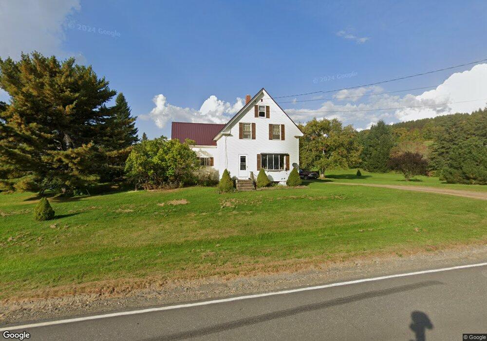
1047 State Rd Mapleton, ME 04757
Estimated Value: $240,015 - $329,000
4
Beds
3
Baths
1,900
Sq Ft
$146/Sq Ft
Est. Value
About This Home
This home is located at 1047 State Rd, Mapleton, ME 04757 and is currently estimated at $277,254, approximately $145 per square foot. 1047 State Rd is a home located in Aroostook County with nearby schools including Presque Isle Middle School and Presque Isle High School.
Ownership History
Date
Name
Owned For
Owner Type
Purchase Details
Closed on
Jul 26, 2010
Sold by
Mcdivitt Billy S and Mcdivitt Rachel H
Bought by
Jones Richard T and Jones Deborah L
Current Estimated Value
Purchase Details
Closed on
Sep 4, 2007
Sold by
Anderson Adam S and Anderson Rita R
Bought by
Mcdivitt Billy S and Mcdivitt Rachel H
Home Financials for this Owner
Home Financials are based on the most recent Mortgage that was taken out on this home.
Original Mortgage
$123,420
Interest Rate
6.71%
Mortgage Type
FHA
Create a Home Valuation Report for This Property
The Home Valuation Report is an in-depth analysis detailing your home's value as well as a comparison with similar homes in the area
Purchase History
| Date | Buyer | Sale Price | Title Company |
|---|---|---|---|
| Jones Richard T | -- | -- | |
| Mcdivitt Billy S | -- | -- |
Source: Public Records
Mortgage History
| Date | Status | Borrower | Loan Amount |
|---|---|---|---|
| Previous Owner | Mcdivitt Billy S | $123,420 |
Source: Public Records
Tax History
| Year | Tax Paid | Tax Assessment Tax Assessment Total Assessment is a certain percentage of the fair market value that is determined by local assessors to be the total taxable value of land and additions on the property. | Land | Improvement |
|---|---|---|---|---|
| 2024 | $2,295 | $182,900 | $27,600 | $155,300 |
| 2023 | $2,133 | $149,700 | $27,600 | $122,100 |
| 2022 | $1,975 | $122,300 | $18,000 | $104,300 |
| 2021 | $1,975 | $122,300 | $18,000 | $104,300 |
| 2020 | $2,018 | $122,300 | $18,000 | $104,300 |
| 2019 | $1,957 | $122,300 | $18,000 | $104,300 |
| 2018 | $16,358 | $122,100 | $17,800 | $104,300 |
| 2017 | $16,991 | $122,100 | $17,600 | $104,500 |
| 2016 | $1,917 | $122,100 | $17,600 | $104,500 |
| 2015 | $1,809 | $122,200 | $17,600 | $104,600 |
| 2014 | $1,821 | $122,200 | $17,600 | $104,600 |
| 2013 | $1,773 | $122,300 | $17,600 | $104,700 |
Source: Public Records
Map
Nearby Homes
- 1421 State Rd
- Lot 7 Off Pulcifer Rd
- 459 Griffin Ridge Rd
- 281 Cross Rd
- M2 L39-1 Pease Rd
- 707 Hughes Rd
- 339 Parsons Rd
- 183 Pulcifur Rd
- 1053 Washburn Rd
- 40 Fords Ln
- 1616 Main St
- M6L38 Coffin Rd
- 15 Canaan Ave
- 16 Stoddard St
- 673 Mapleton Rd
- 228 Waddell Rd
- 17 Churchill St
- 145 Caribou Rd
- 1345 Main St
- 1776 Main St
- 1048 State Rd
- 1037 State Rd
- 1056 State Rd
- 1036 State Rd
- 1042 State Rd
- 1070 State Rd
- 1019 State Rd
- 1020 State Rd
- 1088 State Rd
- 937 Griffin Ridge Rd
- 1113 State Rd
- 909 Griffin Ridge Rd
- 916 Griffin Ridge Rd
- 981 State Rd
- 1118 State Rd
- 62 Hale Rd
- 1148 State Rd
- 950 State Rd
- 884 Griffin Ridge Rd
- 903 State Rd
Your Personal Tour Guide
Ask me questions while you tour the home.