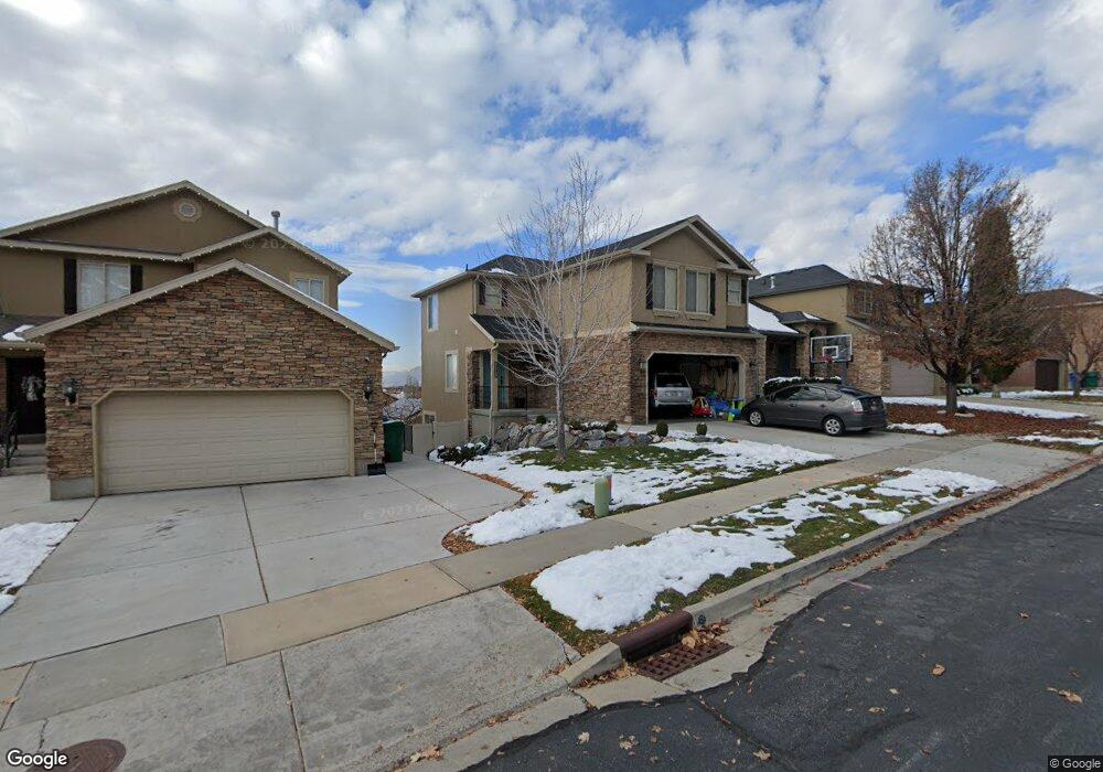
10471 N Doral Dr Cedar Hills, UT 84062
Estimated Value: $543,704 - $612,000
4
Beds
3
Baths
2,300
Sq Ft
$252/Sq Ft
Est. Value
About This Home
This home is located at 10471 N Doral Dr, Cedar Hills, UT 84062 and is currently estimated at $578,676, approximately $251 per square foot. 10471 N Doral Dr is a home located in Utah County with nearby schools including Cedar Ridge Elementary School, Mountain Ridge Junior High School, and American Fork High School.
Ownership History
Date
Name
Owned For
Owner Type
Purchase Details
Closed on
Oct 19, 2020
Sold by
Wingfield Richard and Wingfield Eileen
Bought by
Wingfield Richard Dewight and Wingfield Eileen Mary
Current Estimated Value
Home Financials for this Owner
Home Financials are based on the most recent Mortgage that was taken out on this home.
Original Mortgage
$306,900
Outstanding Balance
$272,474
Interest Rate
2.8%
Mortgage Type
New Conventional
Estimated Equity
$306,202
Purchase Details
Closed on
May 31, 2018
Sold by
Gross Ryan E and Gross Jennifer M
Bought by
Wingfield Richard and Wingfield Eileen
Home Financials for this Owner
Home Financials are based on the most recent Mortgage that was taken out on this home.
Original Mortgage
$318,155
Interest Rate
4.4%
Mortgage Type
New Conventional
Purchase Details
Closed on
May 22, 2015
Sold by
Mysllinski Gerold Mitchell and Mysllinski Vickie Lyn
Bought by
Gross Ryan E
Home Financials for this Owner
Home Financials are based on the most recent Mortgage that was taken out on this home.
Original Mortgage
$242,250
Interest Rate
3.63%
Mortgage Type
New Conventional
Purchase Details
Closed on
May 15, 2015
Sold by
Gross Ryan E
Bought by
Gross Ryan E and Gross Jennifer M
Home Financials for this Owner
Home Financials are based on the most recent Mortgage that was taken out on this home.
Original Mortgage
$242,250
Interest Rate
3.63%
Mortgage Type
New Conventional
Purchase Details
Closed on
Nov 30, 2009
Sold by
Dennis D Reese Investments Llc
Bought by
Myslinski Gerald Mitchell and Myslinski Vickie Lyn
Home Financials for this Owner
Home Financials are based on the most recent Mortgage that was taken out on this home.
Original Mortgage
$206,043
Interest Rate
5.01%
Mortgage Type
FHA
Purchase Details
Closed on
Apr 28, 2006
Sold by
Sundance Homes Llc
Bought by
Dennis D Reese Investments Llc
Purchase Details
Closed on
Jun 8, 2005
Sold by
Stone Ridge Financial Llc
Bought by
Sundance Homes Llc
Home Financials for this Owner
Home Financials are based on the most recent Mortgage that was taken out on this home.
Original Mortgage
$443,100
Interest Rate
5.72%
Mortgage Type
Construction
Create a Home Valuation Report for This Property
The Home Valuation Report is an in-depth analysis detailing your home's value as well as a comparison with similar homes in the area
Home Values in the Area
Average Home Value in this Area
Purchase History
| Date | Buyer | Sale Price | Title Company |
|---|---|---|---|
| Wingfield Richard Dewight | -- | Utah First Title Ins Agcy | |
| Wingfield Richard | -- | First American Title | |
| Gross Ryan E | -- | Northwest Title Ins Agency | |
| Gross Ryan E | -- | First American | |
| Myslinski Gerald Mitchell | -- | Equity Title Production F | |
| Dennis D Reese Investments Llc | -- | Select Title Insurance Agen | |
| Sundance Homes Llc | -- | Signature Title Insurance A |
Source: Public Records
Mortgage History
| Date | Status | Borrower | Loan Amount |
|---|---|---|---|
| Open | Wingfield Richard Dewight | $306,900 | |
| Closed | Wingfield Richard | $318,155 | |
| Previous Owner | Gross Ryan E | $242,250 | |
| Previous Owner | Myslinski Gerald Mitchell | $206,043 | |
| Previous Owner | Sundance Homes Llc | $443,100 |
Source: Public Records
Tax History Compared to Growth
Tax History
| Year | Tax Paid | Tax Assessment Tax Assessment Total Assessment is a certain percentage of the fair market value that is determined by local assessors to be the total taxable value of land and additions on the property. | Land | Improvement |
|---|---|---|---|---|
| 2025 | $2,152 | $274,615 | $181,000 | $318,300 |
| 2024 | $2,152 | $254,815 | $0 | $0 |
| 2023 | $2,072 | $263,615 | $0 | $0 |
| 2022 | $2,279 | $283,195 | $0 | $0 |
| 2021 | $2,034 | $376,600 | $129,900 | $246,700 |
| 2020 | $1,895 | $342,300 | $116,000 | $226,300 |
| 2019 | $1,776 | $333,100 | $106,800 | $226,300 |
| 2018 | $1,649 | $291,400 | $94,600 | $196,800 |
| 2017 | $1,555 | $146,960 | $0 | $0 |
| 2016 | $1,560 | $137,115 | $0 | $0 |
| 2015 | $1,448 | $120,450 | $0 | $0 |
| 2014 | $1,297 | $107,195 | $0 | $0 |
Source: Public Records
Map
Nearby Homes
- 10412 N Bayhill Dr
- 10514 N Doral Dr
- 10358 N Tamarack Way
- 10456 N Morgan Blvd
- 10468 N Sage Vista Ln
- 10448 Sage Vista Ln
- 10587 N Avalon St
- 4083 W Hayes Cir
- 10795 N La Costa
- 4084 W Shinnecock
- 4292 W Joshua Ln
- 3870 Mountaintop Cir
- 4198 W Sage Rd N
- 3851 W Mountaintop Cir Unit 5
- 10207 N Cottonwood Dr
- 9900 N Meadow Dr
- 11197 N Park Dr
- 4616 W Carriage Ln
- 4124 N 810 W
- 4224 W Park Dr
- 10471 Doral Dr
- 10463 N Doral Dr
- 10477 Doral Dr
- 10477 N Doral Dr
- 10463 Doral Dr
- 10458 Doral Dr
- 10457 Doral Dr
- 10487 Doral Dr
- 10487 N Doral Dr
- 10476 Sugarloaf Dr
- 10468 Sugarloaf Dr
- 10484 Sugarloaf Dr
- 10462 Sugarloaf Dr
- 10474 N Doral Dr
- 10474 Doral Dr
- 10466 N Doral Dr
- 10466 Doral Dr
- 10495 Doral Dr
- 10447 N Doral Dr
- 10495 N Doral Dr