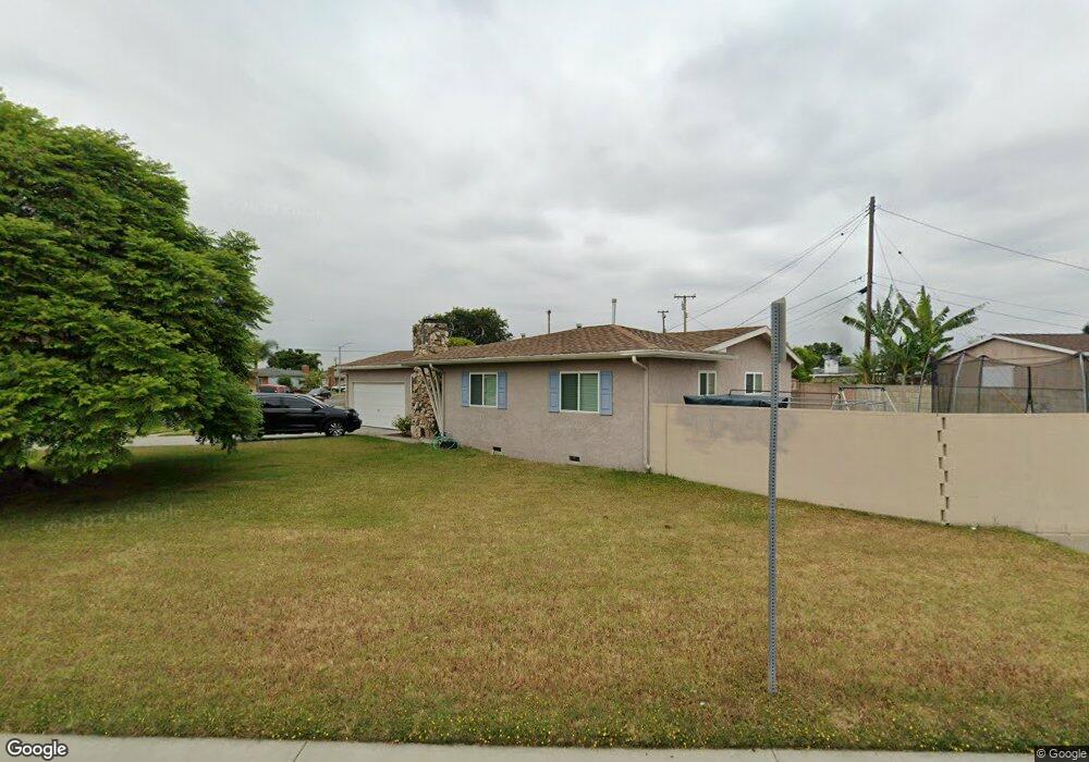
10472 Hedlund Dr Anaheim, CA 92804
West Anaheim NeighborhoodEstimated Value: $735,000 - $906,880
3
Beds
2
Baths
1,125
Sq Ft
$740/Sq Ft
Est. Value
About This Home
This home is located at 10472 Hedlund Dr, Anaheim, CA 92804 and is currently estimated at $832,220, approximately $739 per square foot. 10472 Hedlund Dr is a home located in Orange County with nearby schools including Jonas E. Salk Elementary School, Dale Jr High School, and Magnolia High.
Ownership History
Date
Name
Owned For
Owner Type
Purchase Details
Closed on
Nov 19, 2013
Sold by
Hoffman Donna and Connelly Donna
Bought by
Escalera Aaron and Escalera Jovita
Current Estimated Value
Home Financials for this Owner
Home Financials are based on the most recent Mortgage that was taken out on this home.
Original Mortgage
$309,294
Interest Rate
3.87%
Mortgage Type
FHA
Create a Home Valuation Report for This Property
The Home Valuation Report is an in-depth analysis detailing your home's value as well as a comparison with similar homes in the area
Home Values in the Area
Average Home Value in this Area
Purchase History
We collect this data history from publicly available records. To have your information removed, we recommend requesting removal directly through your county’s website.
| Date | Buyer | Sale Price | Title Company |
|---|---|---|---|
| Escalera Aaron | $315,000 | Western Resources Title Co | |
| Hoffman Donna | -- | Western Resources Title Co |
Source: Public Records
Mortgage History
We collect this data history from publicly available records. To have your information removed, we recommend requesting removal directly through your county’s website.
| Date | Status | Borrower | Loan Amount |
|---|---|---|---|
| Previous Owner | Escalera Aaron | $309,294 |
Source: Public Records
Tax History
| Year | Tax Paid | Tax Assessment Tax Assessment Total Assessment is a certain percentage of the fair market value that is determined by local assessors to be the total taxable value of land and additions on the property. | Land | Improvement |
|---|---|---|---|---|
| 2025 | $4,603 | $386,140 | $328,533 | $57,607 |
| 2024 | $4,603 | $378,569 | $322,091 | $56,478 |
| 2023 | $4,505 | $371,147 | $315,776 | $55,371 |
| 2022 | $4,437 | $363,870 | $309,584 | $54,286 |
| 2021 | $4,413 | $356,736 | $303,514 | $53,222 |
| 2020 | $4,366 | $353,079 | $300,402 | $52,677 |
| 2019 | $4,253 | $346,156 | $294,511 | $51,645 |
| 2018 | $4,208 | $339,369 | $288,736 | $50,633 |
| 2017 | $4,060 | $332,715 | $283,074 | $49,641 |
| 2016 | $4,049 | $326,192 | $277,524 | $48,668 |
| 2015 | $4,047 | $321,293 | $273,356 | $47,937 |
| 2014 | $995 | $48,815 | $24,968 | $23,847 |
Source: Public Records
Map
Nearby Homes
- 9701 Hawkeye Ln
- 10652 Thomas Dr
- 10301 Antigua St
- 9841 W Chanticleer Rd
- 9672 Guinida Ln
- 2106 W Cerritos Ave
- 1250 S Brookhurst St Unit 2006
- 1250 S Brookhurst St Unit 2050
- 1250 S Brookhurst St
- 1250 S Brookhurst St Unit 1059
- 9166 Cerritos Ave Unit 48
- 9155 Pacific Ave Unit 265
- 931 S Sutter Creek Rd Unit 44
- 1935 W Chanticleer Rd
- 9346 Meridian Ln
- 2554 W Chanticleer Rd
- 10471 Magnolia Ave
- 2011 W Katella Ave
- 2011 W Katella Ave Unit 3
- 11211 Gardenaire Ln
- 10462 Hedlund Dr
- 10471 Perdido St
- 10461 Perdido St
- 10442 Hedlund Dr
- 10451 Perdido St
- 10471 Hedlund Dr
- 9732 Cerritos Ave
- 10502 Hedlund Dr
- 10461 Hedlund Dr
- 9742 Cerritos Ave
- 10441 Perdido St
- 10441 Hedlund Dr
- 10432 Hedlund Dr
- 9752 Cerritos Ave
- 10501 Hedlund Dr
- 10462 Oakley Dr
- 9771 Cerritos Ave
- 10421 Perdido St
- 10452 Oakley Dr
- 9772 Cerritos Ave
Your Personal Tour Guide
Ask me questions while you tour the home.