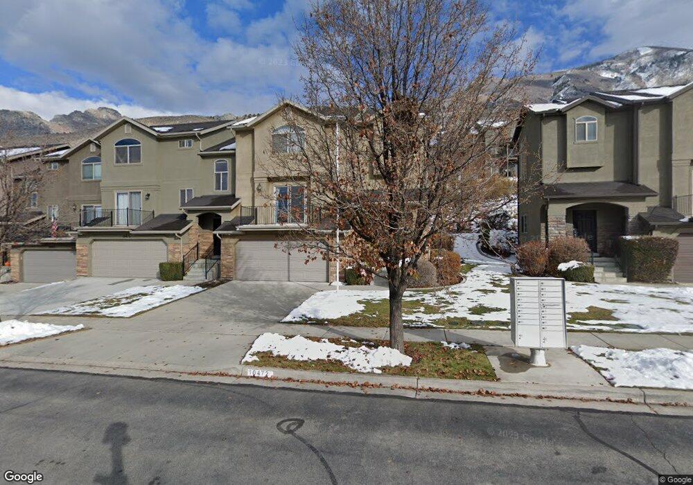
10472 N Morgan Blvd Cedar Hills, UT 84062
Estimated Value: $434,000 - $454,421
3
Beds
3
Baths
1,842
Sq Ft
$242/Sq Ft
Est. Value
About This Home
This home is located at 10472 N Morgan Blvd, Cedar Hills, UT 84062 and is currently estimated at $445,605, approximately $241 per square foot. 10472 N Morgan Blvd is a home located in Utah County with nearby schools including Cedar Ridge Elementary School, Mountain Ridge Junior High School, and American Fork High School.
Ownership History
Date
Name
Owned For
Owner Type
Purchase Details
Closed on
Oct 13, 2009
Sold by
Haux Kelly S
Bought by
Smith Mclane and Smith Ashley Garbe
Current Estimated Value
Home Financials for this Owner
Home Financials are based on the most recent Mortgage that was taken out on this home.
Original Mortgage
$169,375
Outstanding Balance
$110,430
Interest Rate
5.05%
Mortgage Type
FHA
Estimated Equity
$335,175
Purchase Details
Closed on
Nov 22, 2004
Sold by
G & J Construction Inc
Bought by
Haux Kelly S
Home Financials for this Owner
Home Financials are based on the most recent Mortgage that was taken out on this home.
Original Mortgage
$160,540
Interest Rate
5.72%
Mortgage Type
FHA
Create a Home Valuation Report for This Property
The Home Valuation Report is an in-depth analysis detailing your home's value as well as a comparison with similar homes in the area
Home Values in the Area
Average Home Value in this Area
Purchase History
| Date | Buyer | Sale Price | Title Company |
|---|---|---|---|
| Smith Mclane | -- | Utah Mountain Title | |
| Haux Kelly S | -- | Affiliated First Title Comp |
Source: Public Records
Mortgage History
| Date | Status | Borrower | Loan Amount |
|---|---|---|---|
| Open | Smith Mclane | $169,375 | |
| Previous Owner | Haux Kelly S | $160,540 | |
| Closed | Haux Kelly S | $7,550 |
Source: Public Records
Tax History Compared to Growth
Tax History
| Year | Tax Paid | Tax Assessment Tax Assessment Total Assessment is a certain percentage of the fair market value that is determined by local assessors to be the total taxable value of land and additions on the property. | Land | Improvement |
|---|---|---|---|---|
| 2025 | $1,923 | $229,515 | $61,300 | $356,000 |
| 2024 | $1,923 | $227,755 | $0 | $0 |
| 2023 | $1,661 | $211,310 | $0 | $0 |
| 2022 | $1,720 | $213,785 | $0 | $0 |
| 2021 | $1,606 | $297,300 | $44,600 | $252,700 |
| 2020 | $1,476 | $266,600 | $40,000 | $226,600 |
| 2019 | $1,360 | $255,100 | $38,300 | $216,800 |
| 2018 | $1,198 | $211,700 | $31,800 | $179,900 |
| 2017 | $1,141 | $107,800 | $0 | $0 |
| 2016 | $1,120 | $98,450 | $0 | $0 |
| 2015 | $1,124 | $93,500 | $0 | $0 |
| 2014 | $1,018 | $84,150 | $0 | $0 |
Source: Public Records
Map
Nearby Homes
- 10448 Sage Vista Ln
- 10456 N Morgan Blvd
- 10468 N Sage Vista Ln
- 10358 N Tamarack Way
- 10514 N Doral Dr
- 10412 N Bayhill Dr
- 10587 N Avalon St
- 4083 W Hayes Cir
- 10795 N La Costa
- 3870 Mountaintop Cir
- 4084 W Shinnecock
- 3851 W Mountaintop Cir Unit 5
- 4292 W Joshua Ln
- 4198 W Sage Rd N
- 10207 N Cottonwood Dr
- 9900 N Meadow Dr
- 4124 N 810 W
- 11197 N Park Dr
- 9575 Aztec Dr
- 4616 W Carriage Ln
- 10472 N Morgan Blvd Unit 208
- 10472 Morgan Blvd
- 10476 Morgan Blvd
- 10476 Morgan Blvd Unit 207
- 10464 N Morgan Blvd Unit 209
- 10464 N Morgan Blvd
- 10464 Morgan Blvd
- 10478 Morgan Blvd
- 10478 N Morgan Blvd Unit 206
- 10478 N Morgan Blvd
- 10462 Morgan Blvd Unit 210
- 10484 Morgan Blvd
- 10484 Morgan Blvd Unit 205
- 10484 N Morgan Blvd
- 10458 Morgan Blvd Unit 215
- 10456 Morgan Blvd
- 10487 N Sage Vista Ln Unit 324
- 10487 N Sage Vista Ln
- 10487 Sage Vista Ln
- 10481 Sage Vista Ln