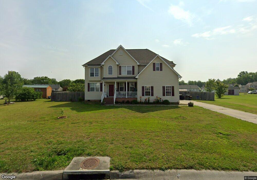
10472 Sylvia Cir Windsor, VA 23487
Estimated Value: $453,000 - $471,033
About This Home
This home is located at 10472 Sylvia Cir, Windsor, VA 23487 and is currently estimated at $460,258, approximately $177 per square foot. 10472 Sylvia Cir is a home located in Isle of Wight County with nearby schools including Windsor Elementary School, Georgie D. Tyler Middle School, and Windsor High School.
Ownership History
We collect this data history from publicly available records. To have your information removed, we recommend requesting removal directly through your county’s website.
Purchase Details
Home Financials for this Owner
Home Financials are based on the most recent Mortgage that was taken out on this home.Purchase Details
Purchase Details
Home Values in the Area
Average Home Value in this Area
Purchase History
We collect this data history from publicly available records. To have your information removed, we recommend requesting removal directly through your county’s website.
| Date | Buyer | Sale Price | Title Company |
|---|---|---|---|
| -- | True North Title | ||
| $275,000 | -- | ||
| -- | -- |
Mortgage History
We collect this data history from publicly available records. To have your information removed, we recommend requesting removal directly through your county’s website.
| Date | Status | Borrower | Loan Amount |
|---|---|---|---|
| Closed | $257,000 | ||
| Closed | $257,000 |
Tax History
We collect this data history from publicly available records. To have your information removed, we recommend requesting removal directly through your county’s website.
| Year | Tax Paid | Tax Assessment Tax Assessment Total Assessment is a certain percentage of the fair market value that is determined by local assessors to be the total taxable value of land and additions on the property. | Land | Improvement |
|---|---|---|---|---|
| 2025 | $3,007 | $388,000 | $50,000 | $338,000 |
| 2024 | $2,832 | $388,000 | $50,000 | $338,000 |
| 2023 | $2,809 | $388,000 | $50,000 | $338,000 |
| 2022 | $2,556 | $294,400 | $50,000 | $244,400 |
| 2021 | $2,556 | $294,400 | $50,000 | $244,400 |
| 2020 | $2,556 | $294,400 | $50,000 | $244,400 |
| 2019 | $2,556 | $294,400 | $50,000 | $244,400 |
| 2018 | $2,358 | $271,000 | $45,000 | $226,000 |
| 2016 | $2,376 | $271,000 | $45,000 | $226,000 |
| 2015 | $2,771 | $271,000 | $45,000 | $226,000 |
| 2014 | $2,771 | $317,500 | $60,000 | $257,500 |
| 2013 | -- | $317,500 | $60,000 | $257,500 |
Map
- 10455 Sylvia Cir
- 15+AC Courthouse Hwy
- 44 N Court St
- 11480 Blue Ridge Trail
- 32 N Court St
- 29 N Court St
- 26 N Court St
- 9545 Windsor Blvd
- 47AC Holland Dr
- .71 Ac E Windsor Blvd
- 10176 Bank St
- 12177 Ava Ln
- 12199 Ava Ln
- 12185 Ava Ln
- 11563 Savannah St
- 308 Pheasant Ln
- 12169 Ava Ln
- 11572 Savannah St
- 11564 Savannah St
- 24248 Liam Ct
- 23071 Andrew Ct
- 23085 Andrew Ct
- 10466 Sylvia Cir
- LOT 14 Andrew Ct
- 10467 Sylvia Cir
- 11025 Wythe Dr
- 23082 Andrew Ct
- 10461 Sylvia Cir
- 23090 Andrew Ct
- 10479 Sylvia Cir
- 23109 Andrew Ct
- 23080 Rolfe Ave
- 10478 Sylvia Cir
- 23102 Andrew Ct
- 11024 Wythe Dr
- 10481 Sylvia Cir
- 23064 Rolfe Ave
- 10479 Albert Ct
- 23116 Andrew Ct
- 11036 Wythe Dr
Ask me questions while you tour the home.