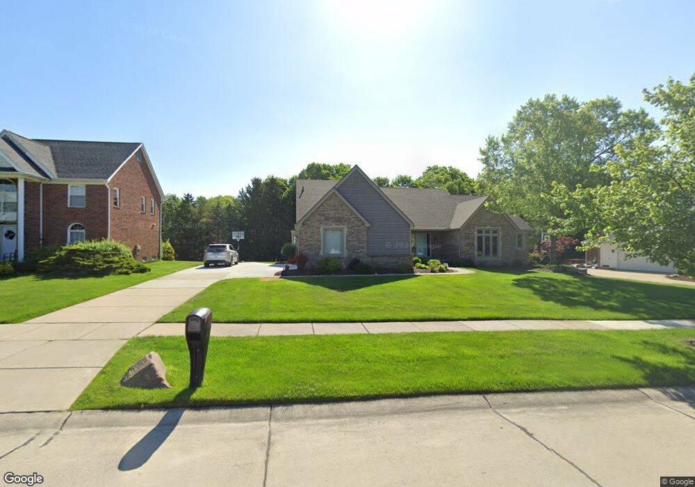
10476 Red Maple Dr Plymouth, MI 48170
Estimated Value: $632,463 - $704,000
3
Beds
4
Baths
2,873
Sq Ft
$231/Sq Ft
Est. Value
About This Home
This home is located at 10476 Red Maple Dr, Plymouth, MI 48170 and is currently estimated at $663,116, approximately $230 per square foot. 10476 Red Maple Dr is a home located in Wayne County with nearby schools including Canton High School, Isbister Elementary School, and Salem High School.
Ownership History
Date
Name
Owned For
Owner Type
Purchase Details
Closed on
Mar 1, 2022
Sold by
Jennifer Sroka-Kost Susan and Jennifer Scot Randall
Bought by
Kost Family Trust
Current Estimated Value
Purchase Details
Closed on
Sep 16, 2019
Sold by
Kost Randall Scott and Sroka Kost Susan Jennifer
Bought by
Kost Randall Scott and Sroka Kost Susan Jennifer
Home Financials for this Owner
Home Financials are based on the most recent Mortgage that was taken out on this home.
Original Mortgage
$325,000
Interest Rate
3.6%
Mortgage Type
New Conventional
Purchase Details
Closed on
Apr 27, 2007
Sold by
Kost Randall S
Bought by
Kost Randall S
Home Financials for this Owner
Home Financials are based on the most recent Mortgage that was taken out on this home.
Original Mortgage
$59,250
Interest Rate
6.2%
Mortgage Type
New Conventional
Purchase Details
Closed on
Jun 30, 2006
Sold by
Schwarze Frederick B and Schwarze Ann M
Bought by
Kost Randall S
Create a Home Valuation Report for This Property
The Home Valuation Report is an in-depth analysis detailing your home's value as well as a comparison with similar homes in the area
Home Values in the Area
Average Home Value in this Area
Purchase History
| Date | Buyer | Sale Price | Title Company |
|---|---|---|---|
| Kost Family Trust | -- | Land Title | |
| Kost Randall Scott | -- | Reputation First Ttl Agcy Ll | |
| Kost Randall S | -- | Independence Title | |
| Kost Randall S | $372,000 | Multiple |
Source: Public Records
Mortgage History
| Date | Status | Borrower | Loan Amount |
|---|---|---|---|
| Previous Owner | Kost Randall Scott | $325,000 | |
| Previous Owner | Kost Randall S | $59,250 |
Source: Public Records
Tax History Compared to Growth
Tax History
| Year | Tax Paid | Tax Assessment Tax Assessment Total Assessment is a certain percentage of the fair market value that is determined by local assessors to be the total taxable value of land and additions on the property. | Land | Improvement |
|---|---|---|---|---|
| 2025 | $5,185 | $293,900 | $0 | $0 |
| 2024 | $5,185 | $276,800 | $0 | $0 |
| 2023 | $4,940 | $250,500 | $0 | $0 |
| 2022 | $6,876 | $237,800 | $0 | $0 |
| 2021 | $6,688 | $235,200 | $0 | $0 |
| 2019 | $6,492 | $213,590 | $0 | $0 |
| 2018 | $4,183 | $214,910 | $0 | $0 |
| 2017 | $3,532 | $41,800 | $0 | $0 |
| 2016 | $5,477 | $206,700 | $0 | $0 |
| 2015 | $17,515 | $205,100 | $0 | $0 |
| 2013 | $16,969 | $182,230 | $0 | $0 |
| 2012 | -- | $166,310 | $41,800 | $124,510 |
Source: Public Records
Map
Nearby Homes
- 49238 Plum Tree Dr
- 9377 Pineview Dr
- 9875 Ann Arbor Trail
- 9079 Woodgrove Dr
- 0 E Ann Arbor Trail Unit 20251048195
- 48100 Powell Rd
- 9350 Colony Farms Ct
- 50157 E Fellows Creek Ct
- 11809 Amherst Ct
- 11641 Chandler Dr
- 9421 Mapletree Dr
- 48441 N Territorial Rd
- 11431 Sandalwood Dr
- 48814 Gyde Rd
- 47442 Verona Ct
- 47443 Verona Ct
- 50501 Elmwood Ct Unit 11
- 50520 Elmwood Ct
- B1 Tall Timber Unit B1
- 48434 Hill Top Dr E
- 10374 Red Maple Dr
- 10578 Red Maple Dr
- 10477 Red Maple Dr
- 10680 Red Maple Dr
- 10272 Red Maple Dr
- 10579 Red Maple Dr
- 10677 Harvest Ct
- 10375 Red Maple Dr
- 10681 Red Maple Dr
- 10273 Red Maple Dr
- 10782 Red Maple Dr
- 49300 Pinehill Dr
- 10666 Harvest Ct
- 10779 Harvest Ct
- 10171 Red Maple Dr
- 10783 Red Maple Dr
- 10884 Red Maple Dr
- 49270 Pinehill Dr
- 10881 Harvest Ct
- 10885 Red Maple Dr