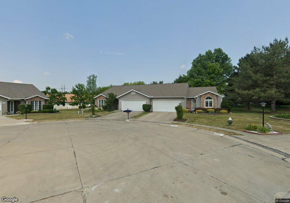
10478 Royal Oak Dr Strongsville, OH 44136
Estimated Value: $266,386 - $277,000
2
Beds
2
Baths
1,632
Sq Ft
$167/Sq Ft
Est. Value
About This Home
This home is located at 10478 Royal Oak Dr, Strongsville, OH 44136 and is currently estimated at $272,597, approximately $167 per square foot. 10478 Royal Oak Dr is a home located in Cuyahoga County with nearby schools including Strongsville High School, Sts Joseph & John Interparochial School, and Royal Redeemer Lutheran School.
Ownership History
Date
Name
Owned For
Owner Type
Purchase Details
Closed on
Oct 25, 2011
Sold by
Mitchell Elizabeth M and Mitchell Lawrence C
Bought by
Juresko Gary F
Current Estimated Value
Home Financials for this Owner
Home Financials are based on the most recent Mortgage that was taken out on this home.
Original Mortgage
$80,800
Outstanding Balance
$55,363
Interest Rate
4.12%
Mortgage Type
New Conventional
Estimated Equity
$217,234
Purchase Details
Closed on
Dec 11, 1998
Sold by
Glaze Richard N and Glaze E
Bought by
Glaze Richard N and Glaze Elizabeth M
Purchase Details
Closed on
Jan 1, 1991
Bought by
Glaze Richard M and E M
Create a Home Valuation Report for This Property
The Home Valuation Report is an in-depth analysis detailing your home's value as well as a comparison with similar homes in the area
Home Values in the Area
Average Home Value in this Area
Purchase History
| Date | Buyer | Sale Price | Title Company |
|---|---|---|---|
| Juresko Gary F | $125,800 | Guardian Title | |
| Glaze Richard N | -- | Lorain County Title Co | |
| Glaze Richard M | -- | -- |
Source: Public Records
Mortgage History
| Date | Status | Borrower | Loan Amount |
|---|---|---|---|
| Open | Juresko Gary F | $80,800 |
Source: Public Records
Tax History Compared to Growth
Tax History
| Year | Tax Paid | Tax Assessment Tax Assessment Total Assessment is a certain percentage of the fair market value that is determined by local assessors to be the total taxable value of land and additions on the property. | Land | Improvement |
|---|---|---|---|---|
| 2024 | $3,748 | $79,835 | $14,525 | $65,310 |
| 2023 | $3,822 | $61,040 | $13,300 | $47,740 |
| 2022 | $3,794 | $61,040 | $13,300 | $47,740 |
| 2021 | $3,764 | $61,040 | $13,300 | $47,740 |
| 2020 | $3,575 | $51,280 | $11,170 | $40,110 |
| 2019 | $3,470 | $146,500 | $31,900 | $114,600 |
| 2018 | $3,149 | $51,280 | $11,170 | $40,110 |
| 2017 | $2,877 | $43,370 | $8,510 | $34,860 |
| 2016 | $2,854 | $43,370 | $8,510 | $34,860 |
| 2015 | $2,952 | $43,370 | $8,510 | $34,860 |
| 2014 | $2,952 | $44,240 | $8,680 | $35,560 |
Source: Public Records
Map
Nearby Homes
- 10369 Council Bluff
- 9945 Twelve Oaks Cir
- 16519 Albion Rd
- 15485 Albion Rd
- 9890 Webster Rd
- 10010 Chevy Chase
- 0 Webster Rd
- 9129 Tahoe Cir
- 12101 The Bluffs
- 11650 River Moss Rd
- 14069 Basswood Cir
- 9531 Nicole Cir
- 14298 Calderdale Ln
- 14584 Baywood Ln
- 14557 Baywood Ln
- 14644 Baywood Ln
- 14236 Calderdale Ln
- 17945 Cliffside Dr
- 18433 Whitney Rd
- 18203 Broxton Dr
- 10450 Royal Oak Dr
- 10534 Royal Oak Dr
- 10534 Royal Oak Dr Unit 41-A
- 10497 Decatur Dr
- 10519 Decatur Dr
- 10519 Decatur Dr Unit 45-A
- 10471 Royal Oak Dr
- 10562 Royal Oak Dr
- 10541 Decatur Dr
- 10499 Royal Oak Dr
- 10499 Royal Oak Dr Unit 37-A
- 10453 Decatur Dr
- 10453 Decatur Dr Unit 47-A
- 16161 N Laguardia Pkwy
- 16129 N Laguardia Pkwy
- 10555 Royal Oak Dr
- 10555 Royal Oak Dr Unit 36-A
- 10563 Decatur Dr
- 10583 Royal Oak Dr
- 10583 Royal Oak Dr Unit 35-A