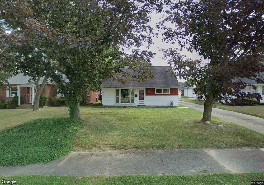
1048 Roseland Rd Alliance, OH 44601
Estimated Value: $131,000 - $183,000
3
Beds
3
Baths
1,146
Sq Ft
$134/Sq Ft
Est. Value
About This Home
This home is located at 1048 Roseland Rd, Alliance, OH 44601 and is currently estimated at $153,393, approximately $133 per square foot. 1048 Roseland Rd is a home located in Stark County with nearby schools including Alliance Early Learning School, Alliance Intermediate School at Northside, and Alliance Middle School.
Ownership History
Date
Name
Owned For
Owner Type
Purchase Details
Closed on
May 11, 2010
Sold by
Greene Wilma J and Murphy Martha S
Bought by
Cody Rebecca L
Current Estimated Value
Home Financials for this Owner
Home Financials are based on the most recent Mortgage that was taken out on this home.
Original Mortgage
$52,000
Outstanding Balance
$35,041
Interest Rate
5.16%
Mortgage Type
New Conventional
Estimated Equity
$118,352
Purchase Details
Closed on
Dec 28, 2007
Sold by
Murphy Martha S and Heath Candace J
Bought by
Greene Robert W
Purchase Details
Closed on
Dec 18, 2006
Sold by
Greene Robert W and Greene Wilma J
Bought by
Murphy Martha S and Heath Candace J
Purchase Details
Closed on
Apr 4, 2006
Sold by
Mckenna Edward J and Milovich Mckenna Michelle A
Bought by
Greene Robert W and Greene Wilma J
Purchase Details
Closed on
Aug 27, 1990
Create a Home Valuation Report for This Property
The Home Valuation Report is an in-depth analysis detailing your home's value as well as a comparison with similar homes in the area
Home Values in the Area
Average Home Value in this Area
Purchase History
| Date | Buyer | Sale Price | Title Company |
|---|---|---|---|
| Cody Rebecca L | -- | Heritagae Union Title Co Ltd | |
| Cody Rebecca L | $65,000 | Heritage Union Title Co Ltd | |
| Greene Robert W | -- | Attorney | |
| Murphy Martha S | -- | Attorney | |
| Greene Robert W | $81,500 | Union Title Co | |
| -- | $35,000 | -- |
Source: Public Records
Mortgage History
| Date | Status | Borrower | Loan Amount |
|---|---|---|---|
| Open | Cody Rebecca L | $52,000 |
Source: Public Records
Tax History Compared to Growth
Tax History
| Year | Tax Paid | Tax Assessment Tax Assessment Total Assessment is a certain percentage of the fair market value that is determined by local assessors to be the total taxable value of land and additions on the property. | Land | Improvement |
|---|---|---|---|---|
| 2025 | -- | $36,830 | $9,070 | $27,760 |
| 2024 | -- | $36,830 | $9,070 | $27,760 |
| 2023 | $1,159 | $28,850 | $7,180 | $21,670 |
| 2022 | $1,167 | $28,850 | $7,180 | $21,670 |
| 2021 | $1,168 | $28,850 | $7,180 | $21,670 |
| 2020 | $1,106 | $25,520 | $6,230 | $19,290 |
| 2019 | $1,091 | $25,520 | $6,230 | $19,290 |
| 2018 | $1,096 | $25,520 | $6,230 | $19,290 |
| 2017 | $995 | $22,790 | $4,830 | $17,960 |
| 2016 | $1,184 | $26,920 | $4,830 | $22,090 |
| 2015 | $1,195 | $26,920 | $4,830 | $22,090 |
| 2014 | $1,178 | $25,270 | $4,550 | $20,720 |
| 2013 | $588 | $25,270 | $4,550 | $20,720 |
Source: Public Records
Map
Nearby Homes
- 884 W College Rd
- 1515 S Rockhill Ave
- 2112 Blenheim Ave
- 2050 Federal Ave
- 1321 Parkway Blvd
- 1201 Overlook Dr
- 1038 Fairview Place
- 2220 Western Ave
- 970 Kingsway St
- 1059 Oakwood Dr
- 738 Kingsway St
- 896 Parkway Blvd
- 2839 S Rockhill Ave
- 734 Parkway Blvd
- 112 E College St
- 725 W Summit St
- 1475 Chatauqua Ct
- 3101 Ridgehill Ave
- 645 W Summit St
- 317 E State St
- 1054 Roseland Rd
- 1032 Roseland Rd
- 1062 Roseland Rd
- 1045 Hartshorn St
- 1053 Hartshorn St
- 1035 Hartshorn St
- 1070 Roseland Rd
- 1025 Hartshorn St
- 1061 Hartshorn St
- 1061 W Hartshorn St
- 1016 Roseland Rd
- 1045 Roseland Rd
- 1053 Roseland Rd
- 1033 Roseland Rd
- 1069 Hartshorn St
- 1015 Hartshorn St
- 1078 Roseland Rd
- 1059 Roseland Rd
- 1008 Roseland Rd
- 1077 Hartshorn St