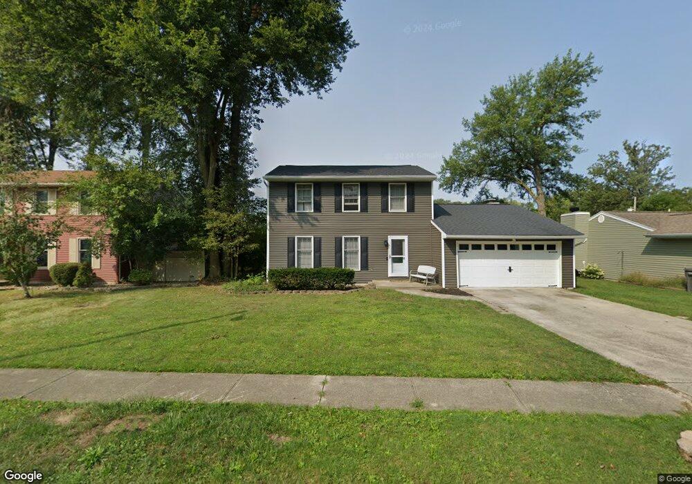
1048 Westerly Dr Lima, OH 45805
Lakewood West NeighborhoodEstimated Value: $206,000 - $239,000
3
Beds
2
Baths
1,624
Sq Ft
$134/Sq Ft
Est. Value
About This Home
This home is located at 1048 Westerly Dr, Lima, OH 45805 and is currently estimated at $218,390, approximately $134 per square foot. 1048 Westerly Dr is a home located in Allen County with nearby schools including Maplewood Elementary School, Elmwood Elementary School, and Shawnee Middle School.
Ownership History
Date
Name
Owned For
Owner Type
Purchase Details
Closed on
Oct 22, 2002
Sold by
O'Neil Leslie H
Bought by
Perrine Ronald and Perrine Cheryl
Current Estimated Value
Purchase Details
Closed on
Dec 19, 1997
Sold by
Garber John
Bought by
Hill O'Neal H and Hill Julie
Home Financials for this Owner
Home Financials are based on the most recent Mortgage that was taken out on this home.
Original Mortgage
$83,457
Interest Rate
7.36%
Mortgage Type
New Conventional
Purchase Details
Closed on
Apr 18, 1990
Bought by
Garber John L
Create a Home Valuation Report for This Property
The Home Valuation Report is an in-depth analysis detailing your home's value as well as a comparison with similar homes in the area
Home Values in the Area
Average Home Value in this Area
Purchase History
| Date | Buyer | Sale Price | Title Company |
|---|---|---|---|
| Perrine Ronald | $100,000 | -- | |
| Hill O'Neal H | $87,875 | -- | |
| Garber John L | $73,500 | -- |
Source: Public Records
Mortgage History
| Date | Status | Borrower | Loan Amount |
|---|---|---|---|
| Previous Owner | Hill O'Neal H | $83,457 |
Source: Public Records
Tax History Compared to Growth
Tax History
| Year | Tax Paid | Tax Assessment Tax Assessment Total Assessment is a certain percentage of the fair market value that is determined by local assessors to be the total taxable value of land and additions on the property. | Land | Improvement |
|---|---|---|---|---|
| 2024 | $2,064 | $51,040 | $7,740 | $43,300 |
| 2023 | $1,711 | $38,090 | $5,780 | $32,310 |
| 2022 | $1,720 | $38,090 | $5,780 | $32,310 |
| 2021 | $1,729 | $38,090 | $5,780 | $32,310 |
| 2020 | $1,396 | $32,380 | $5,460 | $26,920 |
| 2019 | $1,396 | $32,380 | $5,460 | $26,920 |
| 2018 | $1,402 | $32,380 | $5,460 | $26,920 |
| 2017 | $1,420 | $32,380 | $5,460 | $26,920 |
| 2016 | $1,402 | $32,380 | $5,460 | $26,920 |
| 2015 | $1,398 | $32,380 | $5,460 | $26,920 |
| 2014 | $1,390 | $31,890 | $5,640 | $26,250 |
| 2013 | $1,362 | $31,890 | $5,640 | $26,250 |
Source: Public Records
Map
Nearby Homes
- 2997 Cletus Pkwy
- 2964 Hanover Dr
- 2921 Canterbury Dr
- 0 Springview Dr
- 00 Seriff
- 3390 Spencerville Rd
- 1408 Winghaven Dr
- 147 Eagles Point St S
- 123 Eagles Point W
- 2700 Lowell Ave
- 1440 Riverview Dr
- 1453 W Shore Dr
- 1446 Adak Ave
- 1421 Shawnee Rd
- 1540 Adak Ave
- 2940 Koop Rd
- XXXX Spencerville Rd
- 2072 Arcadia Ave
- 1880 Wendell Ave
- 1635 Tanglewood Ln