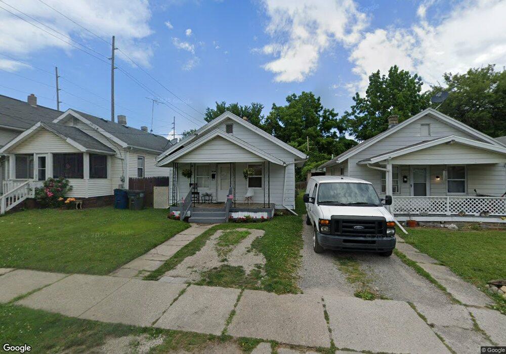
1048 Whittier St Toledo, OH 43609
Southside NeighborhoodEstimated Value: $47,000 - $58,000
2
Beds
1
Bath
880
Sq Ft
$59/Sq Ft
Est. Value
About This Home
This home is located at 1048 Whittier St, Toledo, OH 43609 and is currently estimated at $51,678, approximately $58 per square foot. 1048 Whittier St is a home located in Lucas County with nearby schools including Pickett Elementary School, Jesup W. Scott High School, and Summit Academy - Toledo.
Ownership History
Date
Name
Owned For
Owner Type
Purchase Details
Closed on
Apr 13, 2018
Sold by
Chris Gordy Llc
Bought by
Cdc Llc
Current Estimated Value
Purchase Details
Closed on
Feb 4, 2013
Sold by
Gordy Chris R and Gordy Chris
Bought by
Chris Gordy Llc
Purchase Details
Closed on
Mar 19, 2002
Sold by
Robert Farris
Bought by
Gordy Chris R
Purchase Details
Closed on
Nov 13, 1997
Sold by
Manis Carl L
Bought by
Farris Robert and Farris Sherry
Purchase Details
Closed on
Aug 19, 1996
Sold by
Beeler Krista A
Bought by
Manis Carl L and Manis Connie L
Purchase Details
Closed on
Apr 29, 1996
Sold by
Whitson Theresa
Bought by
Beeler Krista A
Purchase Details
Closed on
Apr 4, 1990
Sold by
May Edward Lee
Purchase Details
Closed on
Nov 14, 1989
Sold by
May Edward L
Create a Home Valuation Report for This Property
The Home Valuation Report is an in-depth analysis detailing your home's value as well as a comparison with similar homes in the area
Home Values in the Area
Average Home Value in this Area
Purchase History
| Date | Buyer | Sale Price | Title Company |
|---|---|---|---|
| Cdc Llc | -- | None Available | |
| Chris Gordy Llc | -- | None Available | |
| Gordy Chris R | $15,000 | -- | |
| Farris Robert | $10,000 | -- | |
| Manis Carl L | $15,000 | -- | |
| Beeler Krista A | $2,000 | -- | |
| -- | -- | -- | |
| -- | -- | -- |
Source: Public Records
Tax History Compared to Growth
Tax History
| Year | Tax Paid | Tax Assessment Tax Assessment Total Assessment is a certain percentage of the fair market value that is determined by local assessors to be the total taxable value of land and additions on the property. | Land | Improvement |
|---|---|---|---|---|
| 2024 | $238 | $6,545 | $1,540 | $5,005 |
| 2023 | $420 | $5,390 | $1,435 | $3,955 |
| 2022 | $422 | $5,390 | $1,435 | $3,955 |
| 2021 | $428 | $5,390 | $1,435 | $3,955 |
| 2020 | $454 | $4,970 | $1,365 | $3,605 |
| 2019 | $437 | $4,970 | $1,365 | $3,605 |
| 2018 | $431 | $4,970 | $1,365 | $3,605 |
| 2017 | $411 | $4,375 | $875 | $3,500 |
| 2016 | $421 | $12,500 | $2,500 | $10,000 |
| 2015 | $420 | $12,500 | $2,500 | $10,000 |
| 2014 | $283 | $4,380 | $880 | $3,500 |
| 2013 | $283 | $4,380 | $880 | $3,500 |
Source: Public Records
Map
Nearby Homes
- 109 Wellington St
- 71 Wellington St
- 1266 Western Ave
- 1123 Hamilton St
- 1321 Gordon St
- 650 Curtis St
- 1220 South Ave
- 717 Segur Ave
- 323 Langdon St
- 910 Blum St
- 1133 Blum St
- 947 Vance St
- 1002 Prouty Ave
- 1255 Nebraska Ave
- 702 Boalt St
- 1250 Prouty Ave
- 1023 Prouty Ave
- 1267 Nebraska Ave
- 546 Hiett Ave
- 213 Dale St
- 1050 Whittier St
- 1042 Whittier St
- 1052 Whittier St
- 1038 Whittier St
- 1032 Whittier St
- 127 S Hawley St
- 1041 Whittier St
- 1039 Whittier St
- 1028 Whittier St
- 1035 Whittier St
- 1026 Whittier St
- 1031 Whittier St
- 1022 Whittier St
- 1027 Whittier St
- 1025 Whittier St
- 1020 Whittier St
- 1023 Whittier St
- 1018 Whittier St
- 1021 Whittier St
- 139 S Hawley St