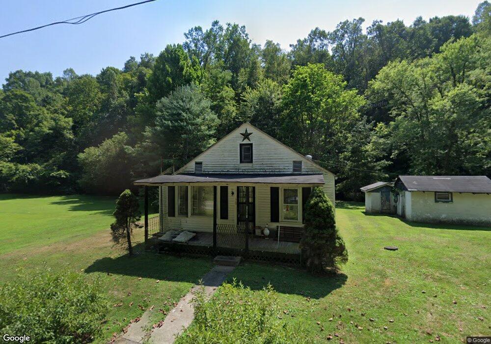
10481 State Route 775 Scottown, OH 45678
Estimated Value: $62,000 - $135,000
2
Beds
1
Bath
780
Sq Ft
$141/Sq Ft
Est. Value
About This Home
This home is located at 10481 State Route 775, Scottown, OH 45678 and is currently estimated at $110,151, approximately $141 per square foot. 10481 State Route 775 is a home located in Lawrence County with nearby schools including Symmes Valley Elementary School and Symmes Valley High School.
Ownership History
Date
Name
Owned For
Owner Type
Purchase Details
Closed on
Mar 30, 2009
Sold by
Mccomas Paul and Mccomas Druzella
Bought by
Mccomas David and Mccomas Laura
Current Estimated Value
Purchase Details
Closed on
Feb 26, 2001
Bought by
Mccomas Druzella
Purchase Details
Closed on
Oct 28, 1996
Sold by
Mccomas Druzella
Bought by
Mccomas, Druzella Life Es
Create a Home Valuation Report for This Property
The Home Valuation Report is an in-depth analysis detailing your home's value as well as a comparison with similar homes in the area
Home Values in the Area
Average Home Value in this Area
Purchase History
| Date | Buyer | Sale Price | Title Company |
|---|---|---|---|
| Mccomas David | $35,000 | None Available | |
| Mccomas Druzella | -- | -- | |
| Mccomas, Druzella Life Es | -- | -- |
Source: Public Records
Tax History Compared to Growth
Tax History
| Year | Tax Paid | Tax Assessment Tax Assessment Total Assessment is a certain percentage of the fair market value that is determined by local assessors to be the total taxable value of land and additions on the property. | Land | Improvement |
|---|---|---|---|---|
| 2024 | -- | $21,740 | $17,550 | $4,190 |
| 2023 | $351 | $21,740 | $17,550 | $4,190 |
| 2022 | $349 | $21,740 | $17,550 | $4,190 |
| 2021 | $382 | $19,240 | $13,410 | $5,830 |
| 2020 | $397 | $19,240 | $13,410 | $5,830 |
| 2019 | $417 | $19,240 | $13,410 | $5,830 |
| 2018 | $414 | $18,860 | $13,150 | $5,710 |
| 2017 | $415 | $18,860 | $13,150 | $5,710 |
| 2016 | $384 | $18,860 | $13,150 | $5,710 |
| 2015 | $489 | $22,340 | $13,130 | $9,210 |
| 2014 | $489 | $22,340 | $13,130 | $9,210 |
| 2013 | $489 | $22,340 | $13,130 | $9,210 |
Source: Public Records
Map
Nearby Homes
- 00 Ohio 217
- 0 Ohio 217
- State Route 790
- 0 Dillon Ridge Unit 23651508
- 0 Dillon Ridge Unit 181305
- 1805 Long Creek Rd E
- 11904 State Route 217
- 810 Township Road 141
- 479 Township Road 122
- 168 Township Road 122 W
- State Route 790
- 4754 County Road 36
- 13498 County Road 2
- 266 Twp Rd 209
- 181 Private Road 3954
- 0 Venisonham-Camp Branch Rd Unit Tract 2
- 0 Venisonham-Camp Branch Rd Unit Tract 1
- 0 Venisonham-Camp Branch Rd
- 0 Venisonham-Camp Branch Rd Unit 25766693
- 0 Venisonham-Camp Branch Rd Unit 3
- 10425 State Route 775
- 10541 State Route 775
- 10418 State Route 775
- 10620 State Route 775
- 752 Township Road 79
- 10273 State Route 775
- 10218 State Route 775
- 10270 State Route 775
- 10128 State Route 775
- 1275 Township Road 212 S
- 217 State Route 218
- 10038 State Route 775
- 10013 State Route 775
- 9967 State Route 775
- 10995 State Route 775
- 0 Township Road 212 S
- 85 Private Drive 2121
- 9913 State Route 775
- 985 Township Road 212 S Unit 212S
- 321 Township Road 225