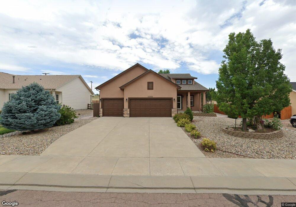
10485 Mile Post Loop Fountain, CO 80817
Central Fountain Valley NeighborhoodEstimated Value: $478,000 - $567,000
5
Beds
3
Baths
1,883
Sq Ft
$283/Sq Ft
Est. Value
About This Home
This home is located at 10485 Mile Post Loop, Fountain, CO 80817 and is currently estimated at $533,605, approximately $283 per square foot. 10485 Mile Post Loop is a home located in El Paso County with nearby schools including Jordahl Elementary School, Fountain Middle School, and Fountain-Fort Carson High School.
Ownership History
Date
Name
Owned For
Owner Type
Purchase Details
Closed on
May 31, 2018
Sold by
Turner Joseph C
Bought by
Espinoza Engenio E and Espinoza Priscilla L
Current Estimated Value
Home Financials for this Owner
Home Financials are based on the most recent Mortgage that was taken out on this home.
Original Mortgage
$113,500
Outstanding Balance
$97,937
Interest Rate
4.4%
Mortgage Type
VA
Estimated Equity
$435,668
Purchase Details
Closed on
Aug 15, 2011
Sold by
Buckland Peter E and Buckland Sheila G
Bought by
Turner Joseph C and Turner Barbara A
Purchase Details
Closed on
Feb 22, 2008
Sold by
Creekstone Development Inc
Bought by
Buckland Peter E and Buckland Sheila G
Home Financials for this Owner
Home Financials are based on the most recent Mortgage that was taken out on this home.
Original Mortgage
$230,000
Interest Rate
5.88%
Mortgage Type
Unknown
Create a Home Valuation Report for This Property
The Home Valuation Report is an in-depth analysis detailing your home's value as well as a comparison with similar homes in the area
Home Values in the Area
Average Home Value in this Area
Purchase History
| Date | Buyer | Sale Price | Title Company |
|---|---|---|---|
| Espinoza Engenio E | $366,500 | Empire Title Colorado Spring | |
| Turner Joseph C | $282,500 | None Available | |
| Buckland Peter E | $330,000 | None Available |
Source: Public Records
Mortgage History
| Date | Status | Borrower | Loan Amount |
|---|---|---|---|
| Open | Espinoza Engenio E | $113,500 | |
| Previous Owner | Buckland Peter E | $230,000 |
Source: Public Records
Tax History
| Year | Tax Paid | Tax Assessment Tax Assessment Total Assessment is a certain percentage of the fair market value that is determined by local assessors to be the total taxable value of land and additions on the property. | Land | Improvement |
|---|---|---|---|---|
| 2025 | $2,085 | $38,640 | -- | -- |
| 2024 | $1,904 | $38,010 | $6,570 | $31,440 |
| 2022 | $1,620 | $27,770 | $5,180 | $22,590 |
| 2021 | $1,505 | $28,570 | $5,330 | $23,240 |
| 2020 | $1,385 | $25,740 | $4,650 | $21,090 |
| 2019 | $1,359 | $25,740 | $4,650 | $21,090 |
| 2018 | $1,217 | $22,270 | $4,100 | $18,170 |
| 2017 | $1,203 | $22,270 | $4,100 | $18,170 |
| 2016 | $1,153 | $21,340 | $4,300 | $17,040 |
| 2015 | $1,155 | $21,340 | $4,300 | $17,040 |
| 2014 | $1,112 | $20,650 | $4,300 | $16,350 |
Source: Public Records
Map
Nearby Homes
- 10484 Mile Post Loop
- 10436 Mile Post Loop
- 10502 Country Park Point
- 10617 Darneal Dr
- 7427 Middle Bay Way
- 119 & 121 E Ohio Ave
- 11081 Buckhead Place
- 843 Hayloft Ln
- 10797 Hidden Prairie Pkwy
- 7 Circle c Rd
- 10581 Traders Pkwy
- 10653 Traders Pkwy
- 11175 Berry Farm Rd
- 212 S Reed St
- 204 S Reed St
- 7338 Benecia Dr
- 842 Barn Owl Dr
- 7431 Alatna Place
- 11288 Berry Farm Rd
- 11130 Feliz Way
- 10479 Mile Post Loop
- 10497 Mile Post Loop
- 7856 High Gate Dr
- 10473 Mile Post Loop
- 10490 Mile Post Loop
- 10478 Mile Post Loop
- 10496 Mile Post Loop
- 10467 Mile Post Loop
- 7870 High Gate Dr
- 10472 Mile Post Loop
- 7857 High Gate Dr
- 7843 High Gate Dr
- 7829 High Gate Dr
- 10460 Mile Post Loop
- 7786 High Gate Dr
- 10461 Mile Post Loop
- 7769 Sapling Ct
- 7749 Sapling Ct
- 7815 High Gate Dr
- 7789 Sapling Ct