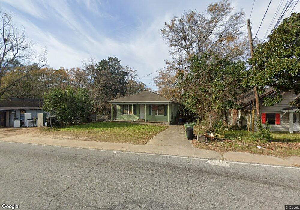
1049 Benning Dr Columbus, GA 31903
Estimated Value: $51,000 - $90,000
3
Beds
3
Baths
1,188
Sq Ft
$62/Sq Ft
Est. Value
About This Home
This home is located at 1049 Benning Dr, Columbus, GA 31903 and is currently estimated at $74,203, approximately $62 per square foot. 1049 Benning Dr is a home located in Muscogee County with nearby schools including Dorothy Height Elementary School, Baker Middle School, and Spencer High School.
Ownership History
Date
Name
Owned For
Owner Type
Purchase Details
Closed on
Mar 21, 2021
Sold by
Battle Sidney
Bought by
Battle Marco
Current Estimated Value
Purchase Details
Closed on
Jun 30, 2010
Sold by
Columbus Area Habitat For Humanity Inc
Bought by
Battle Sidney
Home Financials for this Owner
Home Financials are based on the most recent Mortgage that was taken out on this home.
Original Mortgage
$20,000
Interest Rate
4.7%
Mortgage Type
Stand Alone Second
Purchase Details
Closed on
Jul 24, 2009
Sold by
Leak James G
Bought by
Columbus Area Habitat For Humanity Inc
Create a Home Valuation Report for This Property
The Home Valuation Report is an in-depth analysis detailing your home's value as well as a comparison with similar homes in the area
Home Values in the Area
Average Home Value in this Area
Purchase History
| Date | Buyer | Sale Price | Title Company |
|---|---|---|---|
| Battle Marco | -- | -- | |
| Battle Sidney | $64,800 | None Available | |
| Columbus Area Habitat For Humanity Inc | $4,400 | None Available |
Source: Public Records
Mortgage History
| Date | Status | Borrower | Loan Amount |
|---|---|---|---|
| Previous Owner | Battle Sidney | $20,000 | |
| Previous Owner | Battle Sidney | $64,800 |
Source: Public Records
Tax History Compared to Growth
Tax History
| Year | Tax Paid | Tax Assessment Tax Assessment Total Assessment is a certain percentage of the fair market value that is determined by local assessors to be the total taxable value of land and additions on the property. | Land | Improvement |
|---|---|---|---|---|
| 2025 | $1,233 | $31,504 | $4,088 | $27,416 |
| 2024 | $1,233 | $31,504 | $4,088 | $27,416 |
| 2023 | $1,241 | $31,504 | $4,088 | $27,416 |
| 2022 | $1,471 | $36,036 | $4,088 | $31,948 |
| 2021 | $1,390 | $34,040 | $4,088 | $29,952 |
| 2020 | $1,390 | $34,040 | $4,088 | $29,952 |
| 2019 | $515 | $34,040 | $4,088 | $29,952 |
| 2018 | $515 | $34,040 | $4,088 | $29,952 |
| 2017 | $519 | $34,040 | $4,088 | $29,952 |
| 2016 | $522 | $25,920 | $3,600 | $22,320 |
| 2015 | $209 | $25,920 | $3,600 | $22,320 |
| 2014 | $210 | $25,920 | $3,600 | $22,320 |
| 2013 | -- | $25,920 | $3,600 | $22,320 |
Source: Public Records
Map
Nearby Homes
- 1025 Fletcher Ave
- 920 Brooks Rd
- 917 Fletcher Ave
- 906 Winston Rd
- 3135 Baker Cir
- 903 Winston Rd
- 824 Winston Rd
- 1029 Harbison Dr
- 812 Benning Dr
- 3111 Baker Cir
- 750 Winston Rd
- 716 Benning Dr
- 1401 Clark Ave
- 3223 Lee St
- 1274 Providence Ln
- 2459 Brownie Ln
- 2463 Brownie Ln
- 2451 Brownie Ln
- 2463 Brownie St
- 184 30th Ave
- 1045 Benning Dr
- 1053 Benning Dr
- 1055 Benning Dr
- 1039 Benning Dr
- 3343 Head St
- 3339 Head St
- 1035 Benning Dr
- 3502 Youmans St
- 1060 Winston Rd
- 1058 Winston Rd
- 1064 Winston Rd
- 1056 Winston Rd
- 1103 Benning Dr
- 1033 Benning Dr
- 3510 Youmans St
- 1042 Winston Rd
- 1102 Winston Rd
- 1107 Benning Dr
- 1040 Winston Rd
- 3514 Youmans St