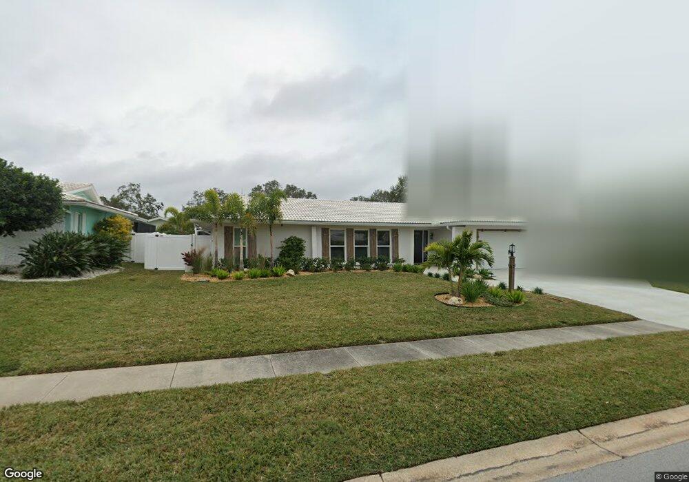
1049 Mccarty St Dunedin, FL 34698
Estimated Value: $593,000 - $673,810
4
Beds
3
Baths
2,342
Sq Ft
$268/Sq Ft
Est. Value
About This Home
This home is located at 1049 Mccarty St, Dunedin, FL 34698 and is currently estimated at $627,953, approximately $268 per square foot. 1049 Mccarty St is a home located in Pinellas County with nearby schools including San Jose Elementary School, Palm Harbor Middle School, and Dunedin High School.
Ownership History
Date
Name
Owned For
Owner Type
Purchase Details
Closed on
Apr 2, 2018
Sold by
Fitzsimmons Paula and Fitzsimmons Paula K
Bought by
Dale Gene A and Dale Sally
Current Estimated Value
Home Financials for this Owner
Home Financials are based on the most recent Mortgage that was taken out on this home.
Original Mortgage
$239,200
Outstanding Balance
$206,635
Interest Rate
5%
Mortgage Type
Adjustable Rate Mortgage/ARM
Estimated Equity
$421,318
Purchase Details
Closed on
Mar 4, 2002
Sold by
Bangos Emanual J and Bangos Lori A
Bought by
Bangos Margaret H and Bangos Lori A
Home Financials for this Owner
Home Financials are based on the most recent Mortgage that was taken out on this home.
Original Mortgage
$175,500
Interest Rate
6.81%
Mortgage Type
New Conventional
Purchase Details
Closed on
Feb 16, 1999
Sold by
Griffith Rulon L and Griffith Danny D
Bought by
Bangos Lori A
Home Financials for this Owner
Home Financials are based on the most recent Mortgage that was taken out on this home.
Original Mortgage
$134,900
Interest Rate
6.85%
Mortgage Type
Balloon
Create a Home Valuation Report for This Property
The Home Valuation Report is an in-depth analysis detailing your home's value as well as a comparison with similar homes in the area
Home Values in the Area
Average Home Value in this Area
Purchase History
| Date | Buyer | Sale Price | Title Company |
|---|---|---|---|
| Dale Gene A | $299,000 | Security Title Co | |
| Bangos Margaret H | $195,000 | -- | |
| Bangos Lori A | $149,900 | -- |
Source: Public Records
Mortgage History
| Date | Status | Borrower | Loan Amount |
|---|---|---|---|
| Open | Dale Gene A | $239,200 | |
| Previous Owner | Bangos Lori A | $23,970 | |
| Previous Owner | Bangos Lori A | $175,500 | |
| Previous Owner | Bangos Lori A | $134,900 |
Source: Public Records
Tax History
| Year | Tax Paid | Tax Assessment Tax Assessment Total Assessment is a certain percentage of the fair market value that is determined by local assessors to be the total taxable value of land and additions on the property. | Land | Improvement |
|---|---|---|---|---|
| 2025 | $3,809 | $270,667 | -- | -- |
| 2024 | $3,748 | $263,039 | -- | -- |
| 2023 | $3,748 | $255,378 | $0 | $0 |
| 2022 | $3,641 | $247,940 | $0 | $0 |
| 2021 | $3,687 | $240,718 | $0 | $0 |
| 2020 | $3,443 | $224,899 | $0 | $0 |
| 2019 | $3,381 | $219,843 | $0 | $0 |
| 2018 | $4,683 | $264,809 | $0 | $0 |
| 2017 | $4,184 | $220,044 | $0 | $0 |
| 2016 | $3,820 | $193,910 | $0 | $0 |
| 2015 | $3,735 | $195,152 | $0 | $0 |
| 2014 | $3,304 | $172,153 | $0 | $0 |
Source: Public Records
Map
Nearby Homes
- 1152 Jackmar Rd
- 1148 Falcon Dr Unit 3
- 1472 Ruth Rd
- 1701 Pinehurst Rd Unit 17G
- 1701 Pinehurst Rd Unit 24B
- 1701 Pinehurst Rd Unit 18C
- 1701 Pinehurst Rd Unit 16C
- 1701 Pinehurst Rd Unit 9G
- 1701 Pinehurst Rd Unit 6A
- 1701 Pinehurst Rd Unit 9H
- 1701 Pinehurst Rd Unit 3E
- 711 San Salvador Dr
- 1655 San Roy Dr
- 1637 San Roy Dr
- 797 Lakeside Dr
- 1327 Georgia Ave
- 716 Hickory Dr
- 1113 Ohio Ave
- 1511 San Helen Dr
- 1618 San Charles Dr
- 1037 Mccarty St
- 1061 Mccarty St
- 1036 Mcfarland St
- 1048 Mcfarland St
- 1024 Mcfarland St
- 1025 Mccarty St
- 1071 Mccarty St
- 1048 Mccarty St
- 1060 Mccarty St
- 1060 Mcfarland St
- 1036 Mccarty St
- 1012 Mcfarland St
- 1070 Mccarty St
- 1024 Mccarty St
- 1013 Mccarty St
- 1081 Mccarty St
- 1070 Mcfarland St
- 1025 Mcfarland St
- 1061 Suemar Rd
- 1047 Suemar Rd
Your Personal Tour Guide
Ask me questions while you tour the home.