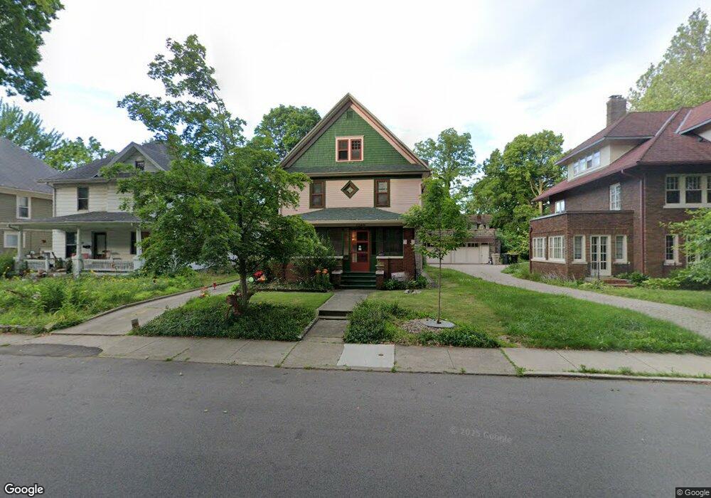
1049 Riverside Dr South Bend, IN 46616
Near Northwest NeighborhoodEstimated Value: $232,000 - $285,000
4
Beds
1
Bath
1,600
Sq Ft
$164/Sq Ft
Est. Value
About This Home
This home is located at 1049 Riverside Dr, South Bend, IN 46616 and is currently estimated at $262,726, approximately $164 per square foot. 1049 Riverside Dr is a home located in St. Joseph County with nearby schools including Muessel Primary Center, Edison Middle School, and Clay High School.
Ownership History
Date
Name
Owned For
Owner Type
Purchase Details
Closed on
Aug 2, 2021
Sold by
Price Ann Graham and Price Ann Louise
Bought by
Price Ann Louise
Current Estimated Value
Home Financials for this Owner
Home Financials are based on the most recent Mortgage that was taken out on this home.
Original Mortgage
$91,476
Outstanding Balance
$69,533
Interest Rate
2.24%
Mortgage Type
New Conventional
Estimated Equity
$193,193
Purchase Details
Closed on
Jul 22, 2021
Sold by
Price Ann Louise
Bought by
Price Ann Graham
Home Financials for this Owner
Home Financials are based on the most recent Mortgage that was taken out on this home.
Original Mortgage
$91,476
Outstanding Balance
$69,533
Interest Rate
2.24%
Mortgage Type
New Conventional
Estimated Equity
$193,193
Purchase Details
Closed on
Jul 17, 2021
Sold by
Price Thomas M
Bought by
Price Ann Graham
Home Financials for this Owner
Home Financials are based on the most recent Mortgage that was taken out on this home.
Original Mortgage
$91,476
Outstanding Balance
$69,533
Interest Rate
2.24%
Mortgage Type
New Conventional
Estimated Equity
$193,193
Create a Home Valuation Report for This Property
The Home Valuation Report is an in-depth analysis detailing your home's value as well as a comparison with similar homes in the area
Home Values in the Area
Average Home Value in this Area
Purchase History
| Date | Buyer | Sale Price | Title Company |
|---|---|---|---|
| Price Ann Louise | -- | None Listed On Document | |
| Price Ann Graham | -- | None Listed On Document | |
| Price Ann Graham | -- | None Available | |
| Price Ann Graham | -- | None Available |
Source: Public Records
Mortgage History
| Date | Status | Borrower | Loan Amount |
|---|---|---|---|
| Open | Price Ann Graham | $91,476 | |
| Closed | Price Ann Louise | $91,476 | |
| Closed | Price Ann Graham | $91,476 |
Source: Public Records
Tax History Compared to Growth
Tax History
| Year | Tax Paid | Tax Assessment Tax Assessment Total Assessment is a certain percentage of the fair market value that is determined by local assessors to be the total taxable value of land and additions on the property. | Land | Improvement |
|---|---|---|---|---|
| 2024 | $2,358 | $224,200 | $14,500 | $209,700 |
| 2023 | $2,315 | $197,100 | $14,500 | $182,600 |
| 2022 | $2,106 | $177,400 | $14,500 | $162,900 |
| 2021 | $1,997 | $165,300 | $16,500 | $148,800 |
| 2020 | $1,433 | $120,600 | $12,000 | $108,600 |
| 2019 | $1,388 | $134,500 | $25,900 | $108,600 |
| 2018 | $1,096 | $94,100 | $18,100 | $76,000 |
| 2017 | $1,113 | $93,200 | $18,100 | $75,100 |
| 2016 | $1,128 | $93,200 | $18,100 | $75,100 |
| 2014 | $1,082 | $92,300 | $18,100 | $74,200 |
Source: Public Records
Map
Nearby Homes
- 1040 Woodward Ave
- 703 Portage Ct
- 1052 Portage Ave
- 1116 Allen St
- 602 W Angela Blvd
- 803 Park Ave
- 328 Parkovash Ave
- 816 Allen St
- 919 Allen St
- 1201 Allen St
- 1245 Woodward Ave
- 310 Ostemo Place
- 715 Blaine Ave
- 628 Portage Ave
- 745 Allen St
- 212 Marquette Ave
- 617 Portage Ave
- 920 Cleveland Ave
- 716 Blaine Ave
- 1253 Diamond Ave
- 1045 Riverside Dr
- 1055 Riverside Dr
- 1043 Riverside Dr
- 1059 Riverside Dr
- 1041 Riverside Dr
- 1026 Woodward Ave
- 1034 Woodward Ave
- 1037 Riverside Dr
- 1061 Riverside Dr
- 1022 Woodward Ave
- 1038 Woodward Ave
- 1016 Woodward Ave
- 1035 Riverside Dr
- 1067 Riverside Dr
- 1033 Riverside Dr
- 1014 Woodward Ave
- 1069 Riverside Dr
- 1044 Woodward Ave Unit 46
- 1029 Riverside Dr
- 1023 Woodward Ave