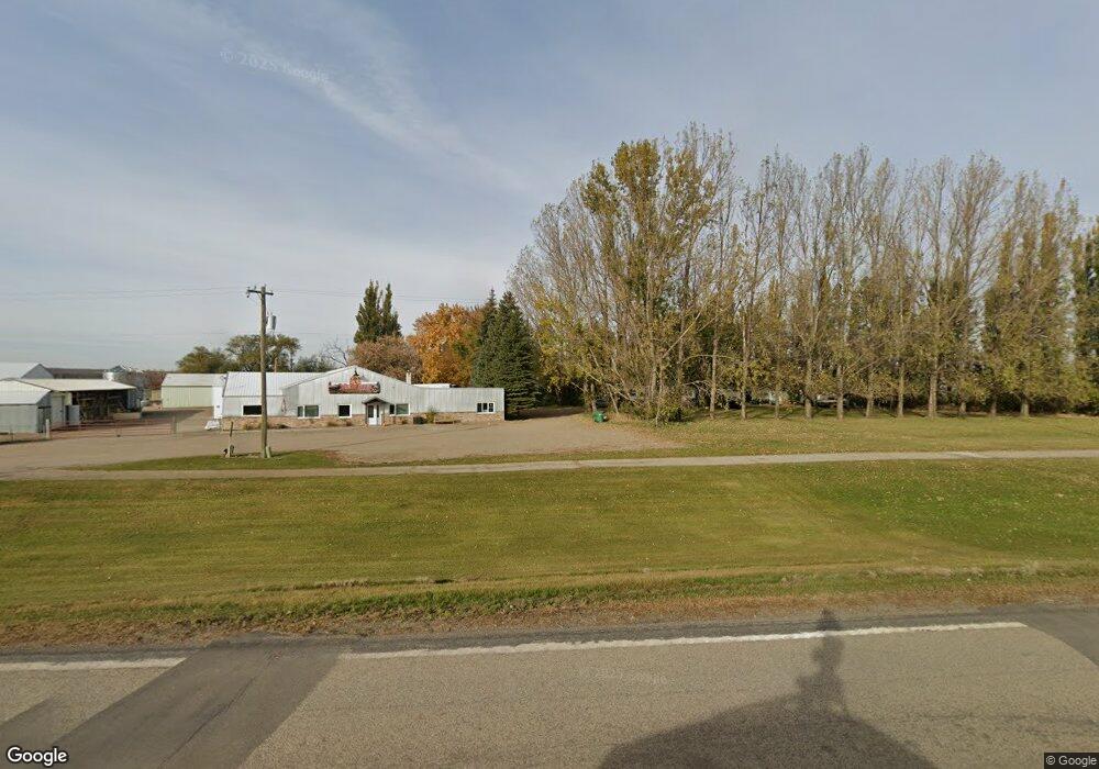
10497 Highway 32 Walhalla, ND 58282
Estimated Value: $70,181 - $147,000
--
Bed
--
Bath
--
Sq Ft
3.29
Acres
About This Home
This home is located at 10497 Highway 32, Walhalla, ND 58282 and is currently estimated at $107,795. 10497 Highway 32 is a home.
Ownership History
Date
Name
Owned For
Owner Type
Purchase Details
Closed on
Apr 4, 2018
Sold by
Lenderusa Llc
Bought by
Series 40 10497 N Hwy 32
Current Estimated Value
Purchase Details
Closed on
Jul 15, 2013
Sold by
Bank Of America N A
Bought by
Lander Usa Llc
Purchase Details
Closed on
Dec 16, 2009
Sold by
Forschen Donald W and Forschen Wanda
Bought by
Bank Of America Na
Purchase Details
Closed on
Oct 13, 2009
Sold by
Forshen Donald W and Forshen Wanda
Bought by
Bank Of America Na
Purchase Details
Closed on
Feb 14, 2007
Sold by
Bailly Richard
Bought by
Forschen Donald W and Forschen Wanda L
Purchase Details
Closed on
Feb 2, 2007
Sold by
Hanson Terry
Bought by
Forschen Donald W and Forschen Wanda L
Create a Home Valuation Report for This Property
The Home Valuation Report is an in-depth analysis detailing your home's value as well as a comparison with similar homes in the area
Home Values in the Area
Average Home Value in this Area
Purchase History
| Date | Buyer | Sale Price | Title Company |
|---|---|---|---|
| Series 40 10497 N Hwy 32 | -- | None Available | |
| Lander Usa Llc | -- | Grand Forks Abstract & Title | |
| Bank Of America Na | $37,800 | None Available | |
| Bank Of America Na | $37,800 | None Available | |
| Forschen Donald W | -- | None Available | |
| Forschen Donald W | -- | None Available |
Source: Public Records
Tax History Compared to Growth
Tax History
| Year | Tax Paid | Tax Assessment Tax Assessment Total Assessment is a certain percentage of the fair market value that is determined by local assessors to be the total taxable value of land and additions on the property. | Land | Improvement |
|---|---|---|---|---|
| 2024 | -- | $22,629 | $3,073 | $19,556 |
| 2023 | $306 | $20,029 | $1,219 | $18,810 |
| 2022 | $302 | $20,029 | $1,219 | $18,810 |
| 2021 | $271 | $19,075 | $1,161 | $17,914 |
| 2020 | $299 | $19,075 | $1,161 | $17,914 |
| 2019 | $299 | $19,075 | $1,161 | $17,914 |
| 2018 | $316 | $19,981 | $1,065 | $18,916 |
| 2017 | $287 | $18,482 | $1,176 | $17,306 |
| 2016 | $261 | $18,482 | $1,176 | $17,306 |
| 2015 | $258 | $0 | $0 | $0 |
| 2014 | $253 | $0 | $0 | $0 |
| 2013 | $245 | $0 | $0 | $0 |
Source: Public Records
Map
Nearby Homes
- 1203 Mountain Ave
- 1201 Mountain Ave
- 1003 Central Ave
- 807 6th St
- 603 Delano Ave
- 423 Emmerling Cir
- 10050 120th Ave NE
- 9749 134th Ave NE
- TBD 94th St NE
- 13988 106th St NE
- 9446 County Road 12
- 100 Oak St E
- 104 Park St W
- 107 W 2nd Ave N
- 103 W 1st Ave N
- 306 E 1st Ave S
- 310 E 1st Ave S
- 202 Valley St E
- 534 E 5th St
- TBD Spruce Ln
- 10498 Highway 32
- 10499 Highway 32
- 10450 Highway 32
- 10476 Highway 32
- 9793 Highway 32
- 1101 Delano Ave
- 308 15th St
- 608 13th St
- 1301 Mountain Ave
- 607 13th St
- 508 13th St
- 1301 Delano Ave NE
- 1209 Mountain Ave
- 1201 Oak Ave NE
- 1206 Oak Ave
- 1205 Mountain Ave
- 1211 Delano Ave
- 1209 Delano Ave
- 1218 Delano Ave
- 1111 Oak Ave